Anguilla Coral Reef Maps — Reefs, Cays and Turquoise Lagoons
Anguilla’s coral reefs fringe much of the low limestone island and ring its offshore cays — Prickly Pear Cays, Sandy Island, Dog Island, Scrub Island and, far to the north-west, Sombrero. The north coast around Shoal Bay and Island Harbour has some of the most accessible reef, while the outer cays hold the richest coral and fish life. The reefs sit on the shallow Anguilla Bank, giving the island its famously clear turquoise water and sheltered white-sand beaches. UNEP-WCMC maps roughly 24 km² of reef around Anguilla.
Anguilla is a small island — about 26 km long and only a few kilometres wide — but its reefs shape almost everything visitors love about it. The calm lagoons, the powder-white sand and the luminous blue water are all products of the coral that rings the island and its cays. This page maps where those reefs are, explains how they formed and looks at what they face.
Anguilla coral reef map
Reef fringes the island and wraps around the small cays that dot the shallow bank.
On the map, coral shading follows much of Anguilla’s coastline and forms rings around the cays scattered off its north-west and east ends. The reefs sit on a broad, shallow platform — the Anguilla Bank, which the island shares with Saint Martin and Saint Barthélemy to the south. Because the water over the bank is shallow and clear, sunlight reaches the seafloor across wide areas, which is what gives Anguilla’s sea its turquoise colour.
The reef outlines are taken from the UNEP-WCMC global warm-water coral reef dataset, which combines satellite imagery and field surveys. The shading shows mapped reef extent, not live coral cover, and is a guide to where reefs are rather than a navigation chart — shallow reefs around Anguilla are a real hazard for boats.

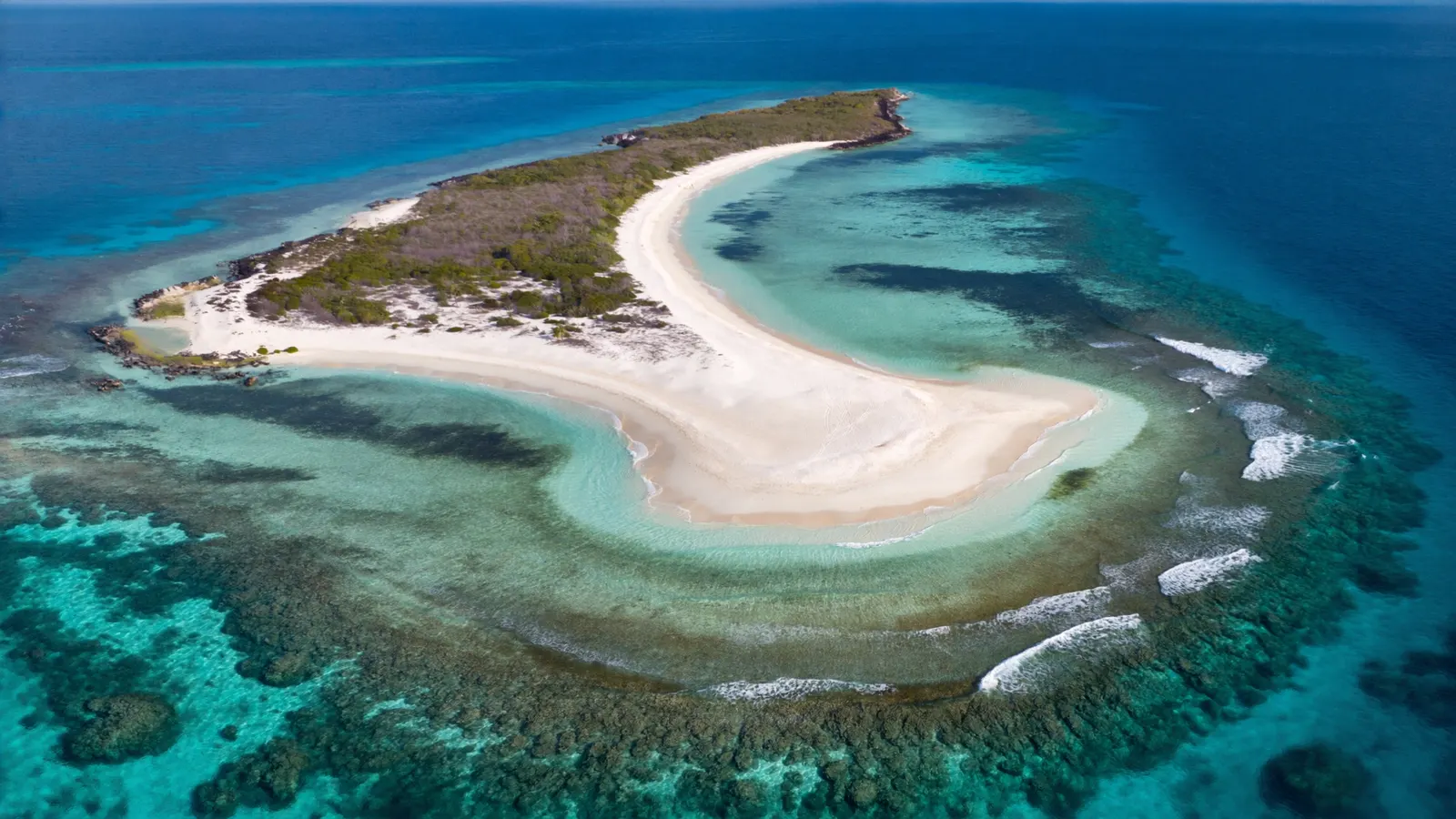
A low coral island, not a volcano
Anguilla is built of limestone, which gives it gentle shores and shallow reefs.
Many of Anguilla’s neighbours, such as Saba, Montserrat and Saint Kitts, are steep volcanic islands. Anguilla is different. It is a low, flat island whose surface is mostly limestone formed from ancient reefs and marine sediments, with its highest point well under 100 metres. Like Barbuda and the Cayman Islands, its shores shelve gently into shallow water rather than plunging steeply, which favours broad fringing reefs, seagrass beds and sandy lagoons.
The white sand of Anguilla’s beaches is largely made of fragments of coral, shells and calcareous algae, much of it ground up by parrotfish and waves. In a very real sense, the beaches are a by-product of the reef. Our page on Barbados coral reef maps looks at another island built on old reef.
Anguilla’s main reef areas
The outer cays hold the best coral; the north coast has the easiest shore access.
- Shoal Bay East and Island Harbour (north-east) — reef-sheltered beaches with snorkelling straight from shore over fringing reef and patch reefs.
- Prickly Pear Cays (north-west) — a pair of cays with reefs, a sheltered lagoon and good snorkelling, reached by boat.
- Sandy Island (off Road Bay) — a tiny sand cay surrounded by reef, a short trip from Sandy Ground.
- Dog Island (north-west) — a remote, uninhabited island with reefs, important seabird colonies and clear offshore water.
- Scrub Island (east) — an uninhabited island off the eastern tip with surrounding reef.
- Sombrero (far north-west) — an isolated rock island with a lighthouse, surrounded by deeper reef and important for wildlife.
Several ships have also been deliberately sunk off Anguilla as artificial reefs and dive sites, adding structure for fish and coral.
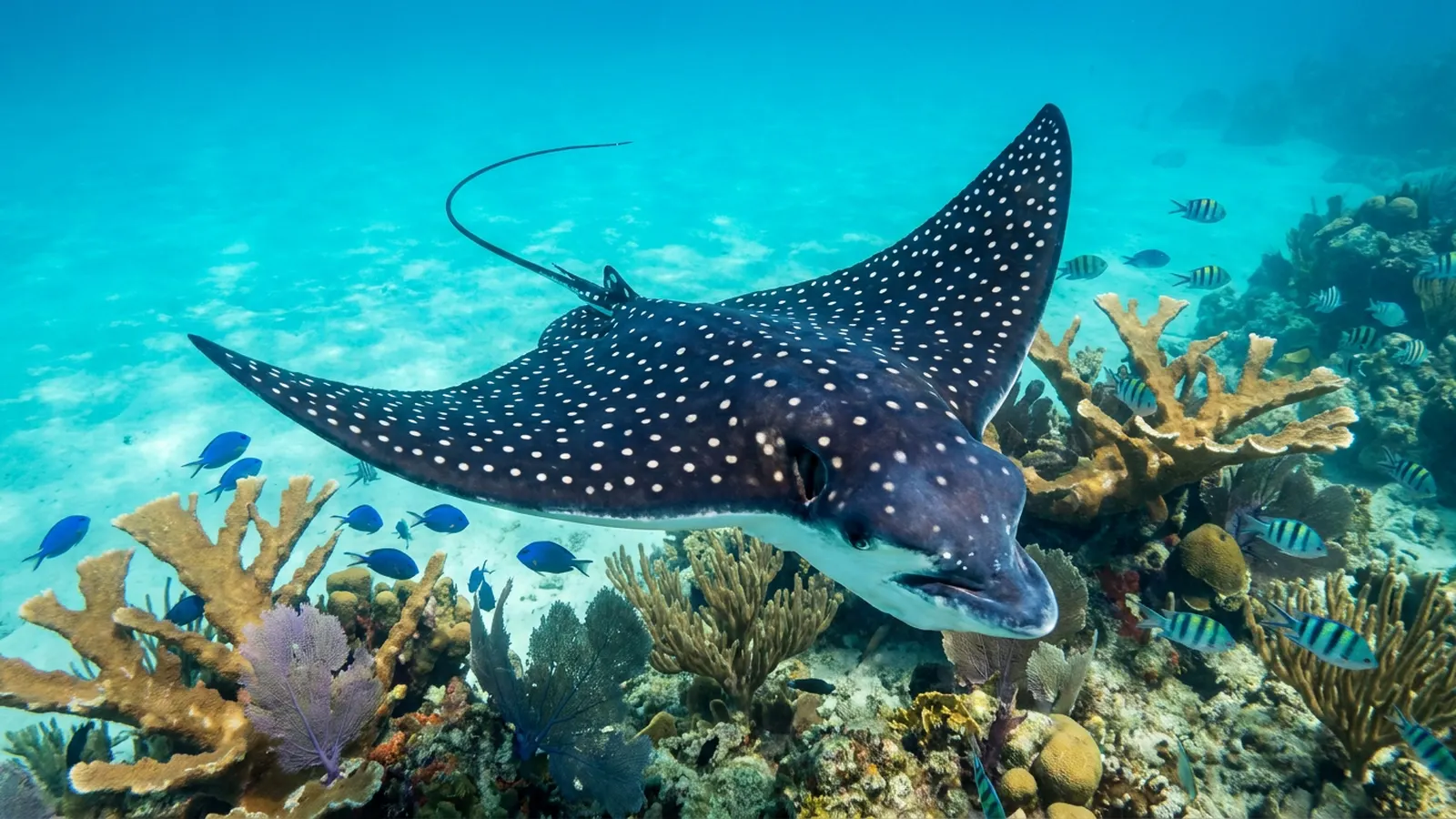
Reef life around Anguilla
Typical Caribbean reef life thrives in the clear, ocean-flushed water around the cays.
Anguilla’s reefs hold the corals and fish typical of the eastern Caribbean: brain and star corals, sea fans and sea rods, and, on some shallow reefs, surviving stands of elkhorn coral. Parrotfish, surgeonfish, angelfish, grunts and snappers are common, along with spiny lobster and queen conch, both important to local fisheries. Hawksbill and green turtles feed on the reefs and in seagrass beds, and stingrays and eagle rays cruise the sand flats. The outer cays, being less visited and better flushed by ocean water, generally have the richest marine life. More on the reef community is in what animals and plants live in coral reefs.
Reefs and Anguillian life
Tourism, fishing and storm protection all depend on the reef.
Anguilla’s economy relies heavily on high-end tourism centred on its beaches, and those beaches depend on the reefs that shelter them and supply their sand. The reefs also support a strong local fishing tradition, especially for lobster, conch and reef fish. For a low island in the hurricane belt, reefs are a natural breakwater that absorbs wave energy before it reaches the shore. Anguilla has designated a network of marine parks around its cays and some coastal reefs to protect coral and fisheries.
Seagrass meadows and the few areas of mangrove around Anguilla’s salt ponds and sheltered bays also matter for the reefs. They act as nurseries for young fish and conch and help trap sediment before it reaches the coral, so protecting them is part of protecting the reef.
Threats to Anguilla’s reefs
Hurricanes, heat, disease and coastal pressure.
As a low island, Anguilla is highly exposed to hurricanes. Hurricane Irma, a Category 5 storm, struck the island in September 2017, causing severe damage on land and breaking up shallow reefs and seagrass beds. Like the rest of the Caribbean, Anguilla’s reefs also face marine heatwaves and bleaching, coral diseases including stony coral tissue loss disease, overfishing of lobster, conch and herbivorous fish, and coastal development and runoff near popular beaches. Large Sargassum seaweed influxes have affected some shores in recent years. The island’s small population and clear waters are an advantage, but long-term reef health depends on well-managed marine parks, sustainable fisheries and action on warming. For the regional picture, see causes of coral reef destruction in the Caribbean.
Related on TheSea
- Coral Reef Conservation
- St Vincent & the Grenadines Coral Reef Maps
- Martinique Coral Reef Maps
- St Lucia Coral Reef Maps
- Cuba Coral Reef Maps
- Dutch Antilles Coral Reef Maps
- Grenada Coral Reef Maps
- Jamaica Coral Reef Maps
- Barbados Coral Reef
- Bahamas Coral Reef
- Coral Reef Underwater Park Trail
- Roatan Coral Reef
Does Anguilla have coral reefs?
Yes. Fringing reefs line much of the island’s coast and surround its offshore cays, including Prickly Pear, Sandy Island, Dog Island and Scrub Island. UNEP-WCMC maps roughly 24 km² of reef.
Where is the best snorkelling in Anguilla?
The offshore cays, especially Prickly Pear Cays and Sandy Island, offer the best reefs. From shore, Shoal Bay East, Little Bay and Island Harbour are popular choices.
Is Anguilla a volcanic island?
No. Anguilla is a low, flat island made mainly of limestone, unlike its volcanic neighbours. That is why it has gently shelving shores, shallow reefs and white coral-sand beaches.
Why is the water in Anguilla so clear?
Anguilla sits on a shallow, sandy bank with no large rivers, a small population and reefs that break the swell. Sunlight reflects off white sand in shallow water, producing the bright turquoise colour.
Are Anguilla’s reefs protected?
Anguilla has a network of marine parks covering several cays and reef areas, with rules on fishing, anchoring and collecting. Moorings are provided at some sites to prevent anchor damage.
What threatens Anguilla’s coral reefs?
Hurricanes such as Irma in 2017, marine heatwaves and bleaching, coral disease, overfishing and coastal development and runoff are the main threats.
- UNEP-WCMC, WorldFish Centre, WRI, TNC: Global distribution of warm-water coral reefs, v4.1 (2021)
- Government of Anguilla, Department of Fisheries and Marine Resources: marine parks
- NOAA Coral Reef Information System: Caribbean reef ecology
Blane Perun has been exploring Earth’s oceans and marine life for over 25 years. Founder of TheSea.Org in 1999, underwater photographer, coral aquaculture pioneer, and explorer of 80+ countries.
About Blane Perun → More Caribbean Coral Reef Maps →