Martinique Coral Reef Maps — Reefs of a French Volcanic Island
Martinique’s coral reefs lie mainly along the south coast around Sainte-Anne, Le Marin and Sainte-Luce, in the bays of the Caribbean (west) coast such as Les Anses-d’Arlet, and on the Atlantic (east) coast, where a barrier reef off Le François and Le Robert shelters shallow lagoons dotted with islets. The famous Diamond Rock (Rocher du Diamant) off the south-west coast is one of the island’s best dive sites. The north-west coast near Mont Pelée has steep, deep water and fewer reefs, but the bay of Saint-Pierre is known for shipwrecks sunk in the 1902 eruption. All of Martinique’s waters lie within the Martinique Natural Marine Park, created in 2017.
Martinique rises steeply out of the eastern Caribbean, a volcanic island dominated by the forested slopes of Mont Pelée in the north. Like many volcanic islands, it has a narrow shelf in places, so its reefs are concentrated where the sea floor is shallow and sheltered. The result is a varied reef map: calm bays and coral gardens in the south and west, a barrier reef and lagoon on the windward Atlantic side, and dramatic wreck diving in the north. This page shows where Martinique’s reefs are, what lives on them and what threatens them.
Martinique coral reef map
Reef shading marks the south coast, the western bays and the Atlantic barrier reef, with less reef along the steep north-west.
The reef outlines come from the UNEP-WCMC global coral reef dataset, compiled from satellite imagery and surveys. The pattern follows the island’s geology. In the north, Mont Pelée’s slopes plunge into deep water with little shelf for reefs to grow on. In the south and east, older volcanic rocks are more eroded and the shelf is wider, giving corals more space. On the Atlantic side, the reef sits offshore and breaks the trade-wind swell, creating calm lagoons with sand banks known locally as fonds blancs, where the water is only waist-deep. The best-known of these shallows is nicknamed “Josephine’s bath” (Baignoire de Joséphine).
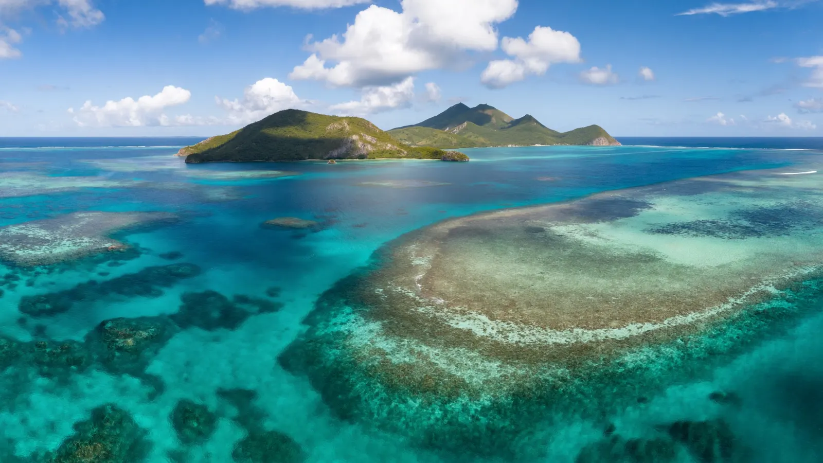
Martinique’s main reef areas
Each coast offers a different kind of reef experience.
| Area | Coast | Known for |
|---|---|---|
| Sainte-Anne & Le Marin | South | Sheltered bays, reefs and seagrass |
| Sainte-Luce & Le Diamant | South-west | Coral gardens; Diamond Rock offshore |
| Les Anses-d’Arlet | West (Caribbean) | Snorkelling with green turtles over seagrass and coral |
| Le François & Le Robert | East (Atlantic) | Barrier reef, islets and shallow lagoons |
| Saint-Pierre | North-west | Wrecks from the 1902 eruption, now artificial reefs |
| Prêcheur | North-west | Volcanic walls and boulder reefs |
Diamond Rock and the southern reefs
The south coast holds Martinique’s richest reefs, and Diamond Rock is its signature dive.
Diamond Rock is a steep volcanic islet about 175 m high, a short distance off the south-west coast. Underwater, its walls and tunnels are covered in sponges, gorgonians and corals, with schools of fish, barracuda and occasional turtles and rays. Because it sits in open water, currents can be strong, and it is usually dived with local operators. The islet also has a famous history: the British Royal Navy occupied it in 1804 and even listed it as a ship, “HMS Diamond Rock”, during the Napoleonic Wars.
Around Sainte-Anne, Le Marin and Sainte-Luce, sheltered bays hold fringing reefs, patch reefs and seagrass beds. Along the west coast, the bays of Les Anses-d’Arlet are popular for snorkelling with green turtles that graze the seagrass close to shore. These areas are also where most of Martinique’s dive centres are based.
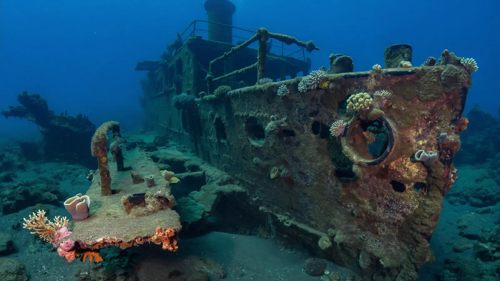
Saint-Pierre: wrecks of the 1902 eruption
The eruption of Mont Pelée destroyed the town of Saint-Pierre and sank the ships in its harbour, creating some of the Caribbean’s most historic wreck dives.
On 8 May 1902, Mont Pelée erupted and a pyroclastic flow swept through Saint-Pierre, then the island’s main commercial town, killing nearly all of its roughly 28,000 inhabitants. More than a dozen ships anchored in the bay were burned or sunk. Today those wrecks lie at a range of depths on the volcanic slope and have become artificial reefs, encrusted with sponges, corals and gorgonians and home to fish and invertebrates. They are some of the most atmospheric dives in the eastern Caribbean, combining marine life with a moving piece of history.
Marine life on Martinique’s reefs
Classic Caribbean reef life, plus turtles, seagrass meadows and the occasional dolphin and whale offshore.
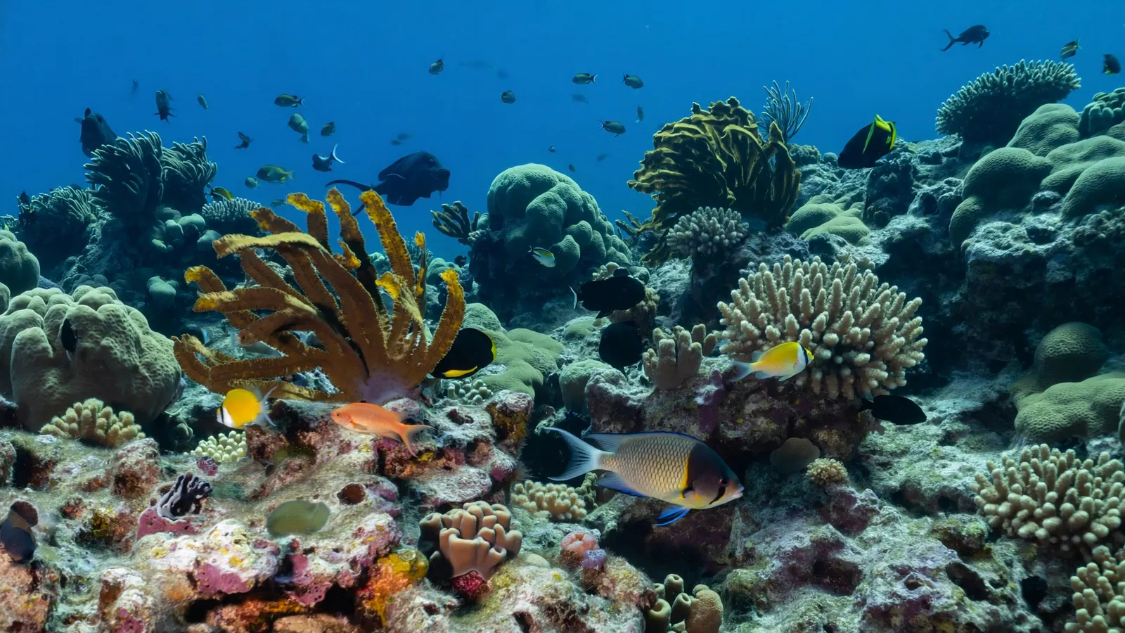
Martinique’s reefs host typical Caribbean corals such as brain coral, star coral and finger coral, with sea fans, sea rods and large sponges. Reef fish include parrotfish, surgeonfish, angelfish, butterflyfish, trumpetfish, snappers and grunts, and divers often see moray eels, octopus, lobsters and seahorses. Green turtles are common over seagrass on the west coast, and hawksbill turtles feed on sponges on the reef. Dolphins and seasonal humpback and sperm whales are seen off the Caribbean coast.
Visibility is usually best on the sheltered Caribbean side, where the water is calmer and clearer than on the windward Atlantic coast. The dry season, roughly December to May, generally brings the most settled conditions, while the wetter months from June to November coincide with the Atlantic hurricane season and heavier runoff after rain. Water temperatures stay warm all year, typically in the high 20s°C. Most dives are boat dives run from the south and west coasts, and shore snorkelling is easiest in the bays around Les Anses-d’Arlet, Sainte-Anne and Sainte-Luce. Visitors can help the reef by using mooring buoys rather than anchors, never standing on coral, keeping a respectful distance from turtles and choosing mineral sunscreen. For a wider view of how the island’s reefs fit into the region, see the Caribbean coral reef maps hub.
Threats and protection
Land-based pollution, sargassum, warming and disease are the main threats; the whole island’s waters are now a marine park.
Runoff from farmland, towns and steep hillsides carries sediment and nutrients onto reefs, especially after heavy rain. Martinique also faces long-lasting pollution from chlordecone, an insecticide formerly used on banana plantations, which has led to fishing restrictions in some coastal areas. Since 2011, large strandings of sargassum seaweed have repeatedly smothered bays on the Atlantic and southern coasts. Like the rest of the Caribbean, the island’s reefs have suffered coral bleaching during marine heatwaves, coral disease, and the loss of grazing sea urchins in the 1980s, and invasive lionfish have spread through local waters. These regional pressures are covered on the threats to Caribbean coral reefs page.
In 2017 France created the Martinique Natural Marine Park, covering the island’s entire marine area. It works with fishers, dive operators and local authorities to manage uses of the sea, monitor reefs and seagrass, and support restoration. Smaller protected areas, such as the Sainte-Luce marine reserve, add stricter protection. More on what helps reefs recover is on the coral reef conservation page.
Related on TheSea
- Bermuda Coral Reef Maps
- Montserrat Coral Reef Maps
- Saint Kitts & Nevis Coral Reef Maps
- Turks Caicos Coral Reef Maps
- Anguilla Coral Reef Maps
- Dutch Antilles Coral Reef Maps
- British Virgin Islands (UK Virgin Islands) Coral Reef Maps
- US Virgin Islands Coral Reef Maps
- Cayman Island Coral Reef Maps
- Jamaica Coral Reef Maps
- Bahamas Coral Reef Maps
- Barbados Coral Reef
Does Martinique have coral reefs?
Yes. Martinique has fringing reefs along its south and Caribbean coasts, a barrier reef on the Atlantic side off Le François and Le Robert, and coral-covered rocks and wrecks elsewhere. The UNEP-WCMC dataset maps about 72 km² of reef.
Where is the best snorkeling in Martinique?
Les Anses-d’Arlet on the west coast is popular for snorkelling with green turtles, and the bays around Sainte-Anne and Sainte-Luce have accessible coral. The shallow lagoons off Le François are good for calm-water exploring by boat.
What is Diamond Rock in Martinique?
Diamond Rock (Rocher du Diamant) is a volcanic islet off the south-west coast, famous as a dive site with walls, tunnels and abundant fish. It was occupied by the British Royal Navy in 1804 and commissioned as “HMS Diamond Rock”.
Can you dive the shipwrecks at Saint-Pierre?
Yes. Ships sunk during the 1902 eruption of Mont Pelée lie in the bay of Saint-Pierre at a range of depths. Several are dived regularly with local operators and are now covered in marine life.
Is there a barrier reef in Martinique?
Yes. On the Atlantic (east) coast, a barrier reef off Le François and Le Robert shelters shallow lagoons and islets, including the sandy shallows known as the “fonds blancs”.
What threatens Martinique’s coral reefs?
The main threats are sediment and nutrient runoff, chlordecone pollution, sargassum strandings, coral bleaching from marine heatwaves, coral disease and invasive lionfish.
- UNEP-WCMC, WorldFish, WRI & TNC (2021), Global distribution of warm-water coral reefs, v4.1
- Office français de la biodiversité: Parc naturel marin de Martinique
- IFRECOR (French initiative for coral reefs): Martinique reef status reports
- Smithsonian Global Volcanism Program: Mont Pelée eruption history
Blane Perun has been exploring Earth’s oceans and marine life for over 25 years. Founder of TheSea.Org in 1999, underwater photographer, coral aquaculture pioneer, and explorer of 80+ countries.
About Blane Perun → More Caribbean Coral Reef Maps →