Pacific Ocean — The Largest, Deepest Ocean on Earth
Enormous. Depending on where boundaries are drawn, the Pacific covers roughly 155 to 168 million km², about a third of Earth’s surface and close to half of the world ocean’s area and volume. It is larger than all the land on Earth combined. Its average depth is about 4,000–4,300 m, and its deepest point, the Challenger Deep in the Mariana Trench, lies at about 10,900 m.
How big is the Pacific Ocean?
Bigger than all the land on Earth put together. Measured to a southern border at Antarctica, it covers about 165 million km², roughly 46% of the planet’s water surface and about 32% of its entire surface.
Exact figures depend on where the boundaries are drawn. If the Southern Ocean is counted separately, with the Pacific ending at 60°S, the area is smaller; if the Pacific runs all the way to Antarctica and includes its marginal seas, it is larger. That is why published figures range from about 155 to 168 million km². On any definition, it is larger than the combined land area of all the continents, which is around 148 to 150 million km².
Its dimensions are hard to picture. From the Bering Sea in the north to 60°S it stretches about 15,500 km. Its widest point, at about 5°N, runs some 19,800 km from Indonesia to the coast of Colombia, almost halfway around the world. The geographic centre of the ocean lies in eastern Kiribati, south of Kiritimati. The Pacific holds an estimated 710 to 714 million km³ of water, about half of all the water in the world ocean. For that volume expressed in gallons, see how many gallons are in the Pacific Ocean.
The ocean is usually split at the equator into the North Pacific and South Pacific, which circulate largely independently, and informally by the International Date Line into a West Pacific near Asia and an East Pacific near the Americas. Along its irregular western margin lie many marginal seas, among them the Philippine Sea, South China Sea, East China Sea, Sea of Japan, Sea of Okhotsk, Bering Sea, Coral Sea and Tasman Sea. The Bering Strait links it to the Arctic, Drake Passage and the Strait of Magellan to the Atlantic, and the passages of the Indonesian archipelago to the Indian Ocean.
Why is it called the Pacific?
Ferdinand Magellan called it Mar Pacífico, the “peaceful sea”, after finding calm water beyond the stormy strait at the southern tip of South America in 1520.
The first European to see the ocean from the Americas was the Spaniard Vasco Núñez de Balboa, who crossed the Isthmus of Panama in 1513 and named it Mar del Sur, the South Sea, because it lay south of the coast where he stood. Seven years later, Magellan’s Spanish expedition became the first in recorded history to cross it. After weeks of storms in the strait that now bears his name, the fleet met steady winds and calm seas, and Magellan called the ocean peaceful. It was often called the Sea of Magellan until the eighteenth century. Magellan reached Guam in March 1521 and was killed in the Philippines later that year; Juan Sebastián Elcano brought the survivors home in 1522 to complete the first circumnavigation.
The name is ironic. The Pacific hosts the two most active tropical cyclone basins on Earth, in the northwest and eastern Pacific, and its rim is the world’s main belt of earthquakes, volcanoes and tsunamis. Magellan simply met it on a good stretch.
Who first crossed the Pacific?
Not Europeans. Austronesian navigators settled most of the Pacific’s islands thousands of years before Magellan.
Modern humans reached the western Pacific margin tens of thousands of years ago, crossing at least 80 km of open water between the Sunda shelf and Sahul, the ice-age continent of Australia and New Guinea. The great ocean voyages came later. Austronesian peoples, originating in Taiwan around 3000 to 1500 BCE, developed outrigger canoes, catamarans and the crab-claw sail. They reached the Philippines from around 2200 BCE and crossed open water to the Mariana Islands by about 1500 BCE, the first people known to reach Remote Oceania.
A branch associated with the Lapita culture reached the Bismarck Archipelago, the Solomon Islands, Vanuatu, Fiji and New Caledonia around 1300 to 1200 BCE, and Tonga and Samoa by 900 to 800 BCE. After a long pause, a new surge of exploration carried Polynesians to the Cook Islands, Tahiti and the Marquesas by about 700 CE, Hawai‘i by about 900 CE, Rapa Nui (Easter Island) by about 1000 CE and finally New Zealand by about 1200 CE. Those voyages, made by navigating with stars, swells and birds, covered a larger share of the planet than any human expansion before the modern era.
European exploration followed Magellan. The Manila galleons linked Manila and Acapulco for two and a half centuries, and Spain long treated the Pacific as a closed sea. Dutch navigators charted parts of Australia and reached New Zealand in 1642. In 1768 the French astronomer Pierre-Antoine Véron, sailing with Bougainville, first measured the ocean’s width accurately. James Cook’s three voyages from 1768 onward mapped much of the South Pacific, Hawai‘i and the Pacific Northwest, and scientific expeditions such as HMS Challenger in the 1870s began measuring its depths.
How deep is the Pacific?
On average about 4,000 to 4,300 m, the deepest of any ocean, with the deepest trenches on Earth along its western edge.
| Feature | Depth | Notes |
|---|---|---|
| Challenger Deep, Mariana Trench | ~10,900–10,930 m | Deepest known point in the ocean; surveys vary |
| Horizon Deep, Tonga Trench | ~10,820 m | Deepest point in the Southern Hemisphere |
| Sirena Deep, Mariana Trench | ~10,800 m | Third-deepest known point |
| Kuril–Kamchatka Trench | ~9,600 m | Northwest Pacific |
| Average depth | ~4,000–4,300 m | Deepest average of any ocean |
The Challenger Deep in the Mariana Trench, southwest of Guam, is the deepest known place in the ocean. Different sonar surveys and pressure measurements give slightly different numbers, mostly between about 10,900 and 10,935 m. It was first reached by Jacques Piccard and Don Walsh in the bathyscaphe Trieste in 1960, and by James Cameron, diving solo, in 2012. The Tonga Trench’s Horizon Deep, at about 10,823 m, is only slightly shallower. See how deep is the Mariana Trench? for the measurements in detail.
What is the Ring of Fire?
A horseshoe of subduction zones, volcanoes and trenches around the Pacific rim, where about 90% of the world’s earthquakes occur.
The Pacific is the only ocean bounded mostly by subduction zones, where oceanic plates dive beneath their neighbours. Those plunging slabs create the deep trenches, and melting above them feeds chains of explosive volcanoes from New Zealand through Indonesia, the Philippines, Japan, Kamchatka and the Aleutians, and down the Americas to the Andes. The Ring of Fire contains roughly 750 to 915 volcanoes that have been active in the last 11,700 years, about two-thirds of the world’s total, and more than 350 have erupted in historical times. About 90% of the world’s earthquakes and 81% of the largest ones happen along it.
Geologists also recognise the andesite line, a boundary that separates the dense basalt floor of the central Pacific basin from the lighter, partly continental rocks of its margins. Inside it, volcanoes such as those of Hawai‘i erupt fluid basalt and build broad shield volcanoes over hot spots in the middle of the plate. Outside it lie the explosive arc volcanoes of the rim.
The ocean is ancient but its floor is young. Its ancestor, Panthalassa, formed around 750 million years ago and surrounded the supercontinent Pangaea; the name Pacific is generally used after Pangaea broke apart about 200 million years ago. Because old sea floor is constantly destroyed at the trenches, the oldest Pacific crust is only about 180 million years old. The ocean is slowly shrinking, by roughly 2.5 cm a year on three sides, while the Atlantic widens; see why the Atlantic is getting bigger and the Pacific smaller.
How many islands are in the Pacific?
About 25,000, more than in all the other oceans combined.
The islands lying wholly within the Pacific are traditionally grouped into three regions. Micronesia, north of the equator and west of the Date Line, includes the Marianas, the Carolines, the Marshall Islands and Kiribati. Melanesia, to the southwest, includes New Guinea, the world’s second-largest island, along with the Bismarck Archipelago, the Solomon Islands, Vanuatu, Fiji and New Caledonia. Polynesia, the largest region, forms a triangle from Hawai‘i to New Zealand to Easter Island, taking in Samoa, Tonga, Tuvalu, the Cook Islands, the Society Islands, the Marquesas and the Tuamotus.
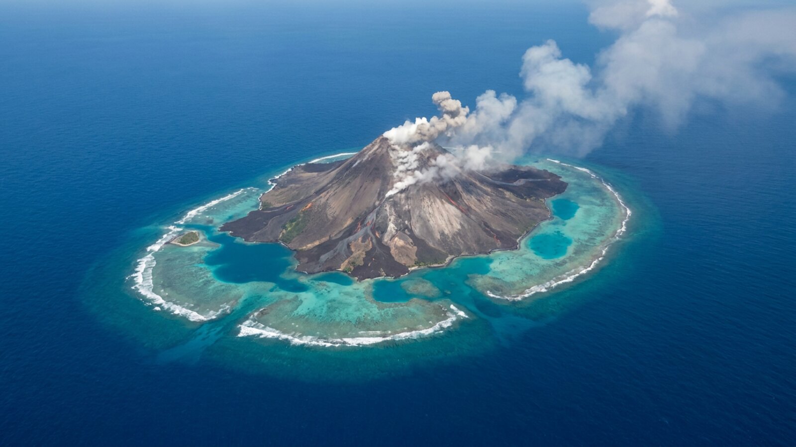
Geologically, they come in four types. Continental islands, such as New Guinea, New Zealand and the Philippines, are pieces of continental crust. High islands are volcanic, and many, including Hawai‘i and Bougainville, have active volcanoes. Low coral islands and atolls are reefs built on sinking volcanic foundations. Uplifted coral platforms, such as Banaba and Makatea, are old reefs raised above sea level.
What are the main currents of the Pacific?
Two giant gyres, clockwise in the north and anticlockwise in the south, joined by the equatorial current system.
In the North Pacific, the warm Kuroshio carries tropical water northeast past Japan. At about 45°N it forks: part flows north as the Aleutian Current and part turns back south. Approaching North America, the flow splits again, feeding a counter-clockwise circulation in the Bering Sea and the cold, slow California Current that runs south along the US West Coast. Coastal upwelling along that current feeds the kelp forests, sardines, sea lions and whales of the California coast.
In the South Pacific, the South Equatorial Current flows west along the equator, swings south east of New Guinea, and joins the eastward flow of the Antarctic Circumpolar Current at high latitudes. Near Chile it divides, one branch rounding Cape Horn and the other turning north as the Humboldt or Peru Current, whose upwelling supports one of the world’s most productive fisheries. Surface temperatures range from about −1.4 °C, the freezing point of seawater, near the poles to about 30 °C near the equator. Salinity peaks at about 37 parts per thousand in the southeast, falls to about 34 near the rainy equator and drops below 32 in the far north.
What is the weather like over the Pacific?
Steady trade winds in the tropics, monsoons in the west, the world’s busiest cyclone basins and fierce westerlies in the far south.
Climate patterns in the two hemispheres broadly mirror each other. The trade winds of the southern and eastern Pacific are remarkably steady, while the North Pacific is more variable: winters on Russia’s east coast are bitterly cold, while British Columbia, warmed by ocean currents, stays mild. In the tropical western Pacific, a wet summer monsoon alternates with dry winter winds blowing off the Asian landmass.
The northwestern Pacific is the most active tropical cyclone basin on Earth, producing the typhoons that strike the Philippines, China, Taiwan and Japan, and the eastern Pacific, south of Mexico, is the second most active. Eastern Pacific hurricanes form mainly between June and October and sometimes reach western Mexico. In the far north, sea ice from October to May and persistent fog from June to December complicate shipping in the Bering Sea. In the south, strong westerly winds circling Antarctica are known by latitude as the Roaring Forties, Furious Fifties and Shrieking Sixties.
What lives in the Pacific?
The richest coral reefs on Earth, some of its largest fisheries and every major group of marine mammals.
The Coral Triangle, spanning Indonesia, the Philippines, Malaysia, Papua New Guinea, Timor-Leste and the Solomon Islands, sits where the Pacific meets the Indian Ocean. It holds more than 76% of the world’s shallow-water reef-building coral species and about 37% of its reef fish species, along with six of the seven sea turtle species. Australia’s Great Barrier Reef, the largest reef system, lies on the Coral Sea. Further east, coral atolls and fringing reefs ring thousands of islands.
The open Pacific supports vast populations of tuna, squid and other pelagic species, and coastal waters yield herring, salmon, sardines, snapper and shellfish. The eastern Pacific is a highway for gray and blue whale migrations (see gray whales), and the deep trenches host specialised life adapted to crushing pressure. Fishing pressure is heavy in places: catches in the Sea of Okhotsk off Russia have fallen by at least half since the 1990s because of overfishing.
What are the biggest threats to the Pacific?
Plastic, overfishing, warming and a legacy of nuclear testing.
The Great Pacific Garbage Patch, in the North Pacific gyre between California and Hawai‘i, is the best-known accumulation of floating debris. A 2018 study by The Ocean Cleanup estimated 45,000 to 129,000 tonnes of plastic in the patch, with a central figure of about 80,000 tonnes and 1.8 trillion pieces. Although tiny fragments dominate by count, 92% of the mass was larger objects not yet broken down, and synthetic fishing nets made up nearly half of it. A 2022 study of large debris items concluded that 75% to 86% of the plastic came from fishing and agriculture, with identified sources mainly in Japan, China, South Korea, the US and Taiwan. Small plastic fragments floating in the northeast Pacific increased about a hundredfold between 1972 and 2012.
The ocean also carries a nuclear legacy. From 1946 to 1958 the United States conducted 67 nuclear tests at atolls in the Marshall Islands, its Pacific Proving Grounds. In 2021 Japan approved the gradual release of treated water from the damaged Fukushima nuclear plant into the Pacific over about 30 years, with the government stating that the water would first be diluted to drinking-water standard. Meanwhile, rising temperatures and marine heatwaves have bleached Pacific reefs repeatedly, and the El Niño years make those events worse.
How big is the Pacific Ocean?
About 155 to 168 million km² depending on boundaries; around 165 million km² to an Antarctic border, roughly a third of Earth’s surface.
What is the deepest point in the Pacific?
The Challenger Deep in the Mariana Trench, about 10,900–10,930 m deep depending on the survey.
Why is it called the Pacific?
Ferdinand Magellan named it the “peaceful sea” in 1520 after calm weather following the stormy strait at the tip of South America.
Is the Pacific Ocean getting smaller?
Yes, slowly, by roughly 2.5 cm a year on three sides as its floor is subducted, while the Atlantic widens.
What is the Ring of Fire?
The belt of trenches, volcanoes and earthquake zones around the Pacific rim, caused by subduction; about 90% of earthquakes occur there.
Is the Pacific bigger than all land?
Yes. Its area exceeds the combined land area of all the continents.
How many islands are in the Pacific?
About 25,000, grouped into Micronesia, Melanesia and Polynesia plus continental islands near Asia and Australia.
- Wikipedia: Pacific Ocean (area, dimensions, volume, depth, islands, currents, history, Austronesian settlement chronology).
- Wikipedia: Ring of Fire (750–915 Holocene volcanoes, 90% of earthquakes, 81% of largest).
- Wikipedia: Coral Triangle (76% of reef-building coral species, 37% of reef fish species).
- Wikipedia: Great Pacific garbage patch, citing Lebreton et al. (2018), Scientific Reports (80,000 t, 1.8 trillion pieces).
- Wikipedia: Kuril–Kamchatka Trench (maximum depth ~9,600 m).
- Charette, M.A. & Smith, W.H.F. (2010). The volume of Earth’s ocean. Oceanography 23(2).
- NOAA Ocean Service. Pacific Ocean and El Niño–Southern Oscillation facts.
Blane Perun has been exploring Earth’s oceans and marine life for over 25 years. Founder of TheSea.Org in 1999, underwater photographer, coral aquaculture pioneer, and explorer of 80+ countries.
About Blane Perun →