Bahamas Coral Reef — The Andros Barrier Reef, Walls, Blue Holes and Reef Map
Yes. The Bahamas has one of the largest and most varied reef systems in the western Atlantic, spread across an archipelago of some 700 islands and thousands of cays sitting on vast, shallow limestone banks. Its centrepiece is the Andros Barrier Reef, which runs for more than 200 kilometres along the east coast of Andros and is often listed among the longest barrier reefs in the world. Around the other islands, fringing and patch reefs, dramatic walls that drop into deep ocean channels, and famous blue holes make the Bahamas one of the world’s great diving destinations. Strictly speaking the Bahamas lies in the Atlantic, not the Caribbean, but its reefs share the same Caribbean coral species.
From the air, the Bahamas look like a watercolour: pale turquoise banks only a few metres deep, laced with sandbars and cays, broken by sudden ribbons of deep indigo where ocean channels cut through. Coral reefs grow where those two worlds meet — along the edges of the banks, around the islands and on the shallow flats. This guide maps and explains the Bahamas’ coral reefs: how the banks formed, the Andros Barrier Reef and the walls of the Tongue of the Ocean, the blue holes, the best reef areas island by island, the marine life you can expect, and the pressures the reefs face today.
How the Bahamas’ reefs formed
The Bahamas sit on enormous platforms of limestone built by marine life over many millions of years.
Unlike volcanic islands, the Bahamas are built almost entirely of carbonate rock: the skeletons and shells of corals, algae, molluscs and microscopic organisms, accumulated over a very long time on a slowly sinking foundation. The result is two main platforms, the Great Bahama Bank and the Little Bahama Bank, plus a scattering of smaller banks to the south-east. On top of the banks the water is often only a few metres deep; at their edges the sea floor plunges into deep channels and basins.
During ice ages, when sea level fell far below today’s, the banks were dry land. Rain dissolved the limestone into caves and sinkholes; when the sea rose again, those flooded to become the blue holes the Bahamas are famous for. Modern reefs have grown on top of this foundation since the sea returned, concentrated where clear oceanic water washes the bank margins and supplies plankton, and where wave energy keeps sediment from smothering the coral.
That geography explains the pattern on the map. Reefs line the windward edges of the banks and the islands, while the broad bank interiors are mostly sand, seagrass and scattered patch reefs.
Bahamas coral reef map
The map shows reefs scattered across the archipelago, concentrated along bank edges where shallow water meets the deep.
The reef shapes on this map come from the global coral-reef dataset compiled by UNEP-WCMC, traced from satellite imagery and survey data, so the coral shading reflects real, mapped reef extent. Notice how the reefs trace the outlines of the banks rather than the islands themselves: the long line down the east side of Andros is the barrier reef, while reefs fringe the Exumas, the Abacos, Grand Bahama, Bimini, Eleuthera and the southern islands.
The map also hints at how much of the Bahamas is shallow bank with little coral. Those pale areas are important habitat in their own right — seagrass meadows and sand flats that feed conch, turtles and juvenile fish — but they are not reefs. For a country-level view see our Bahamas coral reef maps page and the Caribbean coral reef maps overview.
The Andros Barrier Reef and the Tongue of the Ocean
Andros, the largest Bahamian island, is guarded by a barrier reef that runs for more than 200 kilometres beside one of the deepest trenches in the region.
The Andros Barrier Reef lies a short distance off the island’s east coast, separated from the shore by a shallow lagoon. On its inner side are patch reefs, seagrass and sand; on its outer side, the reef slopes and then drops into the Tongue of the Ocean, a deep, steep-sided basin that reaches well over a kilometre in depth and cuts into the Great Bahama Bank like a fjord.
Where reef meets trench, the result is the famous Andros wall: a near-vertical drop covered in sponges, black corals, sea fans and plate corals, with open ocean beyond. Divers can hang at the lip of the wall and look down into blue water that seems bottomless. The combination of a long barrier reef, a sheltered lagoon and a deep wall makes Andros one of the most complete reef systems in the Atlantic.
Andros itself is lightly populated and covered in pine forest, mangrove creeks and inland blue holes, which helps keep pressure on parts of the reef relatively low. Much of the island and surrounding sea is now protected in a network of national parks.
Blue holes, walls and the banks
The Bahamas are the world capital of blue holes — flooded sinkholes that open onto the reefs, flats and even inland lakes.
Blue holes formed when rainwater dissolved the limestone of the exposed banks during ice ages, creating vertical shafts and cave systems. As the sea rose, they flooded. Today they appear as dark circles on the pale bank, on reef flats or inland. Some are linked to underwater cave networks that stretch for kilometres; others are simple, deep shafts. Dean’s Blue Hole on Long Island, around 200 metres deep, is one of the deepest known and is used for freediving competitions.
Ocean blue holes often have tidal currents flowing in and out, carrying plankton that feeds corals, sponges and fish clustered around the rim. Inland blue holes are layered, with fresh water floating over salt, and preserve fossils and sediments that record past climates.
Walls are the other signature feature. Wherever a bank edge meets deep water — along Andros, around the Exumas, off Long Island, San Salvador, Cat Island and Inagua — reefs drop off into the abyss. Visibility on these walls can be exceptional, often 30 metres or more on good days.
The best reef areas island by island
Each island group offers a different mix of reef, wall, wreck and wildlife.
Exuma Cays. A long chain of small cays fringed by reefs, sandbars and tidal channels. The Exuma Cays Land and Sea Park, created in 1958, was one of the first marine protected areas of its kind and became a no-take fisheries reserve; studies there have shown more and larger fish inside the park than outside. Thunderball Grotto, a cave in a small cay, is a popular snorkel.
Bimini. Close to Florida and on the edge of the Gulf Stream, Bimini is known for its reefs and wrecks, and above all for winter encounters with great hammerhead sharks on the sand flats.
Grand Bahama. Reefs, caves and wrecks off Freeport, and nearby Tiger Beach on the Little Bahama Bank, a shallow site famous for tiger shark dives.
Abaco. Fringing reefs and cays along the Sea of Abaco, with some well-protected areas such as the Pelican Cays Land and Sea Park.
New Providence. The capital’s island has easily reached reefs, wrecks and shark dives on its south-west coast, plus the wall at the edge of the Tongue of the Ocean.
Eleuthera, Long Island, Cat Island and the south. Less visited reefs and walls, blue holes, and in the far south the shallow banks around Inagua.
For trip ideas, see our guides to the best snorkeling in the Bahamas and the Andros snorkelling guide.
| Area | Where | Known for |
|---|---|---|
| Andros Barrier Reef | East coast of Andros | 200+ km barrier reef; walls on the Tongue of the Ocean |
| Exuma Cays | Central Bahamas | Land and Sea Park; no-take reserve; Thunderball Grotto |
| Bimini | West, near Florida | Great hammerhead dives; reefs and wrecks |
| Grand Bahama | North | Caves, wrecks, Tiger Beach shark dives |
| Abaco | North-east | Fringing reefs and cays; marine parks |
| Long Island | South-east | Dean’s Blue Hole; walls |
Marine life on Bahamian reefs
Bahamian reefs host the full cast of Caribbean reef life, plus some of the best shark encounters in the world.
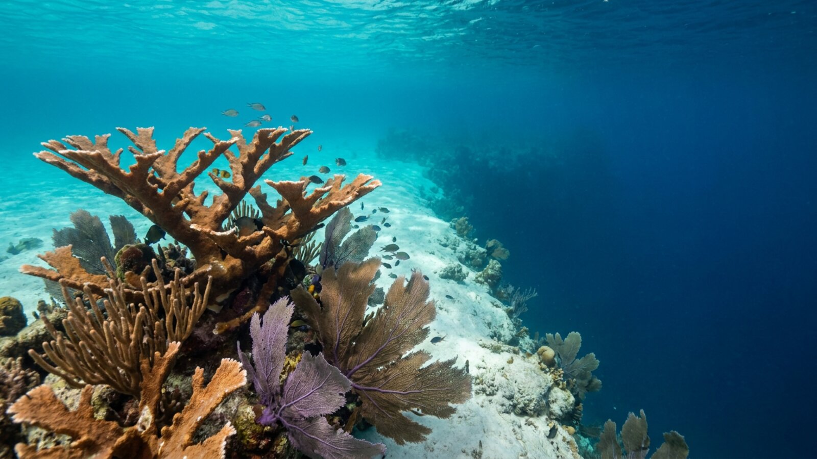
The reef builders are the same species found across the wider Caribbean: brain corals, star corals, pillar coral, and the branching elkhorn and staghorn corals of the genus Acropora, now much reduced. Sea fans, sea rods and huge barrel and tube sponges give the walls their texture. Among the fish, parrotfish, angelfish, butterflyfish, groupers, snappers and grunts are common, along with moray eels, spotted eagle rays and green and hawksbill turtles.
Sharks are a national asset. The Bahamas banned commercial longline fishing in the early 1990s and later made its waters a shark sanctuary, prohibiting commercial shark fishing. As a result, Caribbean reef sharks, nurse sharks, lemon sharks, tiger sharks and great hammerheads are relatively common, and shark diving brings significant tourism income. Learn more about coral reef fish and sea turtles.
Reefs and Bahamian life
For a nation of islands and shallow banks, healthy reefs underpin tourism, food and coastal safety.
Tourism is the mainstay of the Bahamian economy, and much of it depends on clear water, white beaches and the reefs that create and protect them. Diving, snorkelling, sport fishing and boating all draw on the marine environment. Fisheries matter just as much locally: the spiny lobster, known locally as crawfish, is a major export, and queen conch and Nassau grouper are central to Bahamian food and culture.
Reefs also act as natural breakwaters, absorbing wave energy before it reaches the low-lying islands. In a country where most land lies only a few metres above sea level, that protection is vital during hurricanes.
Pressures on the Bahamas’ reefs
Bahamian reefs face warming seas, disease, overfishing, invasive lionfish and increasingly powerful hurricanes.
Rising sea temperatures have caused repeated bleaching events across the Bahamas, and stony coral tissue loss disease has spread to Bahamian reefs from Florida. The Caribbean-wide losses of elkhorn and staghorn coral and the long-spined sea urchin in past decades also hit the Bahamas. Invasive lionfish, first established in the region in the 2000s, spread quickly through Bahamian reefs and prey on small native fish. Overfishing has depleted Nassau grouper and conch in some areas, prompting closed seasons and stricter rules.
Storms are an acute threat: Hurricane Dorian in 2019 devastated the Abacos and Grand Bahama, damaging reefs and coastlines as well as communities. Sea-level rise adds a long-term risk for the entire low-lying archipelago.
The Bahamas has responded with an expanding network of marine protected areas, fisheries management, shark protection and reef restoration projects, building on the long example of the Exuma Cays Land and Sea Park. Read more on our coral reef threats and coral reef conservation pages.
On land, Harbour Island is known for its pink sand beach, coloured by the shells of tiny reef-dwelling foraminifera.
Related on TheSea
- Barbados Coral Reef
- Anguilla Coral Reef Maps
- Dominica Coral Reef Maps
- Dutch Antilles Coral Reef Maps
- Grenada Coral Reef Maps
- Guadeloupe Coral Reef Maps
- Montserrat Coral Reef Maps
- Saint Kitts & Nevis Coral Reef Maps
- St Lucia Coral Reef Maps
- St Vincent & the Grenadines Coral Reef Maps
- British Virgin Islands (UK Virgin Islands) Coral Reef Maps
- US Virgin Islands Coral Reef Maps
Does the Bahamas have a barrier reef?
Yes. The Andros Barrier Reef runs for more than 200 kilometres along the east coast of Andros and is often listed among the longest barrier reefs in the world. It drops into the deep Tongue of the Ocean, creating famous wall dives.
Where is the best coral reef in the Bahamas?
Andros has the largest reef system, the Exuma Cays Land and Sea Park has some of the best-protected reefs and fish life, and Bimini, Grand Bahama, New Providence and Long Island all offer excellent reefs, walls and shark dives.
Can you snorkel coral reefs in Nassau?
Yes. Boat trips from Nassau and Paradise Island visit shallow reefs, wrecks and snorkel sites around New Providence, and Rose Island nearby is a popular snorkel destination.
Is the Bahamas in the Caribbean?
Geographically the Bahamas lies in the Atlantic Ocean, north of the Caribbean Sea, but it is usually grouped with the Caribbean culturally, and its reefs share the same coral and fish species.
What is a blue hole in the Bahamas?
A flooded sinkhole in the limestone banks, formed when the banks were dry land during ice ages and later drowned by rising seas. Dean’s Blue Hole on Long Island, around 200 metres deep, is the most famous.
Are Bahamas coral reefs dying?
They have lost coral to bleaching, disease, storms and overfishing, as across the Caribbean, but many reefs remain rich in fish and sharks. Marine parks, fisheries rules and restoration projects aim to help them recover.
Blane Perun has been exploring Earth’s oceans and marine life for over 25 years. Founder of TheSea.Org in 1999, underwater photographer, coral aquaculture pioneer, and explorer of 80+ countries.
About Blane Perun → More Coral Reef Maps →