Aegean Sea — Islands, Depth, History and Marine Life of Greece’s Sea
The Aegean Sea is an arm of the Mediterranean lying between mainland Greece to the west and north and Turkey (Anatolia) to the east. It covers roughly 214,000–215,000 km² (about 83,000 sq mi), runs a little over 600 km from north to south, and is closed off in the south by the island arc of Kythira, Crete, Karpathos and Rhodes. Its deepest point, about 3,544 m, lies east of Crete. Scattered across it are thousands of islands and islets — the Cyclades, Dodecanese, Sporades, the North and East Aegean islands and Crete — and its shores were the cradle of the Minoan and classical Greek civilisations.
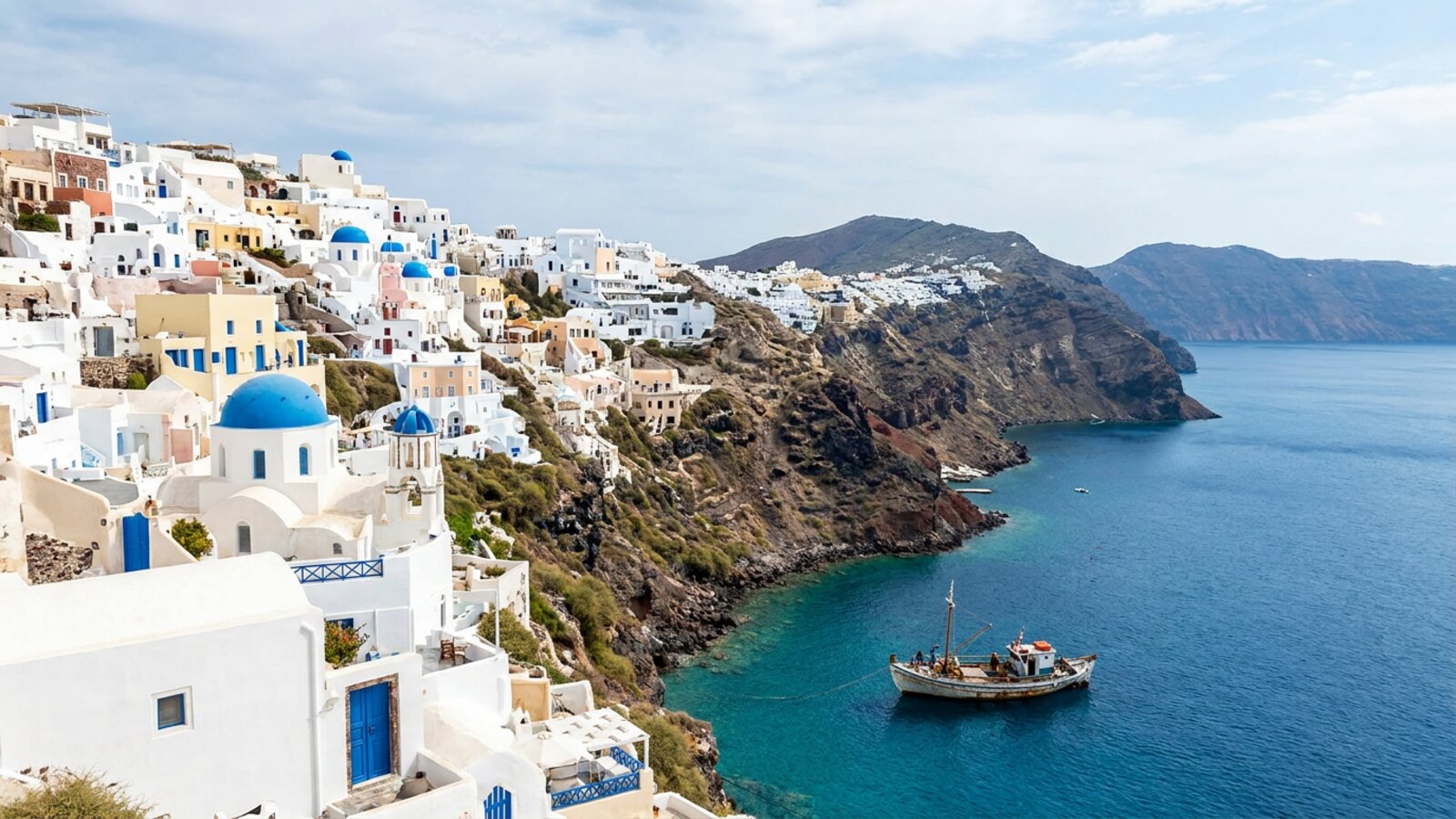
Few seas carry as much history in so small a space. The Aegean is where Bronze Age sailors first linked islands into trading networks, where Athens fought Persia at sea, and where the myths of Theseus, Icarus and the Argonauts were set. Today it is one of the world’s favourite holiday seas, famous for whitewashed island villages, clear blue water and the strong summer meltemi wind. Beneath the postcard surface it is also a complex natural system: a sea fed by fresher water from the Black Sea, shaped by an active volcanic arc and earthquakes, and home to the largest remaining population of the endangered Mediterranean monk seal. This guide covers where the Aegean is, how deep it is, how its waters work, its island groups, its history, its marine life and the pressures it faces.
Where is the Aegean Sea?
The Aegean sits between the Balkan Peninsula and Anatolia, in the north-eastern corner of the Mediterranean.
Mainland Greece forms the Aegean’s western and northern shores, from the Peloponnese past Athens and Thessaloniki to Thrace, while Turkey’s Aegean coast, with ports such as Izmir, runs down its eastern side. In the south, a chain of islands — Kythira, Crete, Kasos, Karpathos and Rhodes — separates it from the open eastern Mediterranean, and the stretch of water just north of Crete is often called the Sea of Crete. In the north-east the narrow Dardanelles strait connects the Aegean to the Sea of Marmara and, through the Bosporus at Istanbul, to the Black Sea.
Several smaller named seas and gulfs are parts of the Aegean, including the Thracian Sea in the north, the Myrtoan Sea in the south-west, the Saronic Gulf off Athens and the Thermaic Gulf at Thessaloniki. Only two countries border it, Greece and Turkey, and the vast majority of its islands belong to Greece.
Where does the name come from?
The origin of the name is uncertain, and ancient writers offered several explanations. The best-known legend tells of King Aegeus of Athens, whose son Theseus sailed to Crete to kill the Minotaur. Theseus promised to change his ship’s black sails to white if he returned alive, but forgot; seeing the black sails, Aegeus believed his son dead and threw himself into the sea, which was named after him. Other traditions link the name to the town of Aegae or to an Amazon queen named Aegea. In Greek the sea is Aigaio Pelagos, and in Turkish it is Ege Denizi. In antiquity the many islands gave the word “archipelago” to the world: it was originally a name for the Aegean itself.
How deep is the Aegean Sea?
The Aegean is shallow in places and very deep in others, reflecting its active geology. Broad continental shelves lie off northern Greece and Thrace, while the North Aegean Trough plunges to well over 1,000 m. The central Aegean is a plateau studded with islands, and the seafloor drops away sharply into deep basins in the south. The deepest point, about 3,544 m, lies east of Crete, close to the Hellenic Trench where the African plate slides beneath the Aegean.
That collision makes the Aegean one of the most seismically active regions in Europe. It also produced the South Aegean Volcanic Arc, a curved line of volcanoes that includes Methana, Milos, Santorini and Nisyros. Below a few hundred metres the water is remarkably uniform, staying around 13–14 °C year-round and among the saltiest deep water in the Mediterranean.
| Measure | Value | Note |
|---|---|---|
| Surface area | ~214,000 km² | About 83,000 sq mi |
| Length × width | ~610 km × ~300 km | North–south, east–west |
| Maximum depth | ~3,544 m | East of Crete |
| Bordering countries | 2 | Greece and Turkey |
| Surface salinity | Lower in the north, higher in the south | Black Sea inflow vs. evaporation |
| Deep water | ~13–14 °C | Very stable below a few hundred metres |
| Prevailing summer wind | Meltemi | Strong, dry northerlies |
Water, currents and the meltemi wind
The Aegean is a meeting place of two very different waters: fresher water flowing out of the Black Sea in the north, and salty, sun-evaporated Mediterranean water in the south.
The Black Sea receives huge volumes of river water and is much less salty than the Mediterranean. Its surplus flows out through the Bosporus and Dardanelles and spreads across the north-eastern Aegean as a light surface layer, while denser, saltier Mediterranean water flows back the other way underneath. Farther south, hot summers and dry winds drive strong evaporation, so the water grows steadily saltier and denser toward Crete. Overall the Aegean is nutrient-poor, like most of the Mediterranean, which is one reason its water is so clear — and why its fish stocks are smaller than those of more productive seas.
The most famous feature of the Aegean climate is the meltemi (called etesian winds by the ancient Greeks), a dry northerly that blows most strongly from about June to September. It can reach gale force in the central Aegean, kicking up short, steep waves that can make ferry crossings rough and sailing exhilarating. The meltemi also keeps the islands cooler than the mainland and helps mix the surface water.
In the early 1990s, a run of cold winters and changes in circulation made the water of the southern Aegean so dense that it sank and, for several years, became a major source of the eastern Mediterranean’s deep water — an event oceanographers call the Eastern Mediterranean Transient. It showed how sensitive Mediterranean circulation can be to changes in this small sea.
The main Aegean island groups
Greece counts thousands of islands and islets in the Aegean, though only a small fraction are inhabited. They are usually grouped as follows:
- Cyclades — a ring of islands around sacred Delos, including Mykonos, Naxos, Paros, Milos and Santorini.
- Dodecanese — off south-western Turkey, including Rhodes, Kos, Kalymnos, Karpathos and Patmos.
- Northern Sporades — north-east of Euboea, including Skiathos, Skopelos and Alonissos.
- North and East Aegean islands — Lesbos, Chios, Samos, Lemnos, Ikaria and Thasos, plus Turkey’s Gökçeada (Imbros) and Bozcaada (Tenedos).
- Saronic islands — Aegina, Hydra, Poros and Salamis, close to Athens.
- Euboea and Crete — two of Greece’s largest islands; Crete is the largest of all and forms the sea’s southern boundary.
Many islands are the tops of drowned mountains, while others, such as Santorini and Milos, are volcanic. Island landscapes range from the green, forested slopes of Samos and Thasos to the dry, terraced rock of the central Cyclades.
Why the Aegean matters in history
The Aegean was the stage for some of the earliest complex societies in Europe. The Cycladic culture produced its famous marble figurines in the Early Bronze Age; the Minoans built palaces such as Knossos on Crete and traded across the eastern Mediterranean; and the Mycenaeans of mainland Greece followed. Around the middle of the second millennium BC, the volcano of Thera (Santorini) erupted in one of the largest eruptions of the past several thousand years, burying the Bronze Age town of Akrotiri under ash and leaving the flooded caldera visitors see today.
In the classical era, the Aegean linked the Greek city-states. The naval battle of Salamis in 480 BC, fought in the Saronic Gulf, turned back the Persian invasion of Greece, and Athens built its power on a fleet that controlled the sea. Later the Aegean was ruled by Rome, Byzantium, Venice and the Ottoman Empire. Its seabed preserves countless wrecks, including the ship found off Antikythera that yielded the Antikythera mechanism, an ancient Greek geared device for calculating astronomical cycles. Ancient remains still lie just offshore at sites such as ancient Epidaurus.
What lives in the Aegean Sea?
Clear, nutrient-poor water means the Aegean holds fewer fish than richer seas, but its wildlife includes some of the Mediterranean’s rarest animals.
- Mediterranean monk seals — Greece holds the largest remaining population of this endangered seal. The National Marine Park of Alonissos and the Northern Sporades protects key breeding caves. See monk seal.
- Dolphins and whales — striped, common and bottlenose dolphins, harbour porpoises in the north, and sperm whales and Cuvier’s beaked whales in the deep waters along the Hellenic Trench.
- Sea turtles — loggerheads feed throughout the Aegean and nest on beaches in Greece and Turkey; green turtles occur in the south-east.
- Fish and cephalopods — sardine, anchovy, bluefin tuna, swordfish, groupers, red mullet and the common octopus, a staple of island tavernas.
- Seagrass and sponges — meadows of Posidonia oceanica shelter young fish and stabilise the seabed, and the island of Kalymnos is famous for its long tradition of sponge diving.
The Aegean also has a growing number of newcomers. Species from the Red Sea that entered the Mediterranean through the Suez Canal, such as rabbitfish and lionfish, have spread north into the warming Aegean, where they compete with native species.
What threatens the Aegean Sea?
Overfishing has depleted many Aegean stocks, and illegal fishing with explosives and destructive trawling has damaged seagrass beds and rocky reefs. Coastal development and mass tourism put pressure on monk seal caves and turtle nesting beaches, while plastic and other litter accumulate in enclosed bays. Shipping between the Black Sea and the Mediterranean adds the risk of spills and introduced species.
Climate change is a growing pressure. Marine heatwaves have become more frequent in the eastern Mediterranean, stressing seagrasses, sponges and gorgonians and helping warm-water invaders spread. Greece has responded by expanding its marine protected areas; in 2024 it announced plans for new national marine parks, including one in the southern Aegean, and a phased ban on bottom trawling in its marine protected areas.
For neighbouring waters, see the Adriatic Sea, the Ionian Sea and the Black Sea, or browse our seas of the world hub.
Where is the Aegean Sea?
It is the arm of the Mediterranean between mainland Greece and Turkey, bounded in the south by Crete and Rhodes and connected to the Black Sea through the Dardanelles, the Sea of Marmara and the Bosporus.
How deep is the Aegean Sea?
Its deepest point is about 3,544 m, east of Crete. The northern Aegean has broad shallow shelves but also a trough more than 1,000 m deep.
How big is the Aegean Sea?
It covers about 214,000 km² (83,000 sq mi) and is roughly 610 km long and 300 km wide.
Which countries border the Aegean Sea?
Greece and Turkey. Most of the islands belong to Greece; Turkey’s include Gökçeada and Bozcaada near the Dardanelles.
Why is it called the Aegean Sea?
According to Greek myth, it is named after King Aegeus of Athens, who threw himself into the sea believing his son Theseus had been killed by the Minotaur. Other ancient explanations also exist.
Are there monk seals in the Aegean?
Yes. Greece holds the largest remaining population of the endangered Mediterranean monk seal, with important breeding caves in the Northern Sporades and other remote islands.
Is the Aegean Sea cold?
Not in summer: surface water usually reaches the low-to-mid 20s °C from July to September. In winter it cools to the mid-teens or lower, and the north is colder than the south.
Blane Perun has been exploring Earth’s oceans and marine life for over 25 years. Founder of TheSea.Org in 1999, underwater photographer, coral aquaculture pioneer, and explorer of 80+ countries.
About Blane Perun → More on Seas →