How Wide Is the Red Sea? — 355 km at Its Widest, 26 km at the Gate of Grief
The Red Sea is about 355 km (221 miles) wide at its widest point, in the southern half between Eritrea and Saudi Arabia/Yemen. It averages roughly 200–300 km across along most of its length and narrows to only about 26 km (16 miles) at the Bab-el-Mandeb strait, its southern entrance. In the north it splits into two narrow gulfs: the Gulf of Suez and the Gulf of Aqaba, which is at most 24 km wide. The sea is about 2,250 km long and is still widening by roughly a centimetre a year.
Width shapes almost everything about the Red Sea: its narrow southern gate limits exchange with the Indian Ocean, which keeps the water unusually salty and warm and lets endemic species evolve; its narrow gulfs create some of the steepest reef walls in the world; and its narrowness makes it one of the busiest and most strategically sensitive shipping lanes on Earth.
Where does the Red Sea begin and end?
Any figure for the width or length of a sea depends on where its edges are drawn. The International Hydrographic Organization sets the southern limit of the Red Sea on a line between Husn Murad in Yemen and Ras Siyyan in Djibouti, at the Bab-el-Mandeb. In the north, the Red Sea proper ends where the two gulfs begin: on a line from Ras Muhammad, the southern tip of the Sinai Peninsula, to Shadwan Island for the Gulf of Suez, and on a line through Tiran Island for the Gulf of Aqaba. Measured between those limits, the sea is about 2,250 km (1,400 miles) long, has a surface area of about 438,000 km² and holds about 233,000 km³ of water.
The shape is unusual: it is roughly six times longer than it is wide, and it runs north-north-west to south-south-east along the line of the rift that created it. Because the sea is so narrow, the maritime zones of the countries on either side meet in the middle along almost its whole length. Saudi Arabia has the largest exclusive economic zone in the Red Sea, at about 186,000 km², followed by Sudan, Egypt and Eritrea at roughly 78,000–93,000 km² each, then Yemen and Djibouti. Part of the Egyptian and Sudanese coast, the Hala’ib Triangle, is disputed between the two countries.

Where is the Red Sea widest?
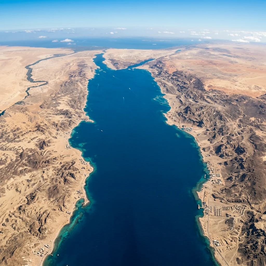
In the southern half, between the coasts of Eritrea and Saudi Arabia and Yemen, where the sea reaches about 355 km (221 miles) across.
This wider southern basin is also where the Red Sea is shallowest along its margins, with broad coastal shelves and large archipelagos such as the Dahlak Islands off Eritrea and the Farasan Islands off Saudi Arabia. Farther north, the sea is narrower and deeper, with a steep central trough.
The width figure hides a great deal of variation in depth. About 40% of the Red Sea is less than 100 m deep and about a quarter is less than 50 m deep, because broad shelves fringe both coasts. Down the middle runs a deep axial trough, and in the central Suakin Trough the sea reaches its greatest depth, about 3,040 m. The average depth of about 490 m is therefore a poor guide to what lies beneath any given point. In the south, where the sea is widest, the shelves are broadest and carry large archipelagos. The Hanish Islands, near the southern entrance, were fought over by Yemen and Eritrea in 1995. After both sides agreed to arbitration in 1998, the Permanent Court of Arbitration awarded most of the archipelago to Yemen and several small islets to Eritrea.
Where is the Red Sea narrowest?

At the Bab-el-Mandeb strait in the far south, where Yemen on the Arabian Peninsula faces Djibouti and Eritrea in Africa across only about 26 km (16 miles) of water.
Perim Island splits the strait into two channels: a narrow eastern channel (Bab Iskender) about 5.4 km wide and 29 m deep, and a western channel about 20 km wide and roughly 310 m deep. The shallow sill here restricts the exchange of water with the Gulf of Aden, which is a key reason the Red Sea is so salty. The name Bab-el-Mandeb is usually translated as “Gate of Grief” or “Gate of Lamentation,” a reference to the dangers of navigating it. An Arab legend links the name instead to the many people said to have drowned in the earthquake that separated Arabia from Africa.
The strait itself is about 50 km long and averages about 186 m in depth. Its two channels behave differently. A surface current flows into the Red Sea through the shallow eastern channel, while a strong undercurrent of dense, salty Red Sea water flows out through the deeper western channel into the Gulf of Aden. Near the Djibouti coast lies a group of small islands known as the Seven Brothers. Perim has a long strategic history: the British East India Company seized it in 1799, Britain formally claimed it in 1857 and built a lighthouse in 1861, and it served as a coaling station for steamships until 1935.
Narrow as it is, the strait is one of the most important shipping routes in the world. In 2006, an estimated 3.3 million barrels of oil a day passed through it, out of a world total of about 43 million barrels moved by tanker. It has also been a gateway for people for much longer. During the past 100,000 years, changes in sea level have repeatedly narrowed the strait, and under the leading out-of-Africa model, early modern humans may have crossed here when sea levels were much lower and the gap between Africa and Arabia was far narrower than today.
How wide are the Gulf of Suez and the Gulf of Aqaba?
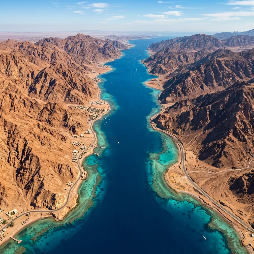
Both northern arms are narrow. The Gulf of Aqaba is at most about 24 km wide and about 160 km long; the Gulf of Suez is about 19–32 km wide and 314 km long.
| Arm | Width | Depth | Bordering countries |
|---|---|---|---|
| Gulf of Suez | ~19–32 km | Average ~40 m, max ~70 m | Egypt (both shores) |
| Gulf of Aqaba | Max ~24 km | Up to ~1,850 m | Egypt, Israel, Jordan, Saudi Arabia |
| Main Red Sea | Up to ~355 km | Up to ~3,040 m | Egypt, Sudan, Eritrea, Saudi Arabia, Yemen |
The Gulf of Suez is broad and shallow and leads to the Suez Canal. The Gulf of Aqaba is a deep, narrow rift valley — part of the same fault system as the Dead Sea — and its reefs at Eilat, Aqaba, Dahab and Nuweiba drop steeply into very deep water.
The two gulfs are very different in origin. The Gulf of Suez lies in a rift basin that began forming about 26 million years ago but is now inactive. It stretches about 314 km from the Strait of Gubal to the city of Suez, is 19–32 km wide, and averages only about 40 m deep, with a maximum of about 70 m. Its floor holds major oil fields, some producing since the early 20th century. The Gulf of Aqaba, by contrast, lies along the active Dead Sea Transform, the plate boundary that also forms the Dead Sea and the Jordan Valley. It is about 160 km long from the Straits of Tiran to Eilat and Aqaba, no more than 24 km wide, and reaches about 1,850 m deep. Its coastline is shared by four countries: Egypt, Israel, Jordan and Saudi Arabia.
How does the narrow shape affect the water?
The Red Sea lies between deserts. Rainfall over the sea and its coasts averages only about 60 mm a year, and no major river flows into it, while evaporation removes about 2,050 mm of water a year. The only way to make up the difference is inflow through the narrow, shallow Bab-el-Mandeb. As a result, the Red Sea is one of the saltiest bodies of seawater in the world, with salinity rising from about 36 parts per thousand in the south to about 41 near the Gulf of Suez and averaging about 40, compared with about 35 for the open ocean.
It is also one of the warmest seas. Average summer surface temperatures are about 26 °C in the north and 30 °C in the south, with only about 2 °C of variation in winter, and the overall average water temperature is about 22 °C. Tides are small: the range is about 0.6 m in the north and 0.9 m in the south, and the central Red Sea near Jeddah is almost tideless. Currents are mostly weak and wind-driven. In summer, north-westerly winds push surface water south for about four months at 15–20 cm per second; in winter the flow reverses and water from the Gulf of Aden enters the sea, producing a net drift towards the north.
Is the Red Sea getting wider?
Yes. The Red Sea lies on a spreading rift between the African and Arabian plates, which are moving apart by roughly a centimetre per year.
The rift began opening tens of millions of years ago, and new oceanic crust is forming along the deep axial trough in the centre. Over geological time the Red Sea is expected to widen into a true ocean basin. For more context, see what the Red Sea is famous for.
The opening of the Red Sea began in the Eocene and accelerated in the Oligocene as the Arabian Peninsula split away from the Horn of Africa. Geologists describe two main stages: an early phase of rifting and spreading, a long quiet period in which thick salt deposits accumulated, and a new phase of active spreading that began about five million years ago and continues today. Magnetic stripes on the sea floor suggest spreading of about 1 cm a year. Widening is not always smooth: in 2005, following a three-week burst of tectonic activity in the Afar region, the rift grew by about 8 m.
The rift is volcanically active. In 1949 a deep-water survey detected unusually hot water in the central Red Sea, and work in the 1960s confirmed pools of hot, very salty brine at about 60 °C, with metal-rich muds, the first hot hydrothermal brines found on any sea floor. Jabal al-Tair, an island volcano north-west of the Bab-el-Mandeb, erupted on 30 September 2007 after 124 years of quiet, and two new islands, Sholan and Jadid, emerged in Yemen’s Zubair archipelago in 2011 and 2013. At some point during the Tertiary, the southern entrance closed and the sea dried out into a hot, salt-floored basin before reopening. The Red Sea is often used as the textbook example of a young ocean, one of the early stages in the cycle described by the geologist John Tuzo Wilson.
Why has the Red Sea’s width mattered to history?
A long, narrow sea with a single southern entrance has always been both a highway and a bottleneck. Ancient Egyptians sailed down it to the land of Punt, with one expedition around 2500 BC and another under Queen Hatshepsut around 1500 BC. In the 6th century BC the Persian king Darius the Great surveyed its hazards and completed a canal linking the Nile to the northern end of the sea, a forerunner of the Suez Canal. The Periplus of the Erythraean Sea, a Greek guide written around the 1st century AD, describes its ports and the route onward to India, and under the Roman Empire trade along the Red Sea grew sharply.
The modern Suez Canal opened in November 1869, linking the Red Sea to the Mediterranean and roughly halving the sea distance between Europe and Asia compared with sailing around Africa. The narrowness that makes the route valuable also makes it fragile. The canal was closed from 1967 to 1975 after the Six-Day War, and disruption at either end of the Red Sea still forces ships onto the long route around the Cape of Good Hope.
The same geography helps explain the Red Sea’s wildlife. It is the world’s northernmost tropical sea. About 2,000 km of coral reef fringes its coasts, more than 1,200 species of fish have been recorded, and around 10% of them are found nowhere else, a level of endemism encouraged by the narrow, shallow connection to the Indian Ocean.
The reefs reflect the sea’s narrow, rift-valley shape. Most are fringing reefs that grow close to shore, largely built by Acropora and Porites corals, and in the deep northern gulfs they drop straight into very deep water a short swim from the beach. Offshore there are also reefs and true atolls whose unusual forms are attributed to the area’s tectonic activity. Visiting fish include some of the 44 species of shark recorded in the sea, and around 175 species of nudibranch have been described, many found only here. Egypt recognised the area’s value by creating Ras Mohammed National Park, at the southern tip of Sinai where the two gulfs meet, in 1983.
The corals have also drawn scientific attention for their heat tolerance. An expedition to reefs off Sudan and Eritrea recorded surface temperatures of about 28 °C in winter and up to 34 °C in summer, yet found the corals largely healthy, with little sign of bleaching. Researchers are studying how Red Sea corals and their symbiotic algae cope with such conditions, in the hope that the lessons may help reefs elsewhere as the oceans warm. One hypothesis is that corals which colonised the sea through its hot southern entrance were selected for heat tolerance on the way north.
How does the Red Sea compare with other seas?
It is long and narrow compared with most seas of similar area.
| Sea | Width | Narrowest entrance | Length | Area |
|---|---|---|---|---|
| Red Sea | Up to 355 km | ~26 km (Bab-el-Mandeb) | ~2,250 km | ~438,000 km² |
| Persian Gulf | — | ~56 km (Strait of Hormuz) | ~989 km | ~251,000 km² |
| Gulf of California | 48–241 km | Open to the Pacific | ~1,126 km | ~160,000 km² |
| Mediterranean Sea | — | ~14 km (Strait of Gibraltar) | — | ~2,500,000 km² |
The Gulf of California is the closest match in shape: like the Red Sea it is a long, narrow sea formed where a plate boundary is pulling continental crust apart. The Persian Gulf, by contrast, is a shallow basin sitting on continental crust rather than a spreading rift.
See our profiles of the Persian Gulf and Mediterranean Sea.
How wide is the Red Sea at its widest?
About 355 km (221 miles), in the southern half near Eritrea.
How wide is the Red Sea at its narrowest?
About 26 km (16 miles) at the Bab-el-Mandeb strait between Yemen and Djibouti/Eritrea.
How long is the Red Sea?
About 2,250 km (1,400 miles) from the Gulf of Suez to Bab-el-Mandeb.
Can you see across the Red Sea?
Across the main sea, no — it is far too wide. Across the Gulf of Aqaba or the Bab-el-Mandeb strait, the far shore is often visible on a clear day.
How deep is the Red Sea?
Average depth is about 490 m; the deepest point is about 3,040 m in the central Suakin Trough.
Is the Red Sea widening?
Yes, by roughly a centimetre per year as the African and Arabian plates move apart.
What is the area of the Red Sea?
About 438,000 km² (169,000 square miles).
- Encyclopaedia Britannica / Wikipedia. Red Sea — dimensions, depth, salinity, temperature, basin countries, name origins.
- Wikipedia / hydrographic sources. Bab-el-Mandeb strait, Gulf of Aqaba, Gulf of Suez and Red Sea Rift.
- International Hydrographic Organization (1953). Limits of Oceans and Seas, 3rd edition (Red Sea limits).
- Permanent Court of Arbitration (1998). Eritrea/Yemen: territorial sovereignty and scope of the dispute (Hanish Islands).
Blane Perun has been exploring Earth’s oceans and marine life for over 25 years. Founder of TheSea.Org in 1999, underwater photographer, coral aquaculture pioneer, and explorer of 80+ countries.
About Blane Perun → More on Red Sea →