Bahamas Coral Reef Maps — The Andros Barrier Reef, Walls and Blue Holes
The Bahamas’ coral reefs fringe the edges of two huge shallow carbonate platforms — the Great Bahama Bank and the Little Bahama Bank — and the islands scattered across them. The largest single reef is the Andros Barrier Reef, which runs for roughly 200 km along the east coast of Andros beside the deep Tongue of the Ocean. Other major reef areas lie around the Exumas, Bimini, Grand Bahama, the Abacos, Eleuthera, New Providence and the southern islands such as San Salvador and Inagua. UNEP-WCMC maps roughly 2,226 km² of reef — one of the largest reef areas in the wider Caribbean.
The Bahamas is an archipelago of around 700 islands and thousands of smaller cays spread across a vast area of the western Atlantic. Most of it sits on shallow banks where the water is only a few metres deep, cut by deep channels and trenches that plunge thousands of metres. Coral reefs grow along the edges where shallow bank meets deep water, giving the Bahamas some of the most dramatic reef scenery in the Atlantic: a long barrier reef, sheer walls, blue holes and some of the best shark diving anywhere.
Bahamas coral reef map
Reefs trace the rims of the great banks and the shores of the islands.
On the map, coral shading outlines the edges of the Great and Little Bahama Banks and wraps around many of the islands. The longest continuous line runs down the east side of Andros, the largest island, facing the Tongue of the Ocean. Reef also follows the Exuma chain, the north and east sides of the Abacos and Eleuthera, the Bimini and Berry Islands, and the shores of the southern islands from Long Island and San Salvador to Inagua.
The reef outlines are from the UNEP-WCMC global warm-water coral reef dataset, compiled from satellite imagery and surveys. In the Bahamas the shallow banks are so bright and clear from space that reef edges show up well, but the shading still marks reef extent rather than live coral cover. It is not a navigation chart: Bahamian waters are notoriously full of shallow reef heads.

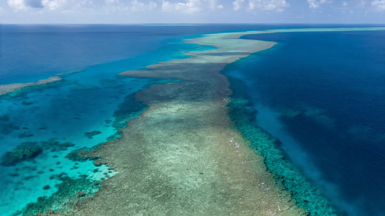
The Andros Barrier Reef and the Tongue of the Ocean
One of the longest barrier reefs in the world sits on the edge of a deep ocean trench.
The Andros Barrier Reef runs for roughly 200 km along the eastern shore of Andros, separated from the island by a shallow lagoon a few kilometres wide. It is often described as one of the largest barrier reefs in the world after the Great Barrier Reef and the Mesoamerican Reef. On its seaward side, the reef drops into the Tongue of the Ocean, a deep basin that reaches depths of more than 1,800 m. Where the reef meets the trench, it forms a vertical wall that begins in shallow water and plunges into the blue — one of the most spectacular wall dives in the Caribbean region.
Behind the reef, the vast shallow flats and creeks of western Andros are among the largest wetland and mangrove areas in the Bahamas, serving as nurseries for reef fish, conch and lobster.
Blue holes and the great carbonate banks
The Bahamas sit on limestone platforms riddled with flooded caves.
The Great and Little Bahama Banks are enormous platforms of limestone built up over many millions of years from the skeletons of corals, algae and other marine organisms. During the ice ages, when sea level was more than 100 m lower than today, the banks were dry land. Rainwater dissolved the limestone, carving caves and sinkholes that flooded when the sea rose again. These are the famous blue holes — circular pits of deep blue water found both inland and on the shallow banks. Dean’s Blue Hole on Long Island is one of the deepest known, at around 200 m.
Some marine blue holes are rimmed with coral and attract fish, turtles and sharks. The Exumas also host living stromatolites, layered microbial structures of a type that dates back billions of years. For more on how reefs have shaped the planet over time, see how coral reefs have changed over time.
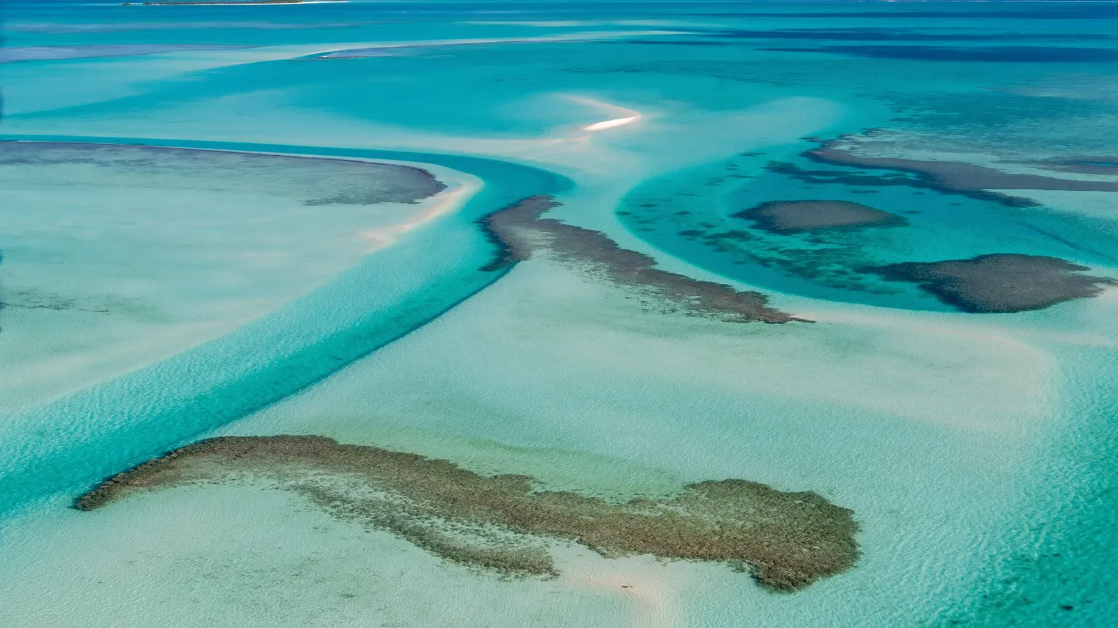
Main reef areas of the Bahamas
From the Exumas to Bimini, each island group has its own reef character.
- Andros — the barrier reef, the wall on the Tongue of the Ocean and many blue holes.
- The Exumas — a chain of more than 300 cays with patch reefs and fringing reefs; home to the Exuma Cays Land and Sea Park, founded in 1958 and later made a no-take reserve.
- Bimini — reefs and walls on the edge of the Gulf Stream, famous for winter great hammerhead shark dives.
- Grand Bahama — reefs and wrecks; nearby Tiger Beach is known for tiger shark encounters.
- The Abacos — a long chain of cays with fringing and patch reefs, including the Fowl Cays and Pelican Cays protected areas.
- Eleuthera and New Providence — reefs, walls and wrecks near Nassau, one of the busiest dive areas.
- Southern islands — Long Island, San Salvador, Cat Island and Inagua, with remote walls and clear water.
Reefs and Bahamian life
Tourism, fisheries and coastal protection all depend on the reefs.
Tourism is the backbone of the Bahamian economy, and much of it is built on beaches, clear water, diving, snorkelling, sport fishing and boating — all tied to healthy reefs. Bahamian fisheries for spiny lobster, queen conch and grouper are culturally and economically important. For low-lying islands, reefs also act as breakwaters that reduce wave energy during storms. The Bahamas has expanded its system of protected areas in recent decades, including national parks and marine reserves managed by the Bahamas National Trust.
Threats to the Bahamas’ coral reefs
Heat, disease, hurricanes and invasive lionfish.
Bahamian reefs share the pressures affecting reefs throughout the region. Marine heatwaves have caused repeated bleaching. Coral diseases, including stony coral tissue loss disease, have spread through parts of the archipelago. Hurricanes are a major disturbance — Hurricane Dorian, a Category 5 storm in 2019, devastated parts of the Abacos and Grand Bahama. Invasive lionfish became abundant in the 2000s and prey on small reef fish. Overfishing of conch and grouper, and coastal development around Nassau and resort areas, add local pressure. Because many Bahamian reefs are remote and lightly populated, some remain in better condition than reefs on more developed coasts. See causes of coral reef destruction in the Caribbean for the wider context.
Related on TheSea
- Coral Reef Conservation
- Saint Kitts & Nevis Coral Reef Maps
- Montserrat Coral Reef Maps
- Dominica Coral Reef Maps
- Martinique Coral Reef Maps
- British Virgin Islands (UK Virgin Islands) Coral Reef Maps
- Guadeloupe Coral Reef Maps
- St Lucia Coral Reef Maps
- US Virgin Islands Coral Reef Maps
- Dutch Antilles Coral Reef Maps
- Grenada Coral Reef Maps
- Barbados Coral Reef
Where are the coral reefs in the Bahamas?
Along the edges of the Great and Little Bahama Banks and around many of the islands. The biggest is the Andros Barrier Reef on the east side of Andros; other important reefs lie around the Exumas, Bimini, Grand Bahama, the Abacos, Eleuthera, New Providence and the southern islands.
How long is the Andros Barrier Reef?
Roughly 200 km. It runs along the eastern shore of Andros beside the Tongue of the Ocean and is often ranked among the largest barrier reefs in the world.
How much coral reef does the Bahamas have?
The UNEP-WCMC global dataset maps roughly 2,226 km² of reef in the Bahamas, one of the largest reef areas in the Caribbean region.
What is a blue hole in the Bahamas?
A blue hole is a water-filled sinkhole or cave in the limestone, formed when the banks were dry land during the ice ages and later flooded by rising seas. Dean’s Blue Hole on Long Island is among the deepest known, at about 200 m.
Where is the best snorkelling in the Bahamas?
The Exuma Cays Land and Sea Park, Thunderball Grotto in the Exumas, the reefs off Andros, and sites around Bimini and Eleuthera are popular, with many shallow patch reefs reachable by boat.
Are the Bahamas’ reefs healthy?
Some remote reefs remain in relatively good condition, but many have been affected by bleaching, coral disease, hurricanes, lionfish and overfishing. Protected areas and the shark sanctuary help, but warming seas remain the biggest long-term threat.
- UNEP-WCMC, WorldFish Centre, WRI, TNC: Global distribution of warm-water coral reefs, v4.1 (2021)
- Bahamas National Trust: national parks and marine protected areas
- Atlantic and Gulf Rapid Reef Assessment (AGRRA): Bahamas reef surveys
Blane Perun has been exploring Earth’s oceans and marine life for over 25 years. Founder of TheSea.Org in 1999, underwater photographer, coral aquaculture pioneer, and explorer of 80+ countries.
About Blane Perun → More Caribbean Coral Reef Maps →