Seas of the World — List, Sizes, Depths & Facts
A sea is a large body of salt water that forms a smaller part of the ocean, usually partly enclosed by land, such as the Mediterranean, Caribbean or South China seas. Seas are generally shallower and more influenced by the surrounding land than the open ocean, and they vary enormously: from the roughly 5-million-km² Philippine Sea to the Sea of Azov, which averages only about 7 metres deep, and from the nearly fresh northern Baltic to the Red Sea at around 40‰ salt. About 50 bodies of water are commonly called seas. This hub compares every sea profiled on TheSea.org and links to each full profile.
“Sea” is one of the oldest words in geography, and also one of the loosest. It is used for vast stretches of the western Pacific, for shallow water over drowned river valleys, for a patch of the Atlantic with no shore at all, and even for salt lakes in the desert. This guide sorts them out: what makes a sea a sea, how seas are classified, how the world’s major seas compare in size, depth and saltiness, and why these partly enclosed waters matter so much for marine life and for people.
What is the difference between a sea and an ocean?
An ocean is one of the five great connected basins of the world ocean; a sea is a smaller part of one of those oceans, usually bordered or partly enclosed by land.
The five oceans are the Pacific, Atlantic, Indian, Southern and Arctic. Most seas are marginal seas lying over continental shelves, which makes them shallower than the open ocean, though some, like the Caribbean and Philippine seas, are thousands of metres deep. Because they are hemmed in by land, seas tend to be more strongly shaped by rivers, evaporation, tides and human activity than the open ocean is. Read more in oceans and seas.
In everyday speech the words are often used interchangeably — people talk about going “to sea” or about life “in the sea” when they mean the ocean in general. In geography, though, the distinction is mostly about size, enclosure and position: seas sit at the edges of oceans, between land masses or island chains, while oceans are the vast open basins that connect them.
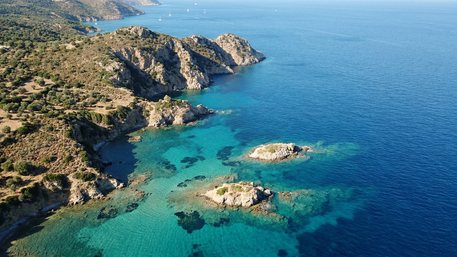
How are seas classified?
Seas are usually grouped by how enclosed they are and what kind of seabed they sit on.
Marginal seas are partly enclosed by islands or peninsulas but open to the ocean, such as the South China Sea or Bering Sea.
Mediterranean (inland) seas are almost entirely surrounded by land and joined to the ocean by a narrow strait, such as the Mediterranean, Black, Red and Baltic seas.
Shelf seas are shallow seas lying entirely on the continental shelf, such as the North Sea, Yellow Sea and Java Sea.
Lakes called seas are landlocked salt lakes with no outlet to the ocean, such as the Caspian and Dead seas.
Seas without coasts are the oddity: the Sargasso Sea in the Atlantic is defined by the ocean currents that circle it rather than by land.
How do the world’s seas compare?
The table below compares the seas profiled on TheSea.org, ranked roughly by surface area. Follow each link for the full profile.
Figures are approximate and vary between sources depending on where boundaries are drawn; salinity is surface salinity in PSU or parts per thousand (‰).
| Sea | Area (km²) | Max depth (m) | Bordering countries | Salinity (‰) |
|---|---|---|---|---|
| Philippine Sea | ~5,000,000 | ~10,540 | 7 | ~34–35 |
| Coral Sea | ~4,791,000 | ~9,140* | 5 | ~34.5–35.5 |
| Arabian Sea | ~3,862,000 | 5,395 | 7 | ~35.5–37 |
| South China Sea | ~3,500,000 | ~5,560 | 7 | ~32–34.5 |
| Caribbean Sea | ~2,754,000 | 7,686 | ~34 states & territories | ~36 |
| Mediterranean Sea | ~2,500,000 | 5,109 | 21 | ~37–39+ |
| Bering Sea | ~2,000,000–2,304,000 | 4,097 | 2 | ~31–33 |
| Norwegian Sea | ~1,383,000 | 3,970 | 4 | ~35.1–35.3 |
| East China Sea | ~770,000–1,250,000 | 2,716 | 4 | ~30–34.5 |
| Sea of Japan | ~1,050,000 | 4,568 | 4 | ~34.1 |
| Argentine Sea | ~1,000,000 | ~2,224 | 3 | ~33.5–34.5 |
| Solomon Sea | ~720,000 | ~9,140 | 2 | ~34.5–35 |
| Timor Sea | ~610,000 | ~3,300 | 3 | ~34–35 |
| North Sea | ~570,000 | ~725 | 7 | ~34–35 |
| Red Sea | ~438,000 | 2,730 | 8 | ~36–41 |
| Black Sea | 436,400 | 2,212 | 6 | ~17–18 |
| Yellow Sea | ~380,000 | 152 | 3 | ~26–34 |
| Baltic Sea | ~377,000 | 459 | 9 | ~1–20 |
| Caspian Sea (lake) | ~371,000 | 1,025 | 5 | ~12 |
| Java Sea | ~320,000 | shallow (avg 46) | 1 | ~31–34 |
| Persian Gulf | ~251,000 | ~90 | 8 | ~39–42 |
| Aegean Sea | ~214,000 | 2,639 | 2 | ~33–39 |
| Ionian Sea | ~169,000 | 5,109 | 3 | ~38.5–39 |
| Sea of Cortez | ~160,000–177,000 | 3,000+ | 1 | ~35–35.5 |
| Adriatic Sea | 138,600 | 1,233 | 6 | ~38–39 |
| White Sea | ~90,000 | 340 | 1 | ~23–27 |
| Irish Sea | ~46,000 | ~275 | 3 | ~33–35 |
| Sea of Azov | ~39,000 | ~14 | 2 | ~10–14 |
| Dead Sea (lake) | ~605 | 304 | 3 | ~342 |
*The Coral Sea’s maximum depth figure depends on boundary definitions; its main basins are about 4,000–5,000 m deep. The Andaman Sea and the Seven Seas also have their own pages.
Which is the largest sea in the world?
By most measures, the Philippine Sea in the western Pacific is the largest sea on Earth.
The Philippine Sea covers roughly 5 million km² or more. The Coral Sea (about 4.8 million km²), Arabian Sea (about 3.9 million km²) and South China Sea (about 3.5 million km²) follow. Rankings vary because seas have no natural edges in the open ocean, so the International Hydrographic Organization draws conventional boundaries. At the other end of the scale, the Sea of Marmara, between the Black Sea and the Aegean, is often cited as the smallest true sea.
Which sea is the deepest, shallowest, saltiest and freshest?
The world’s seas span extremes of depth, salt and oxygen.
Deepest: the Philippine Sea, whose Philippine Trench reaches about 10,540 m; the Caribbean’s Cayman Trough reaches 7,686 m.
Shallowest: the Sea of Azov, averaging about 7 m and nowhere deeper than about 14 m.
Saltiest open sea: the Red Sea, averaging about 40‰, with the Persian Gulf close behind. The landlocked Dead Sea is about 34% salt, almost ten times the ocean.
Freshest: the Baltic Sea, whose northern Gulf of Bothnia is only about 1–3‰.
Least oxygen: the Black Sea, where more than 90% of the deep water is anoxic.
Why are some seas so salty and others almost fresh?
A sea’s salinity reflects a balance between water lost to evaporation, fresh water gained from rivers and rain, and how freely it exchanges water with the open ocean.
In the Red Sea, very little rain falls, no major river flows in and the only link to the Indian Ocean is the narrow, shallow strait of Bab-el-Mandeb. Evaporation removes up to about 2 m of water a year, and the result is surface salinity of around 40 parts per thousand, well above the ocean average of about 35. The Persian Gulf and the eastern Mediterranean are salty for the same reasons.
The Baltic is the opposite. Large rivers and plentiful rain pour fresh water into a sea whose only connection to the ocean runs through the narrow, shallow Danish straits. Surface water in the far north of the Gulf of Bothnia is almost fresh, while denser, saltier North Sea water creeps in along the bottom only occasionally, during strong inflow events. The Black Sea shows what happens when such layering becomes permanent: a cap of lower-salinity water fed by rivers such as the Danube sits on top of salty, dense water that enters through the Bosporus. The layers barely mix, and below roughly 150–200 m the water has no dissolved oxygen and is laced with hydrogen sulfide, making the Black Sea the largest body of anoxic water on Earth.
Salt also shapes the wider ocean. Dense, salty water leaving the Mediterranean sinks as it pours out through the Strait of Gibraltar beneath the inflowing Atlantic surface water, and spreads at mid-depths across the North Atlantic, where it can be traced far from its source.
How did the world’s seas form?
Seas are not permanent features. Rising sea levels and moving tectonic plates have created, drained and reshaped them over time.
Many shelf seas, such as the North Sea and the Yellow Sea, flooded only after the last ice age, when melting ice sheets raised sea level by more than 100 m and drowned low-lying land. The southern North Sea covers a landscape now called Doggerland, which was dry land inhabited by hunter-gatherers until roughly 8,000 years ago. The Baltic took its present form as the Scandinavian ice sheet melted, passing through a series of lake and sea stages, and the land around it is still rising as it recovers from the weight of the ice.
Other seas owe their shape to plate tectonics. The Red Sea is a young ocean basin, opening as the Arabian plate pulls away from Africa; its floor contains hot, salty brine pools and volcanic rock like that found along mid-ocean ridges. The Mediterranean is a remnant of the ancient Tethys Ocean. Between about 5.96 and 5.33 million years ago, during the Messinian salinity crisis, its link with the Atlantic was cut off and it partly or almost completely dried out several times, leaving salt deposits more than a kilometre thick. The crisis ended when the Atlantic broke through at Gibraltar and refilled the basin. Tectonic movements continue to reshape seas today, as the Mediterranean slowly narrows between Africa and Europe and the Red Sea widens.
Who decides where a sea begins and ends?
Out in open water there is no natural line where the Coral Sea stops and the Pacific begins, so the boundaries of seas are conventions.
The reference most often used is Limits of Oceans and Seas, published by the International Hydrographic Organization (IHO). Its first edition appeared in 1928, and the third edition of 1953 is still the version officially in force. A fourth edition was drafted in 2002, which among other changes recognised a Southern Ocean south of 60°S, but member states never approved it. Many atlases and agencies now show the Southern Ocean anyway, which is one reason why figures for the size of seas and oceans differ from source to source.
The IHO limits exist for navigation and charting, not law. In international law, the UN Convention on the Law of the Sea uses its own idea of an “enclosed or semi-enclosed sea”: a gulf, basin or sea surrounded by two or more countries and joined to the ocean by a narrow outlet, or lying mostly within their territorial waters and exclusive economic zones. The convention asks countries bordering such seas to cooperate on fisheries, pollution and research, a principle behind regional agreements for the Mediterranean, Baltic, Black Sea and others. Because different bodies draw lines in different places, the areas and depths in the table above should be read as approximate.
Why do seas matter for marine life?
Seas include many of the world’s richest ecosystems — and some of its most pressured.
Shallow shelf seas like the Bering and North seas support huge fisheries, because sunlight and nutrients reach productive shallow water. Tropical seas like the Coral, Red and Caribbean seas hold much of the world’s coral reef habitat, and enclosed seas such as the Mediterranean and Red seas have high numbers of endemic species found nowhere else. Because they are surrounded by people, seas also bear the brunt of overfishing, pollution, coastal development and oxygen-poor dead zones. Explore every profile in the table above, or start with coral reef facts.
How many seas are there in the world?
About 50 bodies of water are commonly called seas, and the International Hydrographic Organization’s boundaries publication names more than 70 seas, gulfs and straits.
What is the largest sea in the world?
The Philippine Sea, at roughly 5 million km², is usually considered the largest, followed by the Coral Sea and Arabian Sea.
What is the smallest sea in the world?
Among true seas, the Sea of Marmara (about 11,350 km²) is often cited as the smallest; the Sea of Azov is the shallowest.
What is the difference between a sea and an ocean?
Oceans are the five vast, connected basins of the world ocean. Seas are smaller parts of oceans, usually partly bounded by land and generally shallower.
Which sea has no coastline?
The Sargasso Sea in the North Atlantic, which is bounded by ocean currents rather than land.
Which is the saltiest sea?
The Red Sea is the saltiest open sea, averaging about 40‰. The landlocked Dead Sea is far saltier, at about 34%.
What are the Seven Seas?
In modern use, the Arctic, North and South Atlantic, North and South Pacific, Indian and Southern oceans; historically the phrase meant different seas in different cultures.
Blane Perun has been exploring Earth’s oceans and marine life for over 25 years. Founder of TheSea.Org in 1999, underwater photographer, coral aquaculture pioneer, and explorer of 80+ countries.
About Blane Perun → More on the Oceans →