South China Sea — Asia’s Busiest, Most Contested Sea
The South China Sea is a large marginal sea of the western Pacific Ocean, covering about 3.5 million km² (1.4 million sq mi) between southern China, Taiwan, the Philippines, Borneo, the Malay Peninsula and Vietnam. It averages 1,212 m deep and reaches about 5,560 m in its central abyssal basin. It carries roughly a fifth of the world’s seaborne trade, supports one of the planet’s largest fisheries, and its hundreds of reefs and islets — the Spratlys and Paracels among them — are claimed in overlapping parts by six governments.
The South China Sea is one of the largest and most important seas on Earth: a crossroads of trade, a hotspot of marine biodiversity and the focus of some of the world’s most complicated territorial disputes. This guide covers its geography and depth, its monsoon-driven currents, its islands and reefs, its wildlife, why it is contested and what is happening to its reefs and fisheries.
Where is the South China Sea?
The sea is bounded by southern China and Hainan to the north, Vietnam and the Indochinese Peninsula to the west, Taiwan and the Philippine islands of Luzon, Mindoro and Palawan to the east, and Borneo, Sumatra and the Bangka–Belitung islands to the south. The Gulf of Tonkin and, by many definitions, the Gulf of Thailand are part of it. The Taiwan Strait leads north to the East China Sea, the Luzon Strait east to the Philippine Sea and the Pacific, the Strait of Malacca west to the Indian Ocean, and the Karimata Strait south to the Java Sea.
Names differ around its shores. China calls it Nan Hai (“South Sea”), Vietnam calls it the East Sea (Biển Đông), the Philippines uses West Philippine Sea for the waters in its exclusive economic zone, and Indonesia renamed its northern EEZ waters the North Natuna Sea in 2017.
How deep is the South China Sea?
The sea has two very different halves. Its south-western part, the Sunda Shelf, is shallow — mostly under 100 m — and was dry land during the ice ages, when the Mekong flowed across it and Borneo, Sumatra and Java were joined to Asia. The central and north-eastern part is a true oceanic basin that opened by seafloor spreading roughly 30–16 million years ago; its abyssal plain lies around 4,000–4,500 m and its deepest point is about 5,560 m. The Manila Trench runs along its eastern edge off Luzon.
South China Sea — key figures
| Measure | Value | Note |
|---|---|---|
| Surface area | ~3,500,000 km² | One of the largest marginal seas |
| Average depth | 1,212 m | 3,976 ft |
| Maximum depth | ~5,559–5,567 m | Central basin |
| Bordering governments | 7 | China, Taiwan, Philippines, Malaysia, Brunei, Indonesia, Vietnam |
| Surface salinity | ~32–34.5 PSU | Diluted by monsoon rain and rivers |
| Surface temperature | ~22 °C (north, winter) to 30 °C (summer) | Tropical to subtropical |
| Islands, reefs and shoals | 250+ | Mostly uninhabited |
How do the monsoons and currents work?
The South China Sea is a monsoon sea, and its surface circulation reverses with the seasons. From roughly November to March the north-east monsoon blows steadily from the Asian mainland, driving surface water south-west along the coast of China and Vietnam and setting up a broad anticlockwise (cyclonic) circulation. From about May to September the south-west monsoon takes over, and much of the flow reverses. In summer, winds blowing along the coast of central and southern Vietnam push surface water offshore, drawing up cool, nutrient-rich water from below in a seasonal upwelling that supports productive fisheries.
The sea is also connected to the open Pacific. Through the Luzon Strait, branches of the warm Kuroshio Current can intrude into the northern part of the basin, especially in winter. The same strait is the birthplace of some of the largest internal waves ever measured, which travel west across the sea toward the Chinese shelf; see the biggest ocean waves are found beneath the surface.
Weather can be violent. Typhoons form over the warm western Pacific and the sea itself, most often from about July to November, and regularly strike southern China, Vietnam and the Philippines. Heavy monsoon rains and the outflow of the Pearl, Red and Mekong rivers dilute the surface water near the coasts, which is why salinity is lowest close to river mouths.
What are the Spratly and Paracel Islands?
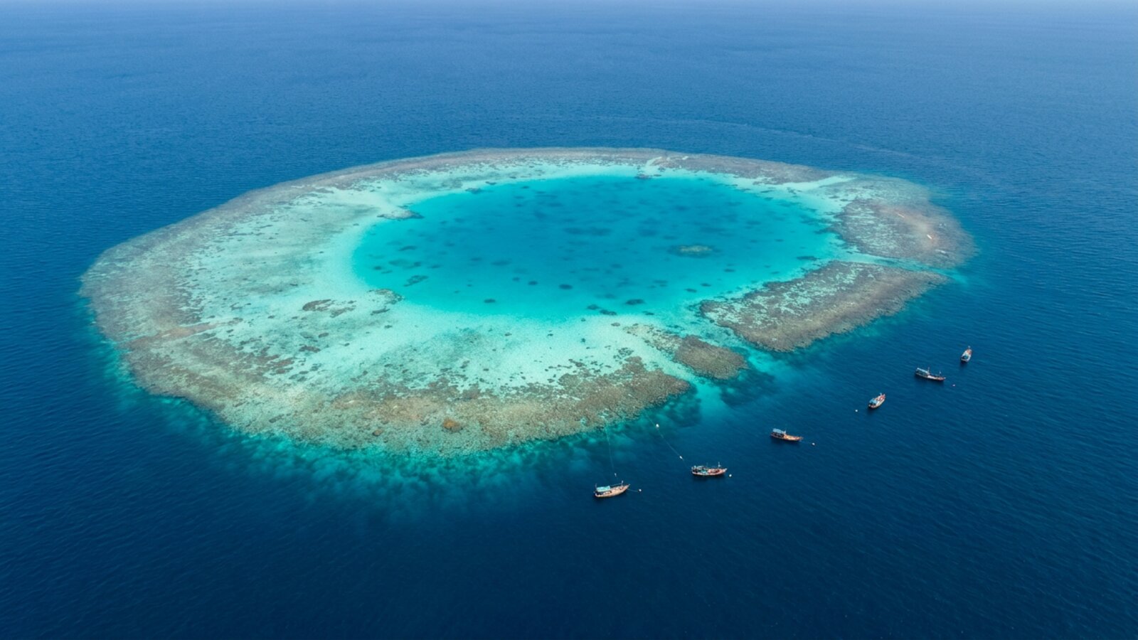
Scattered across the sea are hundreds of small islands, cays, reefs and shoals, most of them tiny and many awash at high tide. They fall into a few main groups. The Spratly Islands, in the south, are a vast scatter of reefs, atolls and islets spread over a very large area of open sea between Vietnam, the Philippines and Malaysia. The Paracel Islands lie in the north-west, south-east of Hainan; China has controlled them since 1974, when it took the western part from South Vietnam. The Pratas Islands, centred on a large ring-shaped atoll in the north, are administered by Taiwan. Scarborough Shoal, a triangular reef west of Luzon, has been the scene of repeated stand-offs between Chinese and Philippine vessels, notably since 2012.
Few of these features could support people on their own. Many are low coral cays or submerged reefs with no fresh water. Their value lies in the maritime zones and fishing grounds that might come with them, in their strategic position beside some of the busiest shipping lanes on Earth, and in the possibility of oil and gas beneath the surrounding seabed. Several claimants have built outposts, airstrips and harbours on them, and China’s artificial islands in the Spratlys are by far the largest.
Biologically, the same reefs are stepping stones. Larvae of corals, fish and invertebrates drift between them on the currents, so a healthy reef in the Spratlys can help reseed reefs hundreds of kilometres away, and damage in one place can echo across the region.
What lives in the South China Sea?
The sea lies on the northern edge of the Coral Triangle and is one of the world’s great marine biodiversity regions. Its offshore atolls, fringing reefs, mangroves and seagrass meadows connect populations of fish and coral larvae across the whole region.
- Coral reefs — reefs in the Spratly and Paracel islands, Tubbataha (in the Sulu Sea just east) and off Vietnam, Malaysia and the Philippines host hundreds of coral species; see Philippines, Vietnam and Malaysia reef maps.
- Sea turtles — green and hawksbill turtles nest on islands such as Sabah’s Turtle Islands and Hainan.
- Giant clams and reef fish — giant clams, groupers, Napoleon wrasse and sharks, all heavily targeted by fishing.
- Marine mammals — Indo-Pacific humpback dolphins in the Pearl River estuary, Irrawaddy dolphins, and dugongs in remaining seagrass beds.
- Fisheries — the wider Western Central Pacific produced about 14% of world commercial fish catch in 2010, and millions of people around the sea depend on fishing.
Why is the South China Sea so important for trade and energy?
The sea sits between the Strait of Malacca and Singapore to the south-west and the ports of East Asia to the north-east, so a large share of the oil, gas and manufactured goods moving between the Indian Ocean, the Middle East, Europe and East Asia passes through it. Some of the world’s busiest container ports ring its shores or sit at its gateways, including Singapore, Hong Kong and the ports of the Pearl River Delta, along with major harbours in Vietnam, the Philippines and Malaysia.
The sea floor also holds oil and gas. Fields off Brunei, Sabah and Sarawak in Malaysia, southern Vietnam and the Chinese coast are already in production, and further reserves are thought to lie in disputed areas, although estimates of how much vary widely and many are speculative. Fisheries are just as valuable: millions of people around the sea depend on fishing for food and income, and fishing fleets from several countries compete for the same grounds.
That combination of trade routes, energy, food and strategic position is what makes the overlapping claims described below so difficult to resolve.
Why is the South China Sea disputed?
China, Taiwan, Vietnam, the Philippines, Malaysia and Brunei claim overlapping parts of the sea and its islands, and Indonesia’s EEZ around the Natuna Islands overlaps China’s broad “nine-dash line” claim. The stakes are fisheries, oil and gas, and control of shipping lanes that carried an estimated $3.4 trillion of trade in 2016. In July 2016 an arbitral tribunal under the UN Convention on the Law of the Sea, in a case brought by the Philippines, ruled that China’s nine-dash line had no legal basis for historic rights to the sea’s resources; China rejected the ruling.
What is happening to the South China Sea’s reefs?
The same tribunal found that China’s land reclamation and artificial island building in the Spratlys had caused “severe harm to the coral reef environment.” Dredging buried living reef under sand and concrete, and industrial-scale harvesting of giant clams, using boat propellers to churn up reef flats, destroyed large areas of reef in the Spratlys and Paracels. Other parties have also reclaimed land, though on a smaller scale.
Add widespread overfishing — some analyses estimate fish stocks have fallen by 70–95% since the 1950s — along with coral bleaching, sediment from rivers, coastal development and pollution, and scientists consider the South China Sea’s fisheries at serious risk of collapse. Marine scientists have proposed a regional “peace park” or joint marine protected area in the Spratlys as one way to protect the reefs regardless of sovereignty.
Can you dive the South China Sea?
Yes, mainly around its edges. In the Philippines, the Palawan region on the sea’s eastern rim is known for limestone islands, clear water and, in Coron Bay, a group of Japanese ship-wrecks sunk in a US air raid in September 1944, now among the most popular wreck dives in Asia. Off the east coast of Peninsular Malaysia, islands such as Tioman and Redang offer reef diving in the calmer months between the north-east monsoons, and Vietnam’s coast around Nha Trang has protected reef areas. Far offshore, Layang-Layang, a Malaysian-held atoll in the Spratlys, has a small dive resort reached by air and is known for steep walls and schooling pelagic fish, including hammerhead sharks in season.
Seasons matter more here than in many tropical seas. The north-east monsoon can make the western and southern coasts rough for months, while typhoons threaten the north in the second half of the year, so most dive operators work to a fixed season. See the Philippines coral reef maps for reef locations on the eastern side of the sea.
- The South China Sea covers ~3.5 million km² of the western Pacific.
- It is shallow in the south-west but reaches ~5,560 m in its oceanic basin.
- Seven governments border it, and six claim parts of its islands.
- About $3.4 trillion in trade crossed it in 2016.
- Its reefs have suffered from island building, clam harvesting and overfishing.
Where is the South China Sea?
It lies in the western Pacific between southern China and Taiwan to the north, the Philippines to the east, Borneo and Indonesia to the south, and Vietnam and the Malay Peninsula to the west.
How big is the South China Sea?
About 3.5 million km² (1.4 million sq mi), making it one of the largest seas on Earth.
How deep is the South China Sea?
Its average depth is 1,212 m, and its deepest point is about 5,559–5,567 m in the central basin. The south-western Sunda Shelf is mostly under 100 m deep.
Which countries border the South China Sea?
China, Taiwan, the Philippines, Malaysia, Brunei, Indonesia and Vietnam. Singapore, Thailand and Cambodia are on connecting straits and gulfs.
Why is the South China Sea important?
It carries roughly a fifth of global sea trade, holds oil and gas reserves, supports huge fisheries, and contains some of the world’s most biodiverse coral reefs.
Who owns the South China Sea?
No single country. China, Taiwan, Vietnam, the Philippines, Malaysia and Brunei have overlapping claims. A 2016 UNCLOS tribunal rejected China’s nine-dash line claim, but China does not accept the ruling.
What are the Spratly Islands?
A group of more than 100 small islands, reefs and shoals in the southern South China Sea, claimed wholly or partly by six governments and the site of extensive artificial island building.
Blane Perun has been exploring Earth’s oceans and marine life for over 25 years. Founder of TheSea.Org in 1999, underwater photographer, coral aquaculture pioneer, and explorer of 80+ countries.
About Blane Perun → More on Seas →