Coral Reefs of Key West — Reef Map and Guide to Sand Key, the Sambos and the Dry Tortugas
Yes. Key West sits at the western end of the Florida Keys, and several miles offshore on its Atlantic side runs the Florida Reef Tract, the only extensive living coral barrier reef in the continental United States. The best-known reefs off Key West are Sand Key, marked by a historic lighthouse, Rock Key, Eastern Dry Rocks and the Eastern and Western Sambos, along with patch reefs closer in and the artificial-reef wreck of the USNS Vandenberg. All lie within the Florida Keys National Marine Sanctuary. Key West is also the gateway to the remote, relatively healthy reefs of Dry Tortugas National Park, about 70 miles to the west.
Key West is better known for sunsets, Hemingway and Duval Street than for coral, but the reefs offshore are the reason many visitors come. Within a short boat ride lie shallow reefs ideal for a first snorkel, protected reserves where fish life is noticeably richer, a deliberately sunk missile-tracking ship, and, far over the western horizon, some of the wildest reefs in Florida. This guide maps the reefs off Key West, describes the main sites, explains how they are protected, and covers the trip to the Dry Tortugas and the pressures the lower Keys reefs face.
Where Key West’s reefs are
The reefs lie several miles south of Key West, along the edge of the shelf where the Florida Straits begin.
Key West is the last island reached by the Overseas Highway, but the reef tract carries on beyond it. On the island’s south side, the shallow shelf extends several miles toward the Florida Straits, and the outer reefs sit near its edge. Sand Key and Rock Key lie to the south-west, Eastern Dry Rocks to the south, and the Sambo reefs to the east toward Boca Chica. Between the island and the outer reefs, Hawk Channel and the shallows hold patch reefs, seagrass and hard-bottom.
To the north and west of Key West, by contrast, the water opens onto the shallow Gulf side, with seagrass flats and small mangrove keys such as those of the Key West National Wildlife Refuge. Coral reefs are an Atlantic-side feature.
Key West reef map
The map shows the line of reefs offshore of Key West at the western end of the Keys.
The reef shapes on this map come from the global coral-reef dataset compiled by UNEP-WCMC, traced from satellite imagery and field surveys, so the coral shading reflects the real, surveyed reef tract. The map shows how the reef runs parallel to the lower Keys a few miles offshore and continues west of Key West toward the Marquesas — a reminder that the Florida reef does not end where the road does.
For a closer look at the lower Keys and Dry Tortugas, see our Key West coral reef map page, and for the whole system the map of coral reefs in Florida.
The best reefs off Key West
Most snorkel and dive trips from Key West visit a handful of named reefs.
Sand Key is the signature Key West reef, marked by a tall nineteenth-century iron lighthouse standing on a small sand island that shifts with storms. Its shallow reef flats and spur-and-groove formations are popular with snorkellers, while the deeper seaward edge suits divers. It is protected as a Sanctuary Preservation Area, where fishing and collecting are banned.
Rock Key, close to Sand Key, has shallow coral formations and abundant reef fish, and the two are often combined on one trip. Eastern Dry Rocks is another shallow reef popular with snorkel boats and one of the sites in NOAA’s Mission: Iconic Reefs restoration plan.
Western Sambo, east of Key West, lies within a larger ecological reserve that protects a full cross-section of habitats from seagrass to deep reef, and is known for its fish life. Eastern Sambo is set aside as a research-only area, closed to the public so scientists can compare protected and visited reefs. Middle Sambo and nearby patch reefs offer calmer-water snorkelling.
Farther up the lower Keys, near Big Pine Key, Looe Key is one of the most celebrated reefs in Florida, usually visited from operators based closer to it.
| Reef or site | Type | Known for |
|---|---|---|
| Sand Key | Outer reef with lighthouse | Snorkelling and diving; protected area |
| Rock Key | Shallow outer reef | Shallow corals, reef fish |
| Eastern Dry Rocks | Shallow outer reef | Snorkelling; restoration site |
| Western Sambo | Reef in an ecological reserve | Rich fish life; no-take |
| Eastern Sambo | Research-only area | Closed to the public |
| USNS Vandenberg | Deliberately sunk ship | Artificial-reef wreck dive |
| Fort Zachary Taylor | Shore rocks and hard-bottom | Snorkelling from the beach |
Snorkelling and diving from Key West
Boat trips leave the harbour daily for the outer reefs, and a few spots can be snorkelled from shore.
Many operators run half-day snorkel and dive trips from the Key West harbour, often stopping at two reefs, plus glass-bottom boat tours for non-swimmers. The run to Sand Key or Eastern Dry Rocks is short on calm days. As elsewhere in the Keys, wind decides everything: strong winds stir up the shallow reefs and can cancel trips, while calm summer days can bring superb visibility.
Divers can also visit the USNS General Hoyt S. Vandenberg, a former Air Force missile-tracking ship sunk south of Key West in 2009 as an artificial reef. It sits in deeper water and is best suited to experienced divers, but its upper structure is now covered in growth and patrolled by large fish.
For a shore snorkel, Fort Zachary Taylor Historic State Park at the western tip of the island has rocky areas with corals, sponges and reef fish close to the beach. Conditions depend on wind and tide, and boat traffic in the nearby channel calls for care. See our guides to the best snorkeling in Key West, Key West diving and Key West scuba photos.
Marine life of the lower Keys reefs
The reefs off Key West host the full range of Florida and Caribbean reef life.
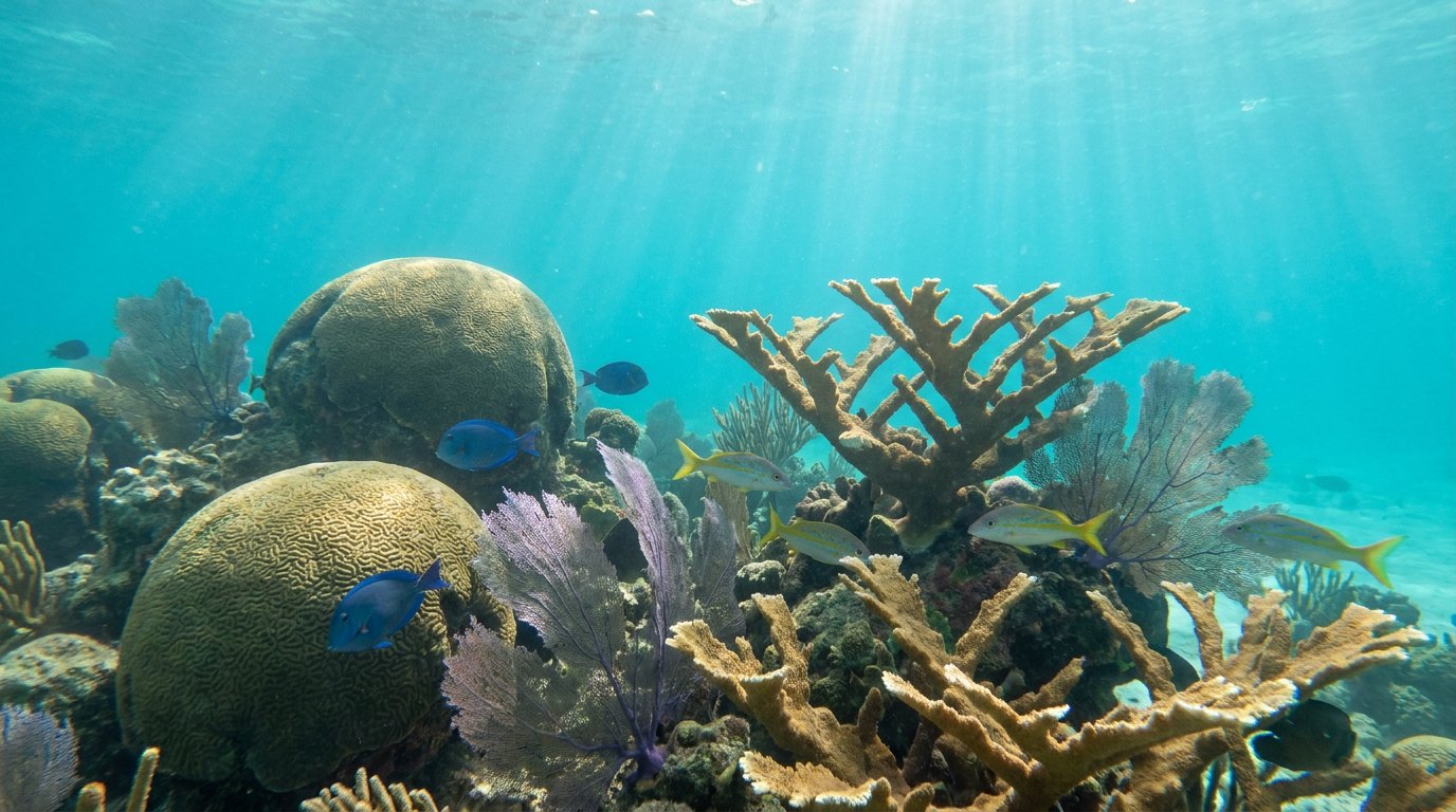
Brain corals, star corals and sea fans form the backbone of the reefs, with branching elkhorn coral, once dominant on shallow crests, now rare and the focus of restoration. Schools of grunts, snapper and goatfish gather along the coral spurs, while parrotfish, angelfish, butterflyfish and wrasses work the reef. Barracuda, groupers, nurse sharks, spotted eagle rays and green and loggerhead turtles are regular sightings, and the protected reserves at Western Sambo and Sand Key tend to have more and larger fish.
Because the lower Keys sit between the Atlantic and the Gulf, they receive clear oceanic water from the Florida Current as well as water from the Gulf, giving rich plankton and varied conditions. Learn more on our Florida coral reef ecosystem page.
Gateway to the Marquesas and Dry Tortugas
West of Key West, the reef tract continues into some of the wildest marine areas in the United States.
About 20 miles west of Key West lie the Marquesas Keys, a ring of uninhabited mangrove islands within a wildlife refuge, surrounded by shallow flats and reefs. Beyond them, roughly 70 miles from Key West, is Dry Tortugas National Park, a cluster of small islands dominated by the massive nineteenth-century Fort Jefferson. The park is reached by daily ferry or seaplane from Key West.
Distance has spared the Tortugas from much of the pressure faced by reefs closer to shore. Their reefs include some of the largest coral heads in Florida, and a large part of the surrounding area is protected in no-take reserves, including the sanctuary’s Tortugas Ecological Reserve. Snorkellers can explore the moat wall around Fort Jefferson and nearby shallow reefs straight from the beach. For many visitors, a day at the Tortugas is the best glimpse of what Florida’s reefs once looked like.
Reefs, wrecks and Key West history
Key West grew rich partly because of its reefs — and the ships they wrecked.
For much of the nineteenth century, the reef off Key West was one of the most dangerous stretches of water in North America. Ships sailing between the Gulf of Mexico and the Atlantic had to pass along the Florida Straits, and many ran aground on the shallow reef in storms or at night. Salvaging those wrecks, known as wrecking, became a major local industry, and licensed wreckers raced out from Key West to rescue crews and claim a share of the cargo. For a time the trade helped make Key West one of the wealthiest towns in Florida.
The answer to the wrecks was a chain of lighthouses. Tall iron screw-pile towers were built on the outer reefs, including Sand Key, so that their lights could be seen far out to sea. Several still stand today and serve as landmarks for boats heading to the reef. The island’s own lighthouse, now a museum, is described on our Key West lighthouse page.
Wrecks from that era, and from later centuries, are scattered across the lower Keys reefs. Many are protected as historical resources within the sanctuary, and some have become reef habitat in their own right, encrusted with coral and sponges and sheltering fish. Divers exploring Key West’s reefs are often swimming over a layered history of trade, shipwreck and salvage.
Pressures on Key West’s reefs
The lower Keys reefs face the same serious threats as the rest of the Florida Reef Tract.
Stony coral tissue loss disease, first reported off Miami in 2014, spread down the Keys and reached the lower Keys and eventually the Tortugas, killing large numbers of brain, star and pillar corals. Repeated marine heatwaves, especially in 2023, caused severe bleaching and mortality. Hurricanes — Irma in 2017 made landfall in the lower Keys — damage reefs physically, and runoff, wastewater and heavy visitor traffic add local stress.
The sanctuary’s zoning, mooring buoys, research areas and restoration projects aim to slow the decline, with Eastern Dry Rocks and Looe Key among the priority restoration reefs. Visitors help by using reef-safe practices: float rather than stand, never touch coral, use mooring buoys and respect no-take zones. Read more on our coral reef threats and coral reef conservation pages.
Related on TheSea
- Brazil Coral Reef Maps
- Columbia Coral Reef Maps
- Coral Reef in Panama City Beach? Wrecks, Artificial Reefs & Map
- Ecuador Coral Reef Maps
- Nicaragua Coral Reef Maps
- Venezuela Coral Reef Maps
- Coral Reef Destin Florida? Artificial Reefs, Jetties & Snorkel Map
- Costa Rica Coral Reef Maps
- Panama Coral Reef Maps
- Honduras Coral Reef Maps
- Mexico Coral Reef Maps
- Belize Coral Reef Maps
How far is the reef from Key West?
The outer reefs such as Sand Key and Eastern Dry Rocks lie several miles offshore, usually well under an hour by boat in good conditions. Patch reefs and shore sites are closer.
Can you snorkel from the beach in Key West?
Yes, at Fort Zachary Taylor Historic State Park, where rocky areas near the beach hold corals, sponges and reef fish. The main coral reefs, however, need a boat trip.
What is the best reef to snorkel in Key West?
Sand Key and Rock Key are classic first choices, and Eastern Dry Rocks and the Sambo reefs are also popular. The best reef on a given day depends on wind and visibility, so follow your boat captain’s advice.
Is the snorkelling better in Key West or Key Largo?
Both offer good reef snorkelling on the same reef tract. Key Largo has more famous sites and John Pennekamp park; Key West offers Sand Key, protected reserves and access to the Dry Tortugas.
How do you get to the Dry Tortugas from Key West?
By daily ferry or seaplane to Dry Tortugas National Park, about 70 miles west. Snorkelling around Fort Jefferson’s moat wall and nearby reefs is possible from the beach.
Are the coral reefs in Key West dying?
They have lost much coral to disease, bleaching and storms, as across Florida, but still support abundant fish and other life. Protection and restoration projects are active on several lower Keys reefs.
Blane Perun has been exploring Earth’s oceans and marine life for over 25 years. Founder of TheSea.Org in 1999, underwater photographer, coral aquaculture pioneer, and explorer of 80+ countries.
About Blane Perun → More Coral Reef Maps →