Deepest Oceans in the World — The Five Deeps, Ranked
The Pacific is the deepest ocean, reaching about 10,935 m at the Challenger Deep. The deepest points of the other four oceans, measured by the 2018–2019 Five Deeps Expedition, are the Atlantic (~8,376 m), Southern (~7,434 m), Indian (~7,192 m) and Arctic (~5,550 m).
By maximum depth and by average depth, the Pacific is the deepest ocean on Earth. Its Mariana Trench contains the Challenger Deep, about 10,935 m below sea level, and the Pacific also holds the next several deepest trenches: Tonga, Kuril-Kamchatka, Philippine and Kermadec, all over 10,000 m.
What is the deepest point in each ocean?
In 2018–2019 the Five Deeps Expedition became the first to dive to the bottom of all five oceans in a crewed submersible and remeasured each deepest point with modern sonar.
| Rank | Ocean | Deepest point | Depth (approx.) |
|---|---|---|---|
| 1 | Pacific | Challenger Deep, Mariana Trench | ~10,935 m |
| 2 | Atlantic | Brownson Deep, Puerto Rico Trench | ~8,376 m |
| 3 | Southern | Factorian Deep, South Sandwich Trench | ~7,434 m |
| 4 | Indian | Java (Sunda) Trench | ~7,192 m |
| 5 | Arctic | Molloy Deep, Fram Strait | ~5,550 m |
Depths differ slightly between surveys. Older sources gave the Indian Ocean’s deepest point as about 7,450 m in the Diamantina Fracture Zone; the expedition found the Java Trench to be deepest at about 7,192 m.
What are the deepest trenches on Earth?
The top five are all in the western Pacific, where old oceanic plates subduct steeply.
| Trench | Ocean | Max depth (approx.) |
|---|---|---|
| Mariana | Pacific | ~10,935 m |
| Tonga (Horizon Deep) | Pacific | ~10,800 m |
| Kuril–Kamchatka | Pacific | ~9,600–10,500 m |
| Philippine (Galathea Depth) | Pacific | ~10,540 m |
| Kermadec | Pacific | ~10,000 m |
Trench depths are hard to pin down; published figures vary by a few hundred metres between surveys. See how deep the Mariana Trench is.
Why is the Pacific so much deeper than other oceans?
Because it is ringed by subduction zones where the oldest, densest seafloor sinks into the mantle.
Seafloor gets colder, denser and deeper as it ages after forming at a mid-ocean ridge. The western Pacific has crust up to about 180 million years old, the oldest in the ocean, and it plunges steeply into trenches along the Ring of Fire. The Atlantic, by contrast, is widening and has few trenches. See why the Atlantic is growing.
How were the deepest points measured?
With ship-mounted multibeam sonar, cross-checked by pressure sensors on landers and the submersible itself.
Sonar times an acoustic pulse to the seafloor and back, but the result depends on the speed of sound through the whole water column, which changes with temperature, salinity and pressure. The Five Deeps team measured those profiles directly and corrected for tides, which is why their figures differ slightly from older charts. Depth records also change as more seafloor is surveyed: only about a quarter of the ocean floor has been mapped in high resolution, so deeper spots could still be found in less-studied trenches. See why we have better maps of Mars.
Is the deepest ocean also the coldest or darkest?
Below about 1,000 m every ocean is dark, and below about 2,000 m most deep water is 0–4°C regardless of the ocean.
The Southern and Arctic oceans are coldest at the surface, but in the abyss the differences are small because deep water everywhere originates from the polar seas. Pressure, not temperature, is the biggest difference at the bottom of the deepest trenches: over 1,000 atmospheres in the Challenger Deep versus roughly 550 in the Molloy Deep. See why the bottom layer is coldest.
How the Five Deeps Expedition did it
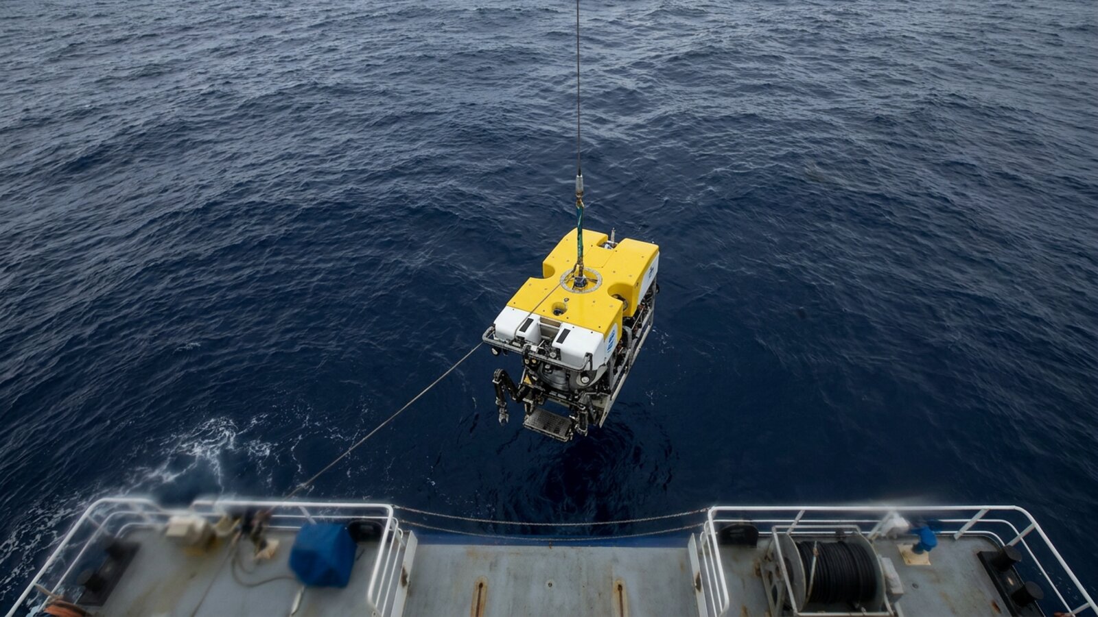
The modern ranking of the ocean deeps comes largely from one privately funded project. In 2018 the American explorer Victor Vescovo set out to dive to the deepest point of every ocean by the end of September 2019, and finished a month early. His submersible, the Limiting Factor, was a two-person Triton 36000/2 built to make repeated dives to full ocean depth. Its support ship, the DSSV Pressure Drop, carried a Kongsberg EM124 multibeam sonar designed for the deepest trenches, along with three robotic landers that sat on the seabed and measured depth by pressure.
That combination is what made the figures credible. The ship’s sonar mapped each trench to find the deepest spot. The submersible and landers then went to that spot and measured water pressure directly with CTD instruments, which record conductivity, temperature and depth. Pressure readings, corrected for the density of the water column above, give a depth that does not depend on assumptions about the speed of sound. Each published figure carries an error margin, typically 10 to 17 m. The survey data were donated to the GEBCO Seabed 2030 project, which aims to map the whole ocean floor. The expedition’s chief scientist, Alan Jamieson, and the geologist Heather Stewart published the results in Earth-Science Reviews in 2019.
The Atlantic came first, in December 2018. The Southern Ocean followed on 4 February 2019, the Indian Ocean in April, and the Pacific’s Challenger Deep, dived four times, in the weeks that followed. A month later, on 5 June 2019, the team made the first crewed dive to the Sirena Deep, also in the Mariana Trench, measuring 10,823 m, and the Tonga Trench’s Horizon Deep. The Arctic was last, on 24 August 2019.
The Atlantic: Puerto Rico and South Sandwich trenches
The Atlantic’s deepest point lies in the Puerto Rico Trench, about 800 km long, north of the island. Vescovo reached the bottom at 8,376 m in December 2018, the first person to do so. Names here are muddled. The deepest point has long been called the Milwaukee Deep, and Brownson Deep originally referred to the seabed around it, but the two names are now often used for the same spot.
The trench exists because the North American Plate is moving west-southwest relative to the Caribbean Plate, at about 20 mm a year, and is being pushed beneath it. Geophysicists worry about it. The subduction zone itself has not produced a great rupture in more than 200 years, and studies have concluded that an earthquake on this fault system could generate a significant tsunami. Puerto Rico was struck by a destructive tsunami after the earthquake of 11 October 1918, although that quake was on an older strike-slip fault near the Mona Passage rather than on the trench itself. Since the 2004 Indian Ocean disaster, warning systems and seismic monitoring in the region have been expanded.
The Atlantic’s second-deepest trench lies far to the south. The South Sandwich Trench, an arc about 965 km long east of the South Sandwich Islands, reaches 8,266 m at the Meteor Deep, named after the German survey ship Meteor, which first surveyed the area in 1926. The Five Deeps team mapped the entire trench for the first time in February 2019, found the true deepest point a short distance from the old position and recommended keeping the original name. At 8,266 m it is only 110 m shallower than the Puerto Rico Trench.
The Southern Ocean: a deep defined by a line of latitude
The Southern Ocean is defined as the water south of 60 degrees south, so its deepest point depends on where that line crosses the seafloor. The South Sandwich Trench is the only great trench that reaches below 60 degrees south, and its southern tip holds the answer. The expedition’s sonar found the deepest point south of the line at 7,434 m, give or take 13 m. Vescovo dived it on 4 February 2019 and proposed naming it the Factorian Deep after his submersible.
Because the Meteor Deep is north of 60 degrees south, it counts as Atlantic, not Southern Ocean. That is why the Southern Ocean ranks third rather than second, even though its deepest trench is deeper than anything in the Indian Ocean. While mapping the trench, Pressure Drop identified about ten previously unknown deeps, seamounts and ridges, and submitted names for them to the International Hydrographic Organization.
The Indian Ocean: settling a long argument
The Indian Ocean was the only one where the location of the deepest point was genuinely in doubt. One candidate was the Sunda Trench, also called the Java Trench, which runs about 3,200 km from the Lesser Sunda Islands past Java and Sumatra to the Andaman Islands. The other was the Diamantina Fracture Zone, a band of rugged seafloor south-west of Australia, first detected by the research vessels Vema and Argo in 1960 and named after HMAS Diamantina, which explored it in 1961.
The Diamantina question was revived by an unexpected source. Between June 2014 and June 2016, the search for the missing airliner MH370 collected the first high-resolution multibeam maps of the central fracture zone, showing depths of more than 5,800 m. Later analysis suggested a spot called the Dordrecht Deep could rival the Sunda Trench. The Five Deeps team surveyed it in March 2019 and found a maximum of 7,019 m. In April 2019 Vescovo dived the Sunda Trench about 500 km south of Bali and measured 7,192 m, settling the matter. On that dive the team reported what they believed were species new to science, including a hadal snailfish and a gelatinous animal thought to be a stalked sea squirt.
The Sunda Trench is also one of the most dangerous trenches on Earth. It marks the boundary where the Indo-Australian plates slide beneath Eurasia, and it produced the great Sumatra earthquake of 1833, estimated at magnitude 8.8 to 9.2, as well as the 2004 earthquake and tsunami. In the late 1950s Robert Fisher of the Scripps Institution of Oceanography was among the first to explore it, using bomb soundings and echo-train analysis.
The Arctic: the Molloy Deep
The Arctic’s deepest point is not under the polar ice cap but in the Fram Strait, the gateway between Greenland and Svalbard. The Molloy Deep lies about 160 km west of Svalbard. Its rim sits at about 2,700 m and encloses some 600 square kilometres, and the floor of the basin covers about 220 square kilometres. It was discovered in September 1972 by the US Navy research ship USNS Hayes, one of the first catamaran-hulled oceanographic ships, and named after Arthur E. Molloy, a Navy scientist who worked in the Arctic, Atlantic and Pacific from the 1950s to the 1970s.
Vescovo reached the bottom on 24 August 2019 and remains the only person to have done so. Direct pressure measurements put the depth at 5,550 m, plus or minus 14 m. That was shallower than earlier estimates made with older equipment, a reminder that depth records can shrink as well as grow when measurements improve.
The Pacific’s other great deeps
The Pacific holds every trench deeper than 10,000 m, and each has its own story. The Tonga Trench’s Horizon Deep, at about 10,800 m, is the deepest point in the Southern Hemisphere and the second deepest on Earth. It is named after the Scripps research vessel Horizon, whose crew found it in December 1952. A 2016 study found roundworms in the sediment at the bottom six times more abundant than at a site on the trench edge at about 6,250 m, though diversity was higher on the slope, probably because a few opportunistic species dominate the trench floor.
South of Tonga, the Kermadec Trench runs about 1,000 km towards New Zealand and reaches 10,047 m. It is almost perfectly straight and carries only about 200 m of sediment, because it lies far from any large landmass. Its animals are among the best studied in the hadal zone. In 2012 researchers caught supergiant amphipods up to 34 cm long in its deepest parts, more than ten times the length of a typical amphipod. A pearlfish, Echiodon neotes, has been caught there at 8,200 to 8,300 m, although every other pearlfish lives at around 1,800 to 2,000 m. The trench is also where the robotic vehicle Nereus, operated by the Woods Hole Oceanographic Institution, imploded at about 9,990 m in May 2014.
The Philippine Trench, about 1,320 km long and only about 30 km wide, reaches roughly 10,540 m. The Kuril-Kamchatka Trench off Russia and Japan is usually given as about 9,600 m in peer-reviewed papers, which is why the table above shows a range. There, the Pacific Plate is being forced under the Okhotsk Plate at about 75 to 83 mm a year.
The deepest seas
Below the five oceans, the seas have their own deeps. The Cayman Trough in the Caribbean reaches 7,686 m, deeper than the bottom of the Indian or Southern oceans. In 2010 a team from the UK National Oceanography Centre mapped it with an autonomous robot submarine and found black smokers at about 5 km, the deepest hydrothermal vents then known, venting water thought to exceed 450 degrees C.
The Mediterranean’s deepest point is the Calypso Deep in the Hellenic Trench, about 63 km south-west of Pylos in Greece. The French bathyscaphe Archimède made the first crewed descent on 27 September 1965. On 10 February 2020 Vescovo and Prince Albert II of Monaco dived it in the Limiting Factor and measured 5,109 m, plus or minus 1 m, confirming that the 1965 crew had reached the true bottom.
The hadal zone: life in the deepest trenches
Water deeper than about 6,000 m is called the hadal zone. The term was proposed in 1956 by the Danish scientist Anton Bruun, after the Danish Galathea and Soviet Vitjaz expeditions of the early 1950s separately found a distinct change in animal life at depths of 6,000 to 7,000 m. Today scientists recognise 46 separate hadal habitats. Together they cover less than 0.25% of the seafloor, yet they span more than 40% of the ocean’s depth range, and most of them are in the Pacific.
More than 400 species are known from hadal depths. Most are scavengers and deposit feeders living on marine snow, fine sediment and the occasional carcass that falls from above. The only known primary producers are bacteria that use hydrogen and methane released when seawater reacts with mantle rock, or hydrogen sulfide from cold seeps. Fish are few: grenadiers, cusk-eels, eelpouts, pearlfish and, above all, snailfish. Because the deepest trenches are separated by long stretches of shallower seafloor, some hadal species are known from a single trench. The Kermadec snailfish Notoliparis kermadecensis, for instance, lives only in that trench, between about 6,472 and 7,561 m.
Why the numbers keep changing
Every deepest-point figure is a measurement with an error bar, and those bars have shrunk. Early depths came from weighted lines, then from explosive soundings and single-beam echo sounders, which could miss a narrow deep or misjudge the speed of sound. Modern multibeam sonar sweeps a wide swath, and direct pressure measurements on the seabed provide an independent check. The Five Deeps results changed the answer for the Indian Ocean, moved the Meteor Deep, and made the Molloy Deep slightly shallower. With most of the deep seafloor still not mapped at high resolution, the rankings in the table above are best read as the current best measurements rather than final answers.
What is the deepest ocean in the world?
The Pacific, with the Challenger Deep at about 10,935 m.
What is the deepest point in the Atlantic Ocean?
The Puerto Rico Trench, about 8,376 m.
What is the deepest point in the Indian Ocean?
The Java (Sunda) Trench, about 7,192 m according to the Five Deeps Expedition.
What is the deepest point in the Southern Ocean?
The Factorian Deep in the South Sandwich Trench, about 7,434 m.
What is the deepest point in the Arctic Ocean?
The Molloy Deep in the Fram Strait, about 5,550 m.
Has anyone been to the bottom of all five oceans?
Yes. Victor Vescovo did it in 2018–2019 in the submersible Limiting Factor.
- Stewart, H. A. & Jamieson, A. J. (2019). The five deeps: the location and depth of the deepest place in each of the world’s oceans. Earth-Science Reviews 197.
- NOAA Ocean Exploration: ocean trench facts.
- Stewart, H.A. & Jamieson, A.J. (2019). The five deeps: the location and depth of the deepest place in each of the world’s oceans. Earth-Science Reviews 197: 102896.
- Jamieson, A.J. (2015). The Hadal Zone: Life in the Deepest Oceans. Cambridge University Press.
- GEBCO Seabed 2030 Project: global bathymetry data and mapping progress.
Blane Perun has been exploring Earth’s oceans and marine life for over 25 years. Founder of TheSea.Org in 1999, underwater photographer, coral aquaculture pioneer, and explorer of 80+ countries.
