Yemen Coral Reef Maps — The Southern Red Sea, the Gulf of Aden and Socotra
Yemen’s coral reefs lie in three very different seas. On the southern Red Sea coast, reefs fringe the mainland and surround islands such as Kamaran and the volcanic Hanish and Zubayr groups. Along the Gulf of Aden, scattered fringing reefs and coral communities grow on a rocky, upwelling-influenced coast. Far out in the Arabian Sea, the Socotra archipelago, a UNESCO World Heritage Site, has coral communities that mix species from the Red Sea, East Africa, Arabia and the wider Indian Ocean. Years of conflict have limited surveys, so Yemen’s reefs remain among the least known in the region.
Yemen occupies the south-western corner of the Arabian Peninsula, facing the Red Sea on one side and the Gulf of Aden and Arabian Sea on the other. Between them lies the Bab-el-Mandeb, the narrow strait that links the Red Sea to the Indian Ocean. This position gives Yemen a share of three distinct marine worlds, each with its own kind of reef. Add the remote islands of Socotra, often described as one of the most biologically unusual places on Earth, and Yemen holds a remarkable range of coral habitats. This map shows where they are.
Yemen coral reef map
Yemen’s reefs cluster around its Red Sea islands, appear in patches along the Gulf of Aden, and surround parts of Socotra far offshore.
On the map, coral shading lines parts of the Red Sea coast, the low-lying Tihama coastal plain, and concentrates around offshore islands. Kamaran Island, off the port of Al Salif, sits in a broad area of shallow reef and seagrass. Further out, the volcanic Zubayr and Hanish islands rise from the southern Red Sea with reefs around their shores. South of the Bab-el-Mandeb, the Gulf of Aden coast shows smaller, scattered reefs near Aden and further east. The Socotra archipelago, a long way off the Horn of Africa, carries its own reef patches.
The outlines come from the UNEP-WCMC global coral reef dataset. The reef area shown within this map’s frame is roughly 658 square kilometres, a figure that includes some reef in neighbouring waters inside the view, so it is best treated as a guide. Because conflict has made field surveys difficult for years, the map relies heavily on satellite data and older surveys, and the true extent and condition of the reefs may differ.
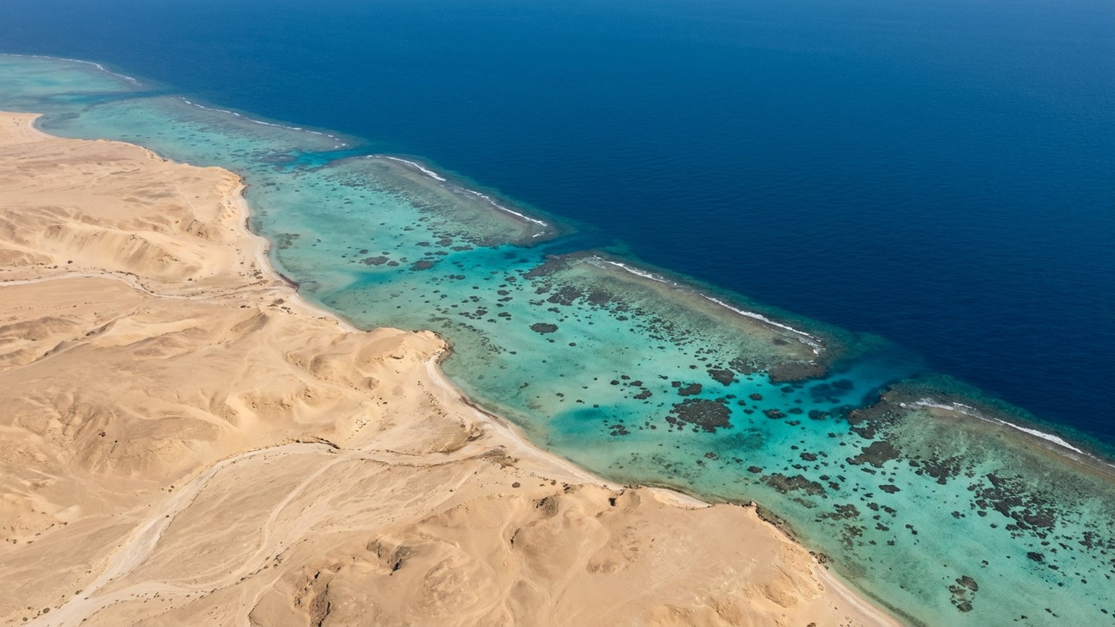
The southern Red Sea coast and islands
Warm, productive and often turbid, the southern Red Sea supports reefs very different from the clear-water reefs of Egypt.
The southern Red Sea is shallower, warmer and richer in nutrients than the north, partly because water flows in from the Gulf of Aden through the Bab-el-Mandeb. The result is greener, sometimes cloudier water, abundant plankton and large fish populations. Reefs here often grow in more turbid conditions, and seagrass beds and mangroves are common along the sheltered parts of the coast.
Kamaran Island and its surroundings have extensive shallow reefs and seagrass, and the area has been proposed for protection because of its value for fisheries, turtles and seabirds. Offshore, the Hanish and Zubayr islands are volcanic, and their reefs grow on lava and rock in clear, deeper water, supporting sharks, groupers and dense schools of reef fish. These islands are remote, rarely visited and among the least studied reef areas in the Red Sea.
The Gulf of Aden coast
Along Yemen’s southern coast, coral grows in patches on a rocky shore shaped by seasonal upwelling.
The Gulf of Aden coast stretches east from the Bab-el-Mandeb past Aden and Mukalla. During the south-west monsoon, upwelling brings cooler, nutrient-rich water to parts of the coast, limiting reef growth in some areas while boosting productivity. Coral therefore tends to form patchy communities on rocky headlands and in sheltered bays rather than extensive reef structures. Sites near Aden and around the volcanic headlands further east, such as the Bir Ali area, have coral communities and diverse fish life.
This coast links the Red Sea with the Indian Ocean, so its fauna includes species from both. Some Red Sea endemics reach their limits here, while species typical of the Arabian Sea and East Africa also occur.
Because the Gulf of Aden is so productive, its waters also support large populations of fish that are important to coastal communities, as well as dolphins, sea turtles and seasonal whale sharks. The reefs and rocky coral communities here act as nursery and feeding grounds for many of these species. Their patchy, scattered nature means they are easy to overlook on a map, yet together they form a chain of habitat linking the reefs of the Red Sea with those of Oman and the wider Arabian Sea.
Socotra: a reef world apart
Famous for dragon’s blood trees on land, Socotra also has some of the most unusual coral communities in the Indian Ocean.
The Socotra archipelago lies in the Arabian Sea, closer to Somalia than to mainland Yemen. It was listed as a UNESCO World Heritage Site for its extraordinary biodiversity, which includes many plants and animals found nowhere else. Around its shores, coral communities grow mostly on rock rather than building large reefs, because strong monsoon winds, rough seas and seasonal upwelling limit reef growth.
What makes Socotra’s reefs special is their mix of species. Surveys have found reef fish and corals from the Red Sea, the Gulf of Aden, East Africa, the Arabian Sea and the wider Indo-Pacific living side by side. That blend makes the archipelago an important meeting point in the biogeography of the Indian Ocean, and it has given scientists insights into how reef species spread between regions.
Pressures on Yemen’s reefs
Conflict has reduced some pressures but made monitoring and protection much harder.
Yemen’s reefs have been studied far less than those of its neighbours, and years of conflict have made survey and management difficult. Fishing is important to coastal communities, and overfishing and destructive gear have affected some reefs. Shipping through the Bab-el-Mandeb, one of the world’s major sea lanes, carries a constant risk of oil pollution and groundings, and port areas add local pollution.
Ocean warming is a long-term threat across all three seas. The southern Red Sea is warmer than the north, so its corals live closer to their thermal limits, as explained in our guide to coral reef bleaching. Socotra has formal protection, and areas such as Kamaran have been identified as priorities, but turning plans into effective protection depends on stability and resources. Broader approaches are covered in our coral reef conservation pages.
Does Yemen have coral reefs?
Yes. Yemen has coral reefs along its southern Red Sea coast and islands, patchy reefs and coral communities on the Gulf of Aden, and coral communities around the Socotra archipelago in the Arabian Sea.
Does Socotra have coral reefs?
Socotra has coral communities that grow mostly on rock rather than large reef structures. They are remarkable for mixing species from the Red Sea, East Africa, Arabia and the wider Indian Ocean.
Which islands in Yemen have reefs?
In the Red Sea, Kamaran Island and the volcanic Hanish and Zubayr islands have reefs. In the Arabian Sea, the islands of the Socotra archipelago have coral communities around their shores.
Why are Yemen’s reefs so little known?
Remote islands, limited research funding and years of conflict have made field surveys difficult, so much of what is known comes from satellite mapping and older studies.
What was the threat from the Safer tanker?
The FSO Safer, a decaying oil storage tanker moored off Yemen’s Red Sea coast, risked a major spill that could have harmed reefs and fisheries. A UN-led operation transferred its oil to another ship in 2023.
What threatens Yemen’s coral reefs?
Warming seas, overfishing and destructive fishing, shipping and oil pollution risks near the Bab-el-Mandeb, and the difficulty of monitoring and enforcing protection during conflict.
- UNEP-WCMC, WorldFish Centre, WRI and TNC (2021), Global distribution of warm-water coral reefs, v4.1
- UNESCO World Heritage Centre: Socotra Archipelago
- PERSGA, the Regional Organization for the Conservation of the Environment of the Red Sea and Gulf of Aden
- United Nations: FSO Safer oil transfer operation (2023)
Blane Perun has been exploring Earth’s oceans and marine life for over 25 years. Founder of TheSea.Org in 1999, underwater photographer, coral aquaculture pioneer, and explorer of 80+ countries.
About Blane Perun → More Middle East Coral Reef Maps →