Why Was the Southern Ocean Added? — How Antarctica’s Waters Became the Fifth Ocean
The Southern Ocean was added because the waters around Antarctica behave as a distinct ocean, defined by the Antarctic Circumpolar Current that has circled the continent for roughly 34 million years. The US Board on Geographic Names approved the name in 1999; the International Hydrographic Organization proposed a northern limit of 60°S in 2000 but never formally adopted it; and National Geographic recognised it as the fifth ocean on 8 June 2021, World Oceans Day.
An older version of this page said the International Hydrographic Organization recognised the Southern Ocean in 2021. That is incorrect. The 2021 change was made by National Geographic. The IHO’s 2000 proposal has never been ratified.
For most of the twentieth century, schoolchildren learned that Earth has four oceans: the Pacific, Atlantic, Indian and Arctic. Today many atlases, textbooks and government agencies list five, with the Southern Ocean surrounding Antarctica. No new water appeared. What changed was how scientists and mapmakers chose to divide the single, connected world ocean, and the growing recognition that the waters around Antarctica behave very differently from the oceans to the north. This page explains why the Southern Ocean was added, who recognised it and when, and why its status still depends on whom you ask.
Is there really more than one ocean?
Strictly speaking, Earth has one global ocean. The Pacific, Atlantic, Indian and Arctic are all connected, and water, heat, salt and animals move between them. Dividing that ocean into named parts is a matter of convention, based on the shapes of the continents, the patterns of currents and the needs of navigation. The boundaries between oceans are drawn by people, and different organisations draw them differently.
That means the question is not whether a fifth ocean exists, but whether the waters around Antarctica are distinct enough to be treated as a separate unit. Over the past century, the answer has shifted from no to yes for most scientists and many mapmakers.
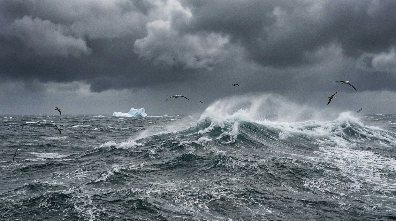
What makes the Southern Ocean different?
The defining feature is the Antarctic Circumpolar Current, or ACC. It is the only ocean current that flows all the way around the globe without being blocked by land, travelling from west to east around Antarctica for about 21,000 kilometres. It carries an enormous volume of water: commonly cited figures are around 130 million cubic metres per second, more than 100 times the flow of all the world’s rivers combined, and some recent measurements in the Drake Passage suggest it may be stronger still. It is generally regarded as the strongest current on Earth.
Along its northern edge runs the Antarctic Convergence, or Polar Front, a zone where cold, relatively fresh Antarctic surface water meets and sinks beneath warmer water from the north. Across this front, sea temperature can change by several degrees over a short distance. The waters to the south are colder and less salty, and they hold distinctive communities of plankton, fish, birds and mammals. National Geographic’s geographer Alex Tait described the result as an ecologically separate region, enclosed by the current as if by an invisible wall.
When did the Antarctic Circumpolar Current form?
The ACC could only begin once Antarctica had separated from its neighbouring continents. Two gateways had to open: the Tasmanian Gateway, between Antarctica and Australia, and the Drake Passage, between Antarctica and South America. Scientists estimate that this happened roughly 34 to 30 million years ago, around the boundary between the Eocene and Oligocene epochs, when Earth’s climate cooled sharply and permanent ice sheets began to grow on Antarctica.
Once the current flowed freely, it isolated Antarctica from the warmer waters to the north, helping keep the continent cold. That is why the Southern Ocean is sometimes called the youngest ocean. The sea floor beneath it is not necessarily younger than other ocean floor, but the circulation that defines the Southern Ocean as a separate body of water is far younger than the basins of the Atlantic or Pacific.
How did hydrographers first treat Antarctic waters?
The International Hydrographic Organization, or IHO, an intergovernmental body that coordinates nautical charting, publishes a standard called Limits of Oceans and Seas, numbered S-23. Its first edition, in 1928, used the coasts of the southern continents as limits. The second edition, in 1937, did include a Southern Ocean, extending north to about 40°S between Africa and Australia and to about 55°S between New Zealand and South America.
The third edition, published in 1953, dropped the Southern Ocean altogether. Instead, the Atlantic, Indian and Pacific Oceans were extended south to the coast of Antarctica, and individual countries’ hydrographic offices were left to set their own limits for Antarctic waters. For half a century, the official international standard therefore had no Southern Ocean, even as many scientists continued to use the name.
Why did scientists keep using the name?
Oceanographers and biologists working in Antarctic waters found the four-ocean scheme unhelpful. The physical oceanography of the region, dominated by the ACC, the Polar Front and the formation of dense bottom water, did not fit neatly into the Atlantic, Indian or Pacific. Nor did its ecology: krill, penguins, notothenioid fish and many other animals form a single, circumpolar community that ignores the lines between the northern oceans.
International agreements also treated Antarctic waters as a unit. The Antarctic Treaty, signed in 1959, covers the area south of 60°S. The Convention for the Conservation of Antarctic Marine Living Resources, in force since 1982, applies to waters south of the Antarctic Convergence. In practice, research, fisheries management and environmental protection were all organised around a Southern Ocean that the international charting standard did not recognise.
When did the United States recognise the Southern Ocean?
In 1999 the US Board on Geographic Names, the federal body that standardises geographic names for US government use and was established in 1890, approved the name Southern Ocean. NOAA, the National Oceanic and Atmospheric Administration, recognised the Southern Ocean as the fifth ocean from that time, and US government publications, including the CIA World Factbook, began to list it.
What did the IHO decide in 2000?
In 1999 and 2000 the IHO consulted its member states on whether to restore a Southern Ocean to S-23 and where to put its limits. Most respondents supported including it, and the majority favoured placing its northern limit at 60°S, the same latitude used by the Antarctic Treaty. The IHO’s correspondence from 2001 confirmed the name Southern Ocean and the 60°S limit for a planned fourth edition.
That fourth edition was circulated as a draft in 2002 but has never been formally approved. The delay was caused largely by disagreements over other sections of the publication, including the naming of seas in other parts of the world, rather than by the Southern Ocean itself. As a result, the third edition of 1953 technically remains the IHO’s official standard, and the Southern Ocean has never been formally ratified by the IHO, even though the organisation’s members broadly agreed to it.
Why did National Geographic make the change in 2021?
National Geographic has published maps since 1915, and its geographers decide what appears on them. For years its maps labelled the waters around Antarctica, but did not count them as a separate ocean. On 8 June 2021, World Oceans Day, the National Geographic Society announced that it would recognise the Southern Ocean as the world’s fifth ocean on its maps and in its publications.
Alex Tait, the Society’s geographer, explained the change as the last step in a process that scientists had already completed: the ocean was distinct because of the ACC and its ecology, and it was time maps reflected that. The Society also hoped the change would draw attention to the Southern Ocean at a time when climate change was affecting it rapidly. Because National Geographic maps are widely used in schools, the decision had a large public impact, and many people first heard of the Southern Ocean through the news coverage it generated.
How did explorers first come to know these waters?
Long before anyone drew a boundary around it, the Southern Ocean was known to sailors as the stormiest sea on Earth. The latitudes south of about 40°S became known as the Roaring Forties, with the Furious Fifties and Screaming Sixties beyond, because the westerly winds blow almost uninterrupted around the globe there. Ships rounding Cape Horn or running east from the Cape of Good Hope to Australia used those winds, and feared them.
James Cook’s second voyage made the first recorded crossing of the Antarctic Circle on 17 January 1773, and over the following year Cook pushed further south than any ship before him without sighting the continent, turned back each time by ice. His reports of seals and whales drew sealers and whalers south in the decades that followed, and the first confirmed sightings of the Antarctic mainland came in 1820. For most of the next century, the waters around Antarctica were known through the logbooks of those hunters and of the scientific expeditions that followed.
What changed for students and teachers?
For schools, recognition means a fifth ocean on classroom maps and in geography lessons, and an opportunity to teach how and why scientists divide the world ocean. Teachers often use the Southern Ocean to show that geographic boundaries are human decisions based on evidence, and that they can change when understanding improves. It is also a practical gateway to topics such as ocean currents, sea ice, climate and the Antarctic food web, all of which come together in this one ocean.
Where is the Southern Ocean’s boundary?
Under the 60°S definition used by the IHO draft and the US government, the Southern Ocean covers about 20.3 million square kilometres, making it the second-smallest of the five oceans after the Arctic. Its southern limit is the coast of Antarctica, and it includes seas such as the Weddell, Ross, Amundsen and Bellingshausen Seas.
Many scientists prefer a natural boundary: the Antarctic Convergence or the northern edge of the ACC, which lie further north in places and shift with the seasons. National Geographic’s maps use 60°S for convenience, while noting that the ecological boundary varies. Australia, as a further example, has treated the waters directly south of its own coast as part of the Southern Ocean. There is still no single, universally agreed northern limit.
Does every country and atlas recognise it?
No. Practice varies by country, publisher and organisation. Many countries and scientific bodies use the name and treat the Southern Ocean as an ocean, while some atlases and school curricula still list four oceans, with the Atlantic, Indian and Pacific extending to Antarctica. In some languages the region has long been called the Antarctic Ocean, a name that is also still used in English.
Because the IHO has not ratified a new edition of S-23, there is no binding international decision. Recognition has instead spread through use: by governments, scientists, educators and mapmakers who found the five-ocean scheme better described the world.
Why does recognising it matter?
Naming the Southern Ocean is more than a matter of labels. Recognising it as a single system encourages scientists, policymakers and the public to think about it as a whole. The Southern Ocean absorbs a large share of the heat and carbon dioxide that humans add to the atmosphere, feeds the deep currents of the global ocean, and supports a food web built on krill that is sensitive to changes in sea ice and temperature. Treating it as a distinct ocean highlights those roles.
It also helps conservation. Marine protected areas in Antarctic waters, such as the Ross Sea region Marine Protected Area that came into force in 2017, are managed under agreements that already treat the Southern Ocean as a unit. A widely recognised name makes it easier to explain why that protection matters.
Was anything else added to the list of oceans?
The four-ocean scheme was itself the result of choices. Some older geographers counted the Arctic as a sea of the Atlantic rather than an ocean, and early maps sometimes used names such as Ethiopian Ocean for the South Atlantic. The addition of the Southern Ocean is the most recent change in this long history of dividing a single global ocean into manageable, meaningful parts. It is unlikely to be the last word, since boundaries are revisited as science and politics change. What the Southern Ocean’s story shows is that the best divisions follow how the ocean actually works, its currents, temperatures and living communities, rather than simply the outlines of the land around it.
When was the Southern Ocean added?
The US named it in 1999, the IHO proposed limits in 2000, and National Geographic recognised it on 8 June 2021.
Did the IHO recognise the Southern Ocean in 2021?
No. Its 2000 proposal was never ratified; the 2021 change was National Geographic’s.
Why is the Southern Ocean a separate ocean?
The Antarctic Circumpolar Current isolates its cold, distinct waters around Antarctica.
How old is the Southern Ocean?
Its defining current formed roughly 34 to 30 million years ago.
Where does the Southern Ocean begin?
Usually at 60°S, though scientists also use the Antarctic Convergence.
How big is the Southern Ocean?
About 20.3 million km², the second-smallest ocean.
Do all countries recognise five oceans?
No. Practice still varies between countries and publishers.
- Smithsonian Magazine (2021), Wave hello to Earth’s newest ocean
- International Hydrographic Organization, Circular Letter 55/2001, draft 4th edition of S-23 Limits of Oceans and Seas
- CIA World Factbook, Southern Ocean, via IndexMundi
- Cheng, C.-H. C. & Detrich, H. W. (2007), Molecular ecophysiology of Antarctic notothenioid fishes, Phil. Trans. R. Soc. B
Blane Perun has been exploring Earth’s oceans and marine life for over 25 years. Founder of TheSea.Org in 1999, underwater photographer, coral aquaculture pioneer, and explorer of 80+ countries.
About Blane Perun →