What Ocean Is Cancun On? — The Caribbean Sea, an Arm of the Atlantic
Cancun is on the Caribbean Sea, which is part of the Atlantic Ocean. The long, turquoise beaches of the Hotel Zone face east onto the Caribbean. The Gulf of Mexico begins just north, beyond Cabo Catoche at the northeastern tip of the Yucatán Peninsula, where the Yucatán Channel links the two seas.
The Caribbean. The International Hydrographic Organization draws the boundary between the Gulf of Mexico and the Caribbean Sea across the Yucatán Channel, from Cabo Catoche in Mexico to Cabo San Antonio at the western tip of Cuba. Cancun lies south of Cabo Catoche, so its coast belongs to the Caribbean. The calm, shallower waters of Bahía de Mujeres between Cancun and Isla Mujeres are also part of the Caribbean.
Why does Cancun’s water look so turquoise?
White carbonate sand, shallow water, high clarity and low plankton make the Caribbean off Cancun glow turquoise.
The beaches are made of fine, white sand composed largely of broken shells, coral fragments and calcareous algae, which reflects sunlight back through clear water. Nutrient-poor tropical water supports little plankton, so visibility is high. Further out, where the bottom drops away, the water turns deep blue. The Yucatán Current, part of the system that feeds the Gulf Stream, flows strongly northward just offshore. See the Caribbean Sea.
What marine life can you see near Cancun?
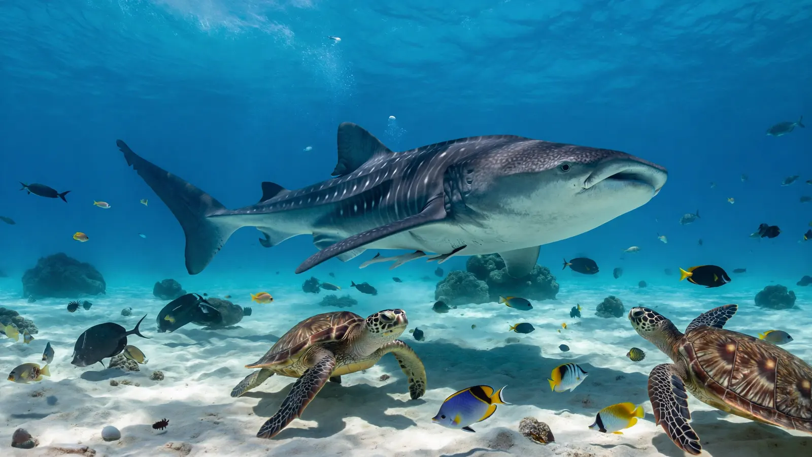
Coral reefs, sea turtles, rays, nurse sharks and, in summer, whale sharks.
Cancun sits at the northern end of the Mesoamerican Reef, which stretches more than 1,100 km to Honduras. Reef sites near Cancun and Isla Mujeres include Manchones and the MUSA underwater museum, where hundreds of sculptures have become an artificial reef. From roughly June to September, whale sharks gather to feed off Isla Mujeres and Isla Holbox; see whale shark. Green and loggerhead turtles nest on local beaches in summer. For diving tips see scuba diving in Cancun and nearby Cozumel.
| Spot | Water | Known for |
|---|---|---|
| Hotel Zone beaches | Caribbean (open) | Surf and swimming; check flags |
| Playa Langosta / Playa Tortugas | Bahía de Mujeres (Caribbean) | Calm, family-friendly water |
| Isla Mujeres | Caribbean | Reefs, MUSA, whale sharks |
| Isla Holbox | Where Gulf meets Caribbean | Whale sharks, flamingos |
| Cozumel | Caribbean | World-class drift diving |
Is the water in Cancun safe for swimming?
Generally yes, but the open Hotel Zone beaches can have strong waves and rip currents.
Check the beach flag system: green for safe, yellow for caution, red or black for no swimming. The calmer north-facing beaches on Bahía de Mujeres are better for children. Jellyfish are occasional; see are there crocodiles in Cancun for the lagoon side. Hurricane season runs June through November, with peak risk August to October; Hurricane Wilma in 2005 caused major damage.
What is sargassum season in Cancun?
Since about 2011, large mats of floating sargassum seaweed have washed onto Caribbean beaches, usually heaviest from roughly April to September.
The seaweed originates in a belt across the tropical Atlantic, sometimes called the Great Atlantic Sargassum Belt, which has expanded dramatically, likely fuelled by nutrients and changing ocean conditions. Mexico deploys barriers and beach crews to manage it. Sargassum at sea is valuable habitat, but rotting piles on beaches release hydrogen sulphide and harm nearshore seagrass and reefs.
Where exactly does the Caribbean end?
Cancun sits close to one of the busiest water boundaries in the Atlantic. The Yucatán Channel, which separates Mexico’s Yucatán Peninsula from the western tip of Cuba, is just over 200 kilometres wide and nearly 2,800 metres deep at its deepest point near the Cuban coast. It is the main doorway between the Caribbean Sea and the Gulf of Mexico. Water moves through the Caribbean from east to west, fed partly by the North Equatorial Current through the Windward Passage and partly by South Equatorial Current water that has travelled up the coast of Brazil. That flow is squeezed through the channel and supplies most of the water entering the Gulf. The Florida Straits add only a small, intermittent inflow.
Once inside the Gulf, the current becomes the Loop Current. It flows north between Cuba and the Yucatán, swings east and south through the Gulf, and leaves through the Florida Straits to join the Gulf Stream. So the warm water lapping at Cancun’s Hotel Zone is, in a real sense, on its way to becoming the Gulf Stream that warms western Europe. Strong northward currents just offshore are also why boat captains and dive guides around Cancun, Isla Mujeres and Cozumel plan so many trips as drift dives.
The boundary matters for more than geography quizzes. Communities a short drive apart can face different seas. Isla Holbox, on the north coast of the peninsula, looks out where the two seas meet. Progreso and the port of Yucatán state face the Gulf. Cancun, Puerto Morelos, Playa del Carmen, Cozumel and Tulum all face the Caribbean.
A city built on a sandbar
Cancun is younger than many of the people who visit it. The Hotel Zone is built on a long, narrow sandbar, once called Isla Cancún, that separates the Caribbean from the Nichupté lagoon system. When development of the resort began on 23 January 1970, the island had just three residents, all caretakers of a coconut plantation owned by a man who lived on Isla Mujeres. Mexico’s national tourism development fund, now called FONATUR, launched Cancun as one of its first “Integrally Planned Centers” in 1974. The idea was to build an entirely new beach destination from scratch, with an airport, roads, water supply and a hotel strip designed together. Cancun International Airport now handles about fifteen million passengers a year.
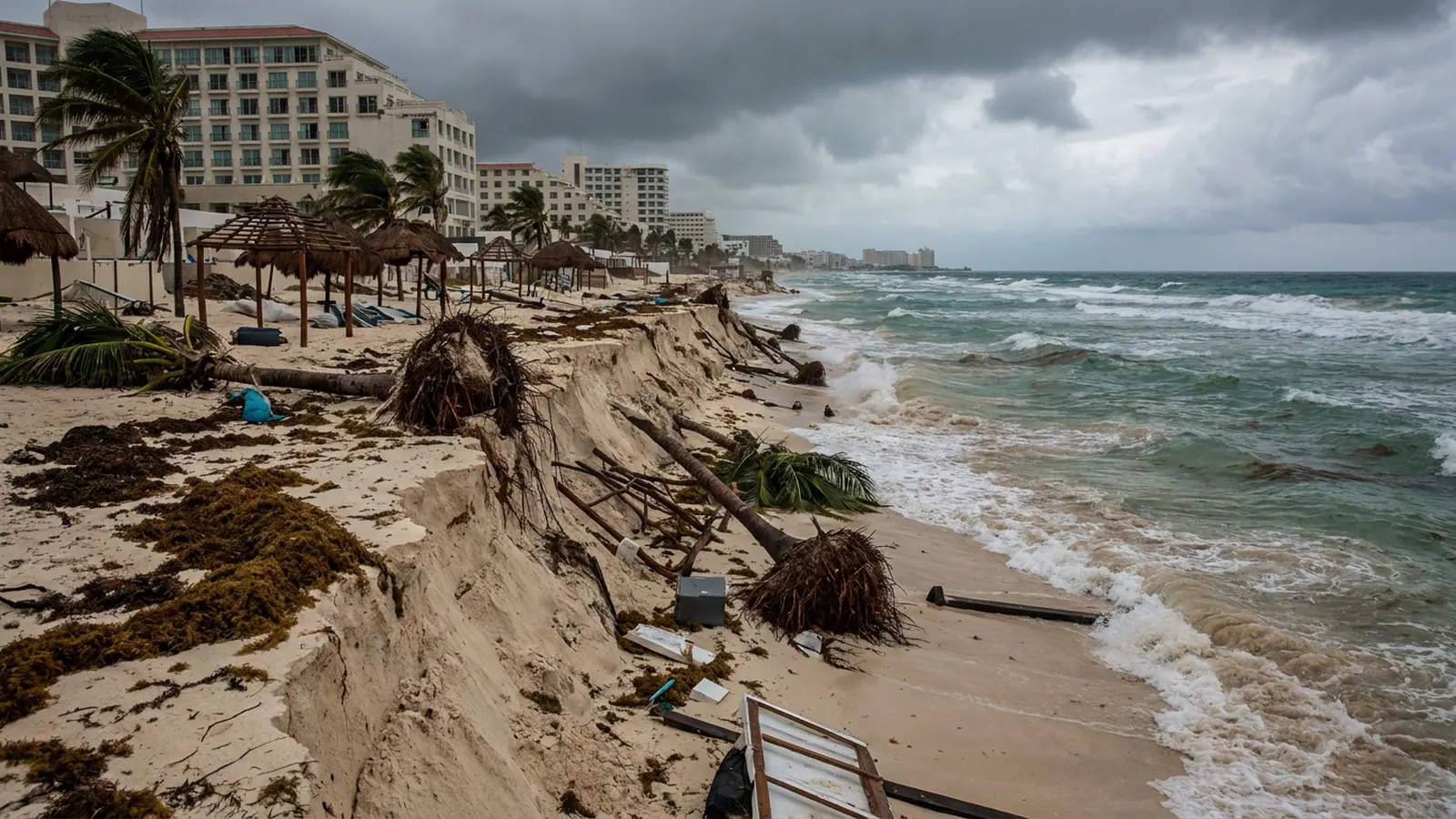
Building a city on a sandbar has consequences. Beaches here are not fixed. They depend on a steady supply of sand moving along the shore, and hotels, sea walls and storms all interrupt that supply. Erosion has been a recurring concern since the resort was built. On the lagoon side, mangroves and seagrass beds once filtered runoff and sheltered young fish, so their condition matters for the whole lagoon system.
Hurricanes that reshaped the coast
Hurricane season runs from June to November, and two storms in particular shaped modern Cancun. Hurricane Gilbert, in September 1988, reached a minimum pressure of 888 millibars over the western Caribbean, a record for the Atlantic at the time. It made landfall on Cozumel and then on the Yucatán Peninsula while still a Category 5 storm, and the Cancun region was estimated to have lost about 87 million US dollars in tourism income in the last three months of 1988 alone.
Hurricane Wilma, in October 2005, was even more extreme. In a 30-hour period ending on 19 October, its central pressure fell from 982 to an estimated 882 millibars, the lowest ever recorded for an Atlantic hurricane. It weakened before reaching Mexico but still made landfall on Cozumel late on 21 October with sustained winds of about 240 kilometres an hour, and then on the mainland near Puerto Morelos about six hours later. A station in Cancun recorded ten-minute sustained winds of about 160 kilometres an hour, with a gust of 212 kilometres an hour before the anemometer failed, the strongest gust ever measured in Mexico. Days of high waves stripped sand from the beaches and damaged nearby reefs. Wilma is the reason many visitors remember Cancun’s beaches as narrower than they are today.
Reefs, art and a museum under the sea
Cancun lies near the northern end of the Mesoamerican Barrier Reef System, sometimes called the Great Maya Reef. It stretches more than 1,100 kilometres along the coasts of Mexico, Belize, Guatemala and Honduras, from Isla Contoy at the northern tip of the Yucatán south to the Bay Islands of Honduras. It is also home to one of the world’s largest populations of manatees, estimated at 1,000 to 1,500 animals.
Close to Cancun the reefs are patchy and shallow, and heavy tourism has taken a toll. Manchones Reef, the largest reef in Cancun, was receiving the most damage because it was the most visited by divers and snorkellers. In response, Jaime González Cano, then director of the local marine park, proposed giving visitors something else to look at. He recruited the British sculptor Jason deCaires Taylor, who had already used underwater sculptures as artificial reefs in Grenada. The result was MUSA, the Cancun Underwater Museum, started in 2009 and officially opened in November 2010. It now has about 500 sculptures in three galleries, three to six metres deep, built from materials designed to let corals and sponges settle on them. The sculptures draw snorkellers and divers away from natural reefs that need time to recover.
The natural reefs face a newer threat. In the summer of 2018, scientists noticed unusually high levels of coral disease in the northern part of the Mexican Caribbean. Surveys of 82 reef sites in 2018 and 2019 showed that stony coral tissue loss disease, first seen in Florida in 2014, had spread along the entire Mexican Caribbean coast. Long-term records showed no sign of such high disease levels anywhere in the region before 2018.
Isla Contoy, a small island north of Isla Mujeres, shows what the coast looked like before development. It has been protected by the Mexican government since 1961 and became a national park in 1998. Loggerhead, green, hawksbill and leatherback turtles nest on its beaches, and the reserve shelters about 152 species of seabirds and coastal birds, including frigatebirds, brown pelicans and double-crested cormorants. Visitor numbers are capped, so trips must be booked through licensed operators.
The whale shark gatherings
The waters off the northeastern tip of the Yucatán are among the best places in the world to swim with whale sharks. Each summer the sharks gather north of Cabo Catoche, off Isla Holbox, to feed mainly on copepods and small sergestid shrimp. In 2009 researchers documented a second and much denser aggregation east of the tip of the peninsula, in the Caribbean, which they nicknamed “the Afuera”. It was the largest gathering of whale sharks ever reported. A single aerial survey counted up to 420 whale sharks in an oval patch of ocean of about 18 square kilometres. DNA barcoding showed that the sharks were feeding on dense patches of fish eggs from little tunny, a small tuna. The discovery revealed a spawning ground that nobody had known existed. When sightings rose at the Afuera they fell at Cabo Catoche, and the two groups had the same sex ratio. Tagging data supported the idea that the same sharks move between the two sites. Most whale shark tours from Cancun and Isla Mujeres now head for these Caribbean feeding grounds.
Why sargassum arrived
The sargassum that piles up on Cancun’s beaches in some summers is not local. Floating Sargassum seaweed has been known in the central North Atlantic since Columbus reported it in the 15th century. Until about 2011, the mats were fairly limited and patchy. Since then, satellite images have shown a recurring band of seaweed, the Great Atlantic Sargassum Belt, stretching from West Africa to the Caribbean and the Gulf of Mexico. Researchers led by Mengqiu Wang reported in Science in 2019 that in June 2018 the belt was 8,850 kilometres long and held more than 20 million tonnes of seaweed, making it the world’s largest seaweed bloom. They linked the 2011 bloom to earlier Amazon River discharge and later increases to winter upwelling off West Africa and Amazon outflow in spring and summer. The pattern suggests a possible regime shift, so recurring sargassum seasons may be the new normal for the Mexican Caribbean. The Caribbean coast of Quintana Roo, including Cancun’s eastern beaches, is directly in the belt’s path, while the north-facing beaches on the Bahía de Mujeres usually receive less.
Why there are no rivers: the Chicxulub crater and cenotes
Look at a map of the northern Yucatán and you will notice something missing: rivers. The peninsula is a flat slab of porous limestone, so rain soaks straight into the ground and flows to the sea through underground channels instead of over the surface. Where cave roofs have collapsed, the result is a cenote, a natural sinkhole opening onto clear groundwater. The cave systems are enormous. Sistema Sac Actun, south of Cancun near Tulum, became the longest known underwater cave system after a link to Sistema Dos Ojos was found in 2018, and it is now second only to the nearby Sistema Ox Bel Ha. Where this fresh water seeps out along the coast, it mixes with the Caribbean and helps shape the lagoons and reefs.
The Yucatán’s geology also holds one of the most famous scars on Earth. Slightly more than 66 million years ago, an asteroid about ten kilometres across struck what is now the northwest of the peninsula, on the Gulf side. The buried Chicxulub crater is estimated at 180 kilometres across and 20 kilometres deep, and the impact is linked to the extinction of the non-bird dinosaurs. Geophysicists Antonio Camargo and Glen Penfield found the structure while prospecting for oil in the late 1970s. Today a ring of cenotes traces part of the crater’s buried rim, a reminder that the coast Cancun’s visitors enjoy was shaped by an event far larger than any hurricane.

What ocean is Cancun on?
The Atlantic Ocean, via the Caribbean Sea.
Is Cancun on the Gulf of Mexico?
No. Cancun is on the Caribbean Sea; the Gulf of Mexico begins north of Cabo Catoche.
Is Cancun on the Pacific Ocean?
No. Mexico’s Pacific coast is on the opposite side of the country.
Is the water in Cancun warm?
Yes, about 26°C in winter and up to 29–30°C in late summer.
When is sargassum season in Cancun?
Usually heaviest from about April to September, varying by year.
Can you see whale sharks from Cancun?
Yes, on day trips to Isla Mujeres or Holbox from roughly June to September.
- International Hydrographic Organization (1953). Limits of Oceans and Seas, S-23, 3rd ed.
- NOAA: Sargassum and the Great Atlantic Sargassum Belt.
- Wang, M. et al. (2019). The great Atlantic Sargassum belt. Science 365.
- de la Parra Venegas, R. et al. (2011). An unprecedented aggregation of whale sharks, Rhincodon typus, in Mexican coastal waters of the Caribbean Sea. PLoS ONE 6: e18994.
- Wang, M. et al. (2019). The great Atlantic Sargassum belt. Science 365: 83-87.
- Alvarez-Filip, L. et al. (2019). A rapid spread of the stony coral tissue loss disease outbreak in the Mexican Caribbean. PeerJ 7: e8069.
- Wikipedia (accessed 2026): Cancún; Yucatán Channel; Loop Current; Hurricane Gilbert; Hurricane Wilma; Cancún Underwater Museum; Mesoamerican Barrier Reef System; Isla Contoy; Sistema Sac Actun; Chicxulub crater.
Blane Perun has been exploring Earth’s oceans and marine life for over 25 years. Founder of TheSea.Org in 1999, underwater photographer, coral aquaculture pioneer, and explorer of 80+ countries.
