The Tallest Waterfall Is Underwater — Inside the Denmark Strait Cataract
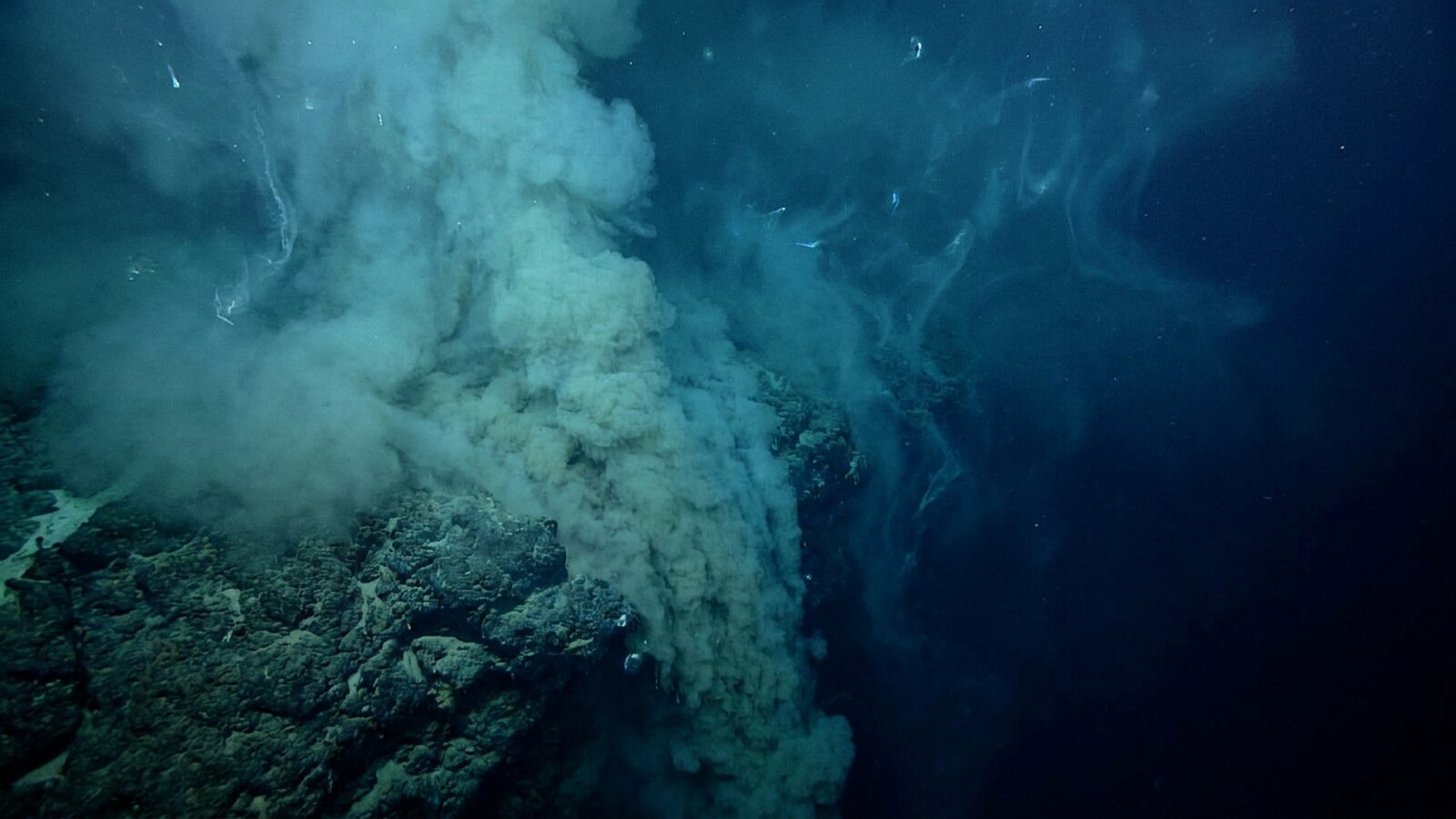
The world’s largest waterfall is the Denmark Strait cataract, a cascade of cold, dense seawater that pours over an undersea ridge between Greenland and Iceland and sinks about 3,500 m toward the floor of the North Atlantic. That is more than three times the height of Angel Falls, the tallest waterfall on land. Its average flow, measured by moored instruments since 1996, is about 3.2 million cubic metres per second, roughly 2,000 times Niagara at peak. You could sail straight over it and never know: the “fall” happens entirely underwater, as heavy water slides down a slope beneath lighter water.
What is the tallest waterfall in the world?
Measured by height and volume, it is the Denmark Strait cataract. On land, the record holder is Angel Falls in Venezuela, the world’s tallest uninterrupted waterfall at 979 m, with a single plunge of 807 m. The cataract’s total descent is usually given as about 3,500 m (11,500 ft), which is why it is so often described as more than three times the height of Angel Falls. Its flow is measured in sverdrups, units of a million cubic metres per second, and the best long-term estimate is about 3.2 million cubic metres per second, which EarthSky puts at almost 2,000 times Niagara Falls at peak flow.
The exact figures depend on how you define a waterfall that has no lip, no splash and no visible edge, and the sources do not all agree. NOAA’s National Ocean Service and EarthSky describe water that begins about 600 to 650 m below the surface of the strait and plunges to about 3,000 m, “nearly a two-mile drop”, while also quoting the 3,500 m height. Live Science, in a December 2024 article, gave 3,500 m as the descent from the top of the slope to the bottom, but noted that the waterfall itself is only about 2,000 m tall because it ends in a deep pool of cold water, making it about double the height of Angel Falls rather than triple. Whichever figure you choose, nothing on land comes close.
Underwater vs land waterfalls
| Waterfall | Height | Flow |
|---|---|---|
| Denmark Strait cataract | ~3,500 m total descent; ~2,000 m by a stricter definition | ~3.2–3.5 million m³/s |
| Angel Falls, Venezuela | 979 m (807 m single plunge) | Small, seasonal |
| Niagara Falls, US/Canada | ~50 m | About 2,000 times less than the cataract, even at peak (EarthSky) |
How much water goes over the underwater waterfall?
About 3.2 million cubic metres every second, on average. Oceanographers have monitored the overflow with moored acoustic current meters in the deep channel of the strait since 1996. A 2012 analysis of that record by Jochumsen, Quadfasel and colleagues gave a mean transport of 3.4 sverdrups and found no significant trend. In 2017 the same group revised the method after deploying a five-mooring array in 2014 and 2015 that measured the flow outside the fast-moving core and corrected a bias in some instruments; the revised mean for 1996 to 2016 is 3.2 sverdrups, with a typical uncertainty of about plus or minus 0.5, and again no significant trend. NOAA and EarthSky quote an estimate of about 3.5 million cubic metres per second.
That flow is far from steady. Most of the variability comes from the passage of eddies, which make the overflow pulse on time scales of two to ten days. The seasonal cycle is weak, explaining less than 5% of the variance, and year-to-year changes are only about 10% of the mean. EarthSky notes that the cataract’s flow equals between 20 and 40 times the combined discharge of all rivers flowing into the Atlantic, and it greatly exceeds the discharge of the Amazon into the ocean.
How can a waterfall exist underwater?
Because seawater is not all the same density. Cold, dense water flowing south from the Nordic Seas meets warmer, lighter water in the Irminger Sea, sinks beneath it and slides down the sea floor.
The dense water is made in the Nordic Seas north of Iceland, where Atlantic water carried north by currents loses heat to the atmosphere and becomes colder and denser. The water mass that spills through the strait is called Denmark Strait Overflow Water, and it is thought to come from the transformation of water in the eastern Nordic Seas, the Greenland Sea and the Iceland Sea. Two branches of the East Greenland Current and a deep current called the North Icelandic Jet carry it towards the strait. A 2011 study by Våge and colleagues in Nature Geoscience identified the North Icelandic Jet as a significant source of the overflow, and a 2016 mooring array study by Harden, Pickart and colleagues traced how the different upstream sources feed it.
The strait is the gap between Greenland and Iceland, about 480 km long and 290 km across at its narrowest. Its floor rises into a submarine ridge, the Greenland–Iceland Rise, which acts like a dam. Dense water pools behind it until it reaches the level of the sill, the lowest point of the ridge, roughly 600 to 650 m below the surface according to NOAA and EarthSky. Live Science describes the water just north of the cataract as about 400 m deep, with only the bottom 200 m or so cascading down the slope. Once over the sill, the dense layer follows the sea floor south and west into the Irminger Sea, descending along a slope that drops away over 500 to 600 km.
The Earth’s rotation shapes the flow. The Coriolis effect deflects moving water to the right in the Northern Hemisphere, so the descending current hugs the Greenland side of the channel, where it stands roughly 1 km higher than on the opposite side. The slope itself is a legacy of the last ice age: according to Live Science, glaciers carved the path of the cataract between about 17,500 and 11,500 years ago.
- Cold: water that loses heat to the Arctic air becomes denser.
- Dense: it is heavier than the warmer Atlantic water to the south.
- Blocked: the ridge across the strait holds it back until it overflows the sill.
- Steep slope: the sea floor south of the sill falls away towards the deep Atlantic.
What would you see if you dived there?
Very little. Unlike a river waterfall, the cataract does not crash or roar. Live Science gives its speed as about 0.5 m per second, slower than a walking pace and far slower than the roughly 30 m per second of water going over Niagara. The marine geoscientist Mike Clare of the UK’s National Oceanography Centre told Live Science that if it could be visualised it would look like “a relatively low-gradient slope”, and that “if you were down there, you probably wouldn’t notice a whole heap going on.” Anna Sánchez Vidal of the University of Barcelona, who led a 2023 expedition to the area, described typical sunny Arctic conditions at the surface; from a ship or from space the cataract can only be detected through measurements of temperature and salinity.
What does happen is mixing. As the plume descends, it drags in, or entrains, surrounding water and grows in volume. A 2018 study by North and colleagues used more than 30 years of profile data to examine the first 200 km downstream of the sill and found that entrainment and turbulence were up to an order of magnitude higher when the overflow was running strongly, driven by shear instabilities at the boundary between the plume and the water above it. By the time the overflow reaches the deep Irminger Sea, it is warmer, less dense and much larger in volume than the water that crossed the sill.
How do scientists measure an invisible waterfall?
With instruments left on the sea floor for years at a time. Since 1996, two acoustic Doppler current profilers moored in the deep channel of the strait have recorded the speed of the water passing over them, although the record has gaps where moorings were lost or instruments failed. To fill those gaps, Jochumsen and colleagues developed a statistical model that estimates the total flow when only one instrument is working. Since 2005, moored sensors have also recorded the temperature, salinity and pressure of the overflow, tracking changes in the water itself as well as its speed. The 2014–2015 five-mooring array then extended the measurements to the slower edges of the plume, which led to the revised estimate of 3.2 sverdrups.
Ships add detail that moorings cannot. The 2018 study by North and colleagues combined decades of temperature and salinity profiles with sections across the plume and “yo-yo” casts, in which an instrument is lowered and raised repeatedly at one spot to capture how turbulence changes over hours. On a basin scale, the Overturning in the Subpolar North Atlantic Program (OSNAP), started in 2010 by the United States, the United Kingdom, Germany, the Netherlands and Canada, has since 2014 maintained a line of instruments across the subpolar North Atlantic to measure the flow of water, heat and fresh water continuously. Together these records show how the cataract fits into the ocean’s wider circulation.
Why does the Denmark Strait cataract matter?
It is one of the main sources of the deep water that drives the Atlantic’s overturning circulation.
The Denmark Strait overflow provides about half of all the dense water that crosses from the Nordic Seas into the North Atlantic; most of the rest crosses the ridge between Iceland, the Faroe Islands and Scotland. Together these overflows form the lower part of North Atlantic Deep Water, a water mass of about 2 to 4 °C and salinity around 34.9 to 35.0 that fills the Atlantic at depths of about 1,500 to 4,000 m. The upper part forms by deep convection in the Labrador Sea, where water sinks to about 2,000 m in winter.
North Atlantic Deep Water is the deep, southward-flowing limb of the Atlantic meridional overturning circulation, the system that also carries warm surface water north in the Gulf Stream and North Atlantic Current. The overturning releases heat to the atmosphere at high latitudes and is generally thought to moderate the climate of north-western Europe, although the size of that effect is debated. It is also the largest carbon sink in the Northern Hemisphere, taking up roughly 0.7 billion tonnes of carbon a year. Results from the international OSNAP observing system, deployed across the subpolar North Atlantic in 2014, showed that the Irminger and Iceland basins, downstream of the cataract, produced about three times as much dense water as the Labrador Sea during the observation period.
Is climate change affecting the underwater waterfall?
So far the measurements show no clear change. Both the 2012 and 2017 analyses of the overflow record found no significant trend in the transport between 1996 and 2016. The wider overturning circulation is a different matter. Climate models consistently project that the Atlantic overturning will weaken over the 21st century as the ocean warms and meltwater from ice sheets freshens the North Atlantic, and a severe weakening could tip it into a collapse that would be hard to reverse. Most comprehensive Earth system models suggest that a shutdown is only likely after high levels of warming sustained well beyond 2100, but some simpler studies argue it could come much sooner, and many scientists remain sceptical of the earliest dates.
The Nordic Seas may behave differently from the rest of the system. A 2023 study by Årthun and colleagues in Nature Communications used global climate models to show that overturning in the Nordic Seas, which supplies the overflow, actually strengthens through most of the 21st century, because the horizontal circulation speeds up and the east–west density contrast increases. They suggested that this could act as a stabilising factor for the wider overturning. That is one reason oceanographers keep current meters moored in the strait: the cataract is a sensitive gauge of how the northern ocean is changing. See how oceans affect the climate and the Arctic Ocean for the bigger picture.
Are there other underwater waterfalls?
Yes. Dense water spills over sills and down slopes wherever it forms next to a deep basin. The overflows across the Iceland–Faroe–Scotland ridge, including the Faroe Bank Channel, supply most of the remaining Nordic Seas overflow. Salty Mediterranean water pours out through the Strait of Gibraltar beneath the inflowing Atlantic water and sinks until it reaches its own density level at mid-depth in the Atlantic. Around Antarctica, wintertime cooling and the salt left behind by forming sea ice create cold, salty dense shelf water in the Weddell and Ross Seas, off the Adélie Coast and near Cape Darnley; it cascades down the continental slope to form Antarctic Bottom Water, the densest water in the open ocean, which fills ocean basins below about 4,000 m. On a smaller scale, Mike Clare notes that knickpoints, steps along continental margins, can resemble land waterfalls, though they are tiny compared with the cataract. None of these matches the Denmark Strait for its combination of height and volume.
One famous “underwater waterfall” is not a waterfall at all. Aerial photographs off Le Morne in south-western Mauritius appear to show the sea pouring into a hole, but the effect is an optical illusion created by sand and silt washing off the island’s shallow shelf into deeper water, seen from above.
What else happened in the Denmark Strait?
The strait connects the Greenland Sea, an extension of the Arctic Ocean, with the Irminger Sea in the North Atlantic. The cold East Greenland Current flows south through it, carrying icebergs into the Atlantic, and the waters host important fisheries. The strait is also known for one of the most famous naval engagements of the Second World War. On 24 May 1941, at the Battle of the Denmark Strait, the German battleship Bismarck sank the British battlecruiser HMS Hood, which exploded with the loss of all but three of its 1,418 crew. Bismarck was damaged in the battle and was sunk three days later. A related phenomenon to the overflow, giant waves travelling along density layers inside the ocean, is covered in the biggest ocean waves are found beneath the surface.
- Earth’s biggest waterfall is the Denmark Strait cataract.
- It descends about 3,500 m, over 3× Angel Falls.
- Its mean flow is about 3.2 million m³/s, with no significant trend since 1996.
- It helps drive the Atlantic overturning circulation.
Where is the largest waterfall in the world?
Under the sea in the Denmark Strait, between Greenland and Iceland.
How tall is the Denmark Strait cataract?
Its total descent is usually given as about 3,500 m (11,500 ft), more than three times Angel Falls. By a stricter definition the fall itself is about 2,000 m.
How much water flows over the underwater waterfall?
About 3.2 million cubic metres per second on average (1996–2016 moorings); NOAA quotes about 3.5 million.
Can you see the underwater waterfall?
No. It flows hundreds of metres down, moves at about 0.5 m/s, and shows only in temperature and salinity measurements.
What causes an underwater waterfall?
Cold, dense water spilling over a seafloor ridge and sinking beneath lighter, warmer water.
Is the underwater waterfall slowing down?
Mooring records from 1996 to 2016 show no significant trend, although models project the wider Atlantic overturning will weaken.
Is the Mauritius underwater waterfall real?
No. It is an optical illusion of sand and silt flowing off the island’s shelf, seen from above.
- Jochumsen, K. et al. (2017). Revised transport estimates of the Denmark Strait overflow. Journal of Geophysical Research: Oceans. doi:10.1002/2017JC012803
- Jochumsen, K., Quadfasel, D., Valdimarsson, H. et al. (2012). Variability of the Denmark Strait overflow: moored time series from 1996–2011. JGR Oceans. doi:10.1029/2012JC008244
- North, R. P. et al. (2018). Entrainment and energy transfer variability along the descending path of the Denmark Strait overflow plume. JGR Oceans. doi:10.1002/2018JC013821
- Våge, K. et al. (2011). Significant role of the North Icelandic Jet in the formation of Denmark Strait overflow water. Nature Geoscience. doi:10.1038/ngeo1234
- Harden, B. E. et al. (2016). Upstream sources of the Denmark Strait Overflow: observations from a high-resolution mooring array. Deep-Sea Research I. doi:10.1016/j.dsr.2016.02.007
- Årthun, M. et al. (2023). Future strengthening of the Nordic Seas overturning circulation. Nature Communications. doi:10.1038/s41467-023-37846-6
- Lozier, M. S. (2023). Overturning in the subpolar North Atlantic: a review. Phil. Trans. R. Soc. A. doi:10.1098/rsta.2022.0191
- Live Science (20 December 2024), “Denmark Strait cataract: the world’s largest waterfall”; EarthSky (15 June 2020), “Earth’s largest waterfall”; NOAA National Ocean Service, “What is the largest waterfall?”
- Wikipedia. Denmark Strait cataract; Denmark Strait; North Atlantic Deep Water; Atlantic meridional overturning circulation; Antarctic bottom water; Angel Falls. Accessed November 2026.
Blane Perun has been exploring Earth’s oceans and marine life for over 25 years. Founder of TheSea.Org in 1999, underwater photographer, coral aquaculture pioneer, and explorer of 80+ countries.
About Blane Perun →