How Much of Earth Is Covered by Ocean? — About 71% of the Planet’s Surface
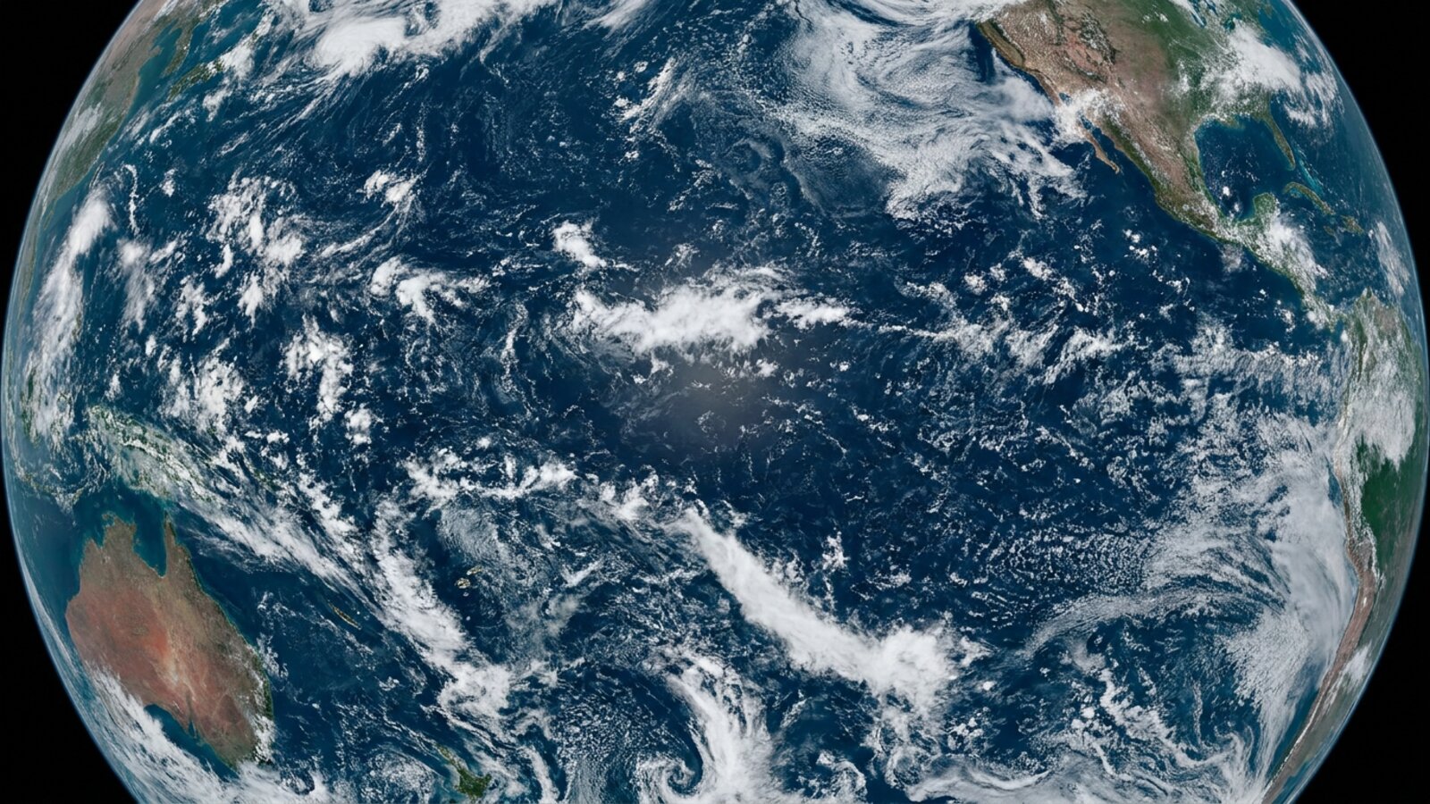
About 71% of Earth’s surface is ocean, roughly 361 million km² (139 million square miles). The sea surface ranges from about −2°C near the poles to over 30°C in the tropics, averages about 35 parts per thousand salinity, and is the most productive layer of the ocean.
The world ocean covers about 361 million km², or about 70.8% of Earth’s surface, and holds about 97% of all water on the planet. The Southern Hemisphere is about 81% ocean, the Northern Hemisphere about 61%. If Earth’s surface were perfectly smooth, the ocean would cover it to a depth of about 2.7 km.
How is ocean surface area divided between the oceans?
The Pacific alone covers almost a third of the planet.
| Ocean | Approx. area | Share of world ocean |
|---|---|---|
| Pacific | ~165 million km² | ~46% |
| Atlantic | ~106 million km² | ~23–29% |
| Indian | ~70 million km² | ~20% |
| Southern | ~22 million km² | ~6% |
| Arctic | ~15 million km² | ~4% |
Areas vary between sources depending on how marginal seas are counted; see the world’s largest oceans.
How warm is the ocean surface?
Sea surface temperatures range from about −2°C, where seawater freezes near the poles, to over 30°C in places like the Persian Gulf and western Pacific warm pool.
Latitude is the biggest control, but currents, upwelling and season all matter; see what affects ocean temperature. The global average sea surface temperature is around 17–21°C depending on how it is calculated, and it reached record levels in 2023 and 2024. See ocean warming.
What is the surface mixed layer?
The top layer of the ocean, stirred by wind and waves so that its temperature and salinity are nearly uniform.
The mixed layer is typically 10–200 m deep, shallower in summer and deeper in winter and stormy seas. Below it lies the thermocline, where temperature drops quickly. Almost all photosynthesis in the ocean happens in this sunlit surface zone, which is why it supports most marine life. See ocean depth zones.
What lives at the very surface of the ocean?
A specialised community called the neuston lives in the top few centimetres, including blue sea dragons, by-the-wind sailors, Portuguese man o’ war and sea skaters.
The sea surface microlayer, less than a millimetre thick, has its own chemistry and microbial life and controls the exchange of gases between ocean and atmosphere. Floating Sargassum weed in the Atlantic forms a moving habitat for juvenile sea turtles, fish and crabs. Unfortunately, floating plastics also accumulate at the surface; see plastic islands.
How salty is the ocean surface?
About 35 grams of dissolved salts per kilogram of seawater on average, but it varies from under 30 to over 40.
Surface salinity is highest in the subtropics where evaporation exceeds rainfall, such as the Red Sea (around 40), and lowest near river mouths and polar seas where fresh water and melting ice dilute it. Salinity matters because, with temperature, it sets seawater density and helps drive deep ocean circulation. See how oceanographers measure salinity.
The ocean’s skin: the sea surface microlayer
The very top of the ocean is not just more of the same water. Scientists call it the sea surface microlayer, a film with an operational thickness of between 1 and 1,000 micrometres, or at most one millimetre. Because it covers roughly 70% of the planet, this thin skin is the main boundary between the ocean and the atmosphere. Every molecule of gas that moves between sea and air, and every droplet of sea spray, passes through it.
The microlayer is never truly clean. Surface-active substances, or surfactants, produced by plankton and bacteria collect there because of surface tension, so the layer is always enriched in organic material. Recent research describes it as an aggregate-rich biofilm with its own microbial community. Bacteria, algae and protists living in the microlayer, together called the bacterioneuston and its relatives, are usually more concentrated than in the water just below and differ from it in species make-up. Where surfactants build up enough to calm the tiny ripples on the surface, they form visible sea slicks, the smooth glassy streaks you often see on a calm day, and these slicks can act as nurseries for fish and invertebrate larvae. Sampling the layer is fiddly: one standard method dips a clean glass plate into the sea and wipes off the film that clings to it, collecting just 3 to 12 cubic centimetres of water per sample. The glass-plate sampler was first described in 1972 by Harvey and Burzell, who used a plate 20 cm square and 4 mm thick, withdrawn slowly and vertically so that only the surface film stayed attached.
The microlayer also has its own temperature. Satellites that measure sea surface temperature in the infrared see radiation emitted from the top 0.01 mm or less, the so-called skin. That skin can differ from the water a metre down because of solar heating by day, evaporation and heat loss to the air. Microwave instruments sense the top centimetre or so. All of these readings have to be adjusted before they can be compared with the bulk temperature measured by ships and buoys.
Life on the surface: the neuston
The animals and plants that live at the surface are known as the neuston, or pleuston. Biologists divide them into the epineuston, which live on top of the water, and the hyponeuston, which live in a thin zone just beneath it, plus the microbes of the microlayer itself. The marine neuston was described as a distinct community by the biologist Zaitsev in 1971.
Some of its members are startling. Sea skaters of the genus Halobates belong to the water strider family, Gerridae. There are more than 40 species, most living along sheltered coasts, but five live on the open ocean and only come near land when storms blow them ashore. They are the only known truly oceanic insects. The first specimens were collected by Johann Friedrich von Eschscholtz, a doctor on the Russian ship Rurik during its voyage of 1815 to 1818, and a fossil species is known from 45-million-year-old rocks near Verona in Italy. Sea skaters feed mainly on zooplankton, along with fish eggs and larvae and dead jellyfish, and three or four may share a small fish. Adults sometimes eat their own young, and older nymphs eat younger ones, although they generally do not eat their own age group.
The open-ocean species need something solid to lay their eggs on, such as a floating feather or a piece of cuttlebone. Each female lays between 1 and 20 whitish eggs, each about 1 mm long. In the open sea such objects are rare, which limits how many eggs can be laid. Plastic has changed that. A 2012 study in Biology Letters led by Miriam Goldstein found that microplastic in the North Pacific Subtropical Gyre had increased by two orders of magnitude over four decades. Where plastic was abundant, so were the eggs of the sea skater Halobates sericeus, and overall egg densities had risen. The plastic had released the insect from a shortage of egg-laying sites, a rare example of a measurable population-level effect of microplastic on wildlife.
The by-the-wind sailor, Velella velella, also called the purple sail or sea raft, is a small hydrozoan colony with a sail that catches the wind. It has no way to swim, so it goes where the wind sends it, catching plankton with stinging tentacles that hang below. That makes it prone to mass strandings. Most springs, a wave of strandings moves down the west coast of North America from British Columbia to California over several weeks. In some years the line of dying animals at the tide mark is many centimetres deep and runs for hundreds of kilometres. Similar strandings have been recorded on the west coast of Ireland and in Cornwall.
Windrows and Langmuir circulation
On a windy day at sea, floating seaweed, foam and debris often line up in long, straight streaks parallel to the wind. Irving Langmuir noticed windrows of Sargassum in the Sargasso Sea in 1927 and investigated what caused them, publishing his results in Science in 1938. The streaks mark a pattern of shallow, slow, counter-rotating vortices aligned with the wind, now called Langmuir circulation. Between each pair of vortices, surface water converges and sinks, leaving floating material behind in a line; in between, water wells up and spreads out.
Langmuir circulation stirs the surface mixed layer, although oceanographers are still unsure how much it contributes to mixing at the base of that layer.
Sea foam and sea spray
Sea foam forms when breaking waves churn water that contains dissolved organic matter, such as proteins and fats released when algal blooms break down offshore. These compounds act as foaming agents, trapping air in bubbles that cling together. Usually the foam is harmless, but large storms can produce extraordinary amounts. In August 2007 the coast at Yamba in New South Wales was buried in foam, and in September 2012 a storm engulfed the Footdee area of Aberdeen in Scotland. Foam can also be dangerous: on 11 May 2020 five surfers died off the coast of the Netherlands, apparently after becoming disoriented in a layer of foam more than 2 m thick.
Bursting bubbles also launch tiny droplets into the air. When the water evaporates, it leaves particles of sea salt and organic material known as sea spray aerosol. These particles serve as cloud condensation nuclei, the seeds around which cloud droplets form, and they help scrub some pollutants from the atmosphere. Research has even found that coarse sea spray can inhibit the development of lightning in storm clouds. The ocean surface therefore helps shape the sky above it.
How sea surface temperature has been measured
The history of sea surface temperature is a history of changing methods. Benjamin Franklin’s survey of the Gulf Stream in the late 18th century relied on thermometer readings. For more than a century afterwards, sailors measured the surface by drawing up a bucket of water and dipping a thermometer into it.
By 1963 automated measurements were being taken at the cooling-water intakes of large ships. Those readings run warm by about 0.6 degrees C on average because of heat from the engine room. One curious jump in the record, between 1940 and 1941, turned out to be caused by an undocumented change in procedure during the Second World War: it was too dangerous to show lights over the side of a ship at night, so samples were taken near the engine intake instead. Climate scientists have to identify and correct such shifts before old and new records can be joined.
Today satellites provide global coverage, checked against thousands of drifting buoys whose readings are beamed to satellites automatically. Infrared sensors cannot see through clouds, which introduces a cool bias in cloudy regions, but passive microwave sensors can see through cloud cover and provide accurate readings in all weather. The combination of buoys, ships, Argo floats and satellites is what makes today’s daily global temperature maps possible.
Measuring salt and colour from orbit
Salinity is harder to measure from space than temperature, because the signal is faint. The European Space Agency’s SMOS satellite, launched on 2 November 2009, carries an instrument called MIRAS that measures natural microwave emission at the L-band frequency of 1.4 gigahertz, which varies slightly with the salt content of seawater. NASA’s Aquarius instrument, flown on the Argentine SAC-D satellite from 10 June 2011, was built to detect changes of just 0.2 on the practical salinity scale across a 390 km swath. Surface salinity across the open ocean ranges from about 32 to 37 on that scale. Aquarius was a joint mission of NASA and Argentina’s space agency CONAE, and its three radiometers used reflectors 2.5 m across. It ended on 7 June 2015, when the satellite’s power supply failed. SMOS, planned for three years, has kept operating for well over a decade.
Colour tells a different story. Phytoplankton contain chlorophyll, which changes the colour of the water, so satellites can map the green of productive seas and the deep blue of ocean deserts. Ocean-colour measurement from space began in 1978 with NASA’s Coastal Zone Color Scanner on the Nimbus-7 satellite. It was an experimental mission meant to last a year, but it kept returning data until early 1986. Then came a ten-year gap until the SeaWiFS sensor was launched in 1997, followed by instruments such as MODIS and Europe’s MERIS. These records show where the ocean surface is most alive, how blooms rise and fall with the seasons, and how river plumes, sediment and red tides spread along coasts.
How much of Earth is covered by ocean?
About 71% of Earth’s surface, roughly 361 million km².
What percentage of Earth’s water is in the ocean?
About 97%.
What is the average temperature of the ocean surface?
Around 17–21°C globally, ranging from about −2°C to over 30°C.
How salty is the ocean?
About 35 parts per thousand on average.
Which hemisphere has more ocean?
The Southern Hemisphere, which is about 81% ocean.
What lives on the surface of the ocean?
The neuston: animals such as blue sea dragons, by-the-wind sailors and man o’ war, plus floating Sargassum communities.
- NOAA: How much water is in the ocean?
- USGS Water Science School: How much water is there on Earth?
- Eakins, B. W. & Sharman, G. F. (2010). Volumes of the World’s Oceans from ETOPO1. NOAA NGDC.
- Cunliffe, M. et al. (2013). Sea surface microlayers: a unified physicochemical and biological perspective of the air-ocean interface. Progress in Oceanography 109: 104-116; Engel, A. et al. (2017). The ocean’s vital skin. Frontiers in Marine Science 4: 165.
- Goldstein, M.C., Rosenberg, M. & Cheng, L. (2012). Increased oceanic microplastic debris enhances oviposition in an endemic pelagic insect. Biology Letters 8: 817-820.
- Langmuir, I. (1938). Surface motion of water induced by wind. Science 87: 119-123.
- NASA Aquarius mission and ESA SMOS mission documentation.
Blane Perun has been exploring Earth’s oceans and marine life for over 25 years. Founder of TheSea.Org in 1999, underwater photographer, coral aquaculture pioneer, and explorer of 80+ countries.
