What Is the Most Dangerous Ocean? — It Depends on the Danger
For sailors, the Southern Ocean is the most dangerous: unbroken westerly winds, the biggest average waves on Earth, icebergs and freezing water, especially in the Drake Passage. For coastal populations, the Pacific is riskiest, with the most tsunamis, typhoons and earthquakes around the Ring of Fire. The Indian Ocean holds the deadliest single disaster, the 2004 tsunami that killed roughly 230,000 people.
There is no single answer because “dangerous” can mean rough seas, storms, tsunamis, piracy or wildlife. Mariners have long rated the Southern Ocean the worst, with the “Roaring Forties”, “Furious Fifties” and “Screaming Sixties” latitudes. Measured by human deaths, however, Pacific and Indian Ocean tsunamis and tropical cyclones have taken far more lives.
How do the five oceans compare for danger?
Each ocean has its own signature hazards.
| Ocean | Main hazards | Notable events |
|---|---|---|
| Southern | Strongest winds, huge waves, icebergs, isolation | Drake Passage, Cape Horn shipwrecks |
| Pacific | Tsunamis, typhoons, earthquakes | 2011 Tōhoku tsunami; Typhoon Haiyan 2013 |
| Indian | Tsunamis, cyclones, piracy | 2004 tsunami; Bhola cyclone 1970 |
| Atlantic | Hurricanes, winter storms, rogue waves | Hurricane Katrina 2005; Titanic 1912 |
| Arctic | Sea ice, extreme cold, remoteness | Franklin expedition 1845 |
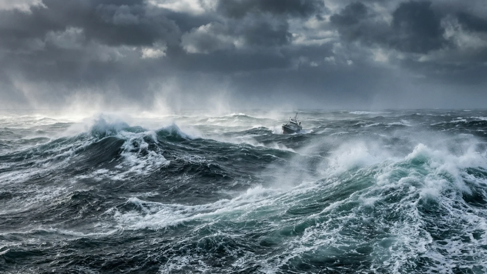
Why is the Southern Ocean so dangerous to sail?
Nothing stops the wind. With no land between about 56°S and Antarctica, westerly gales blow around the planet and build enormous seas.
The Southern Ocean has the highest average wave heights on Earth, and the Drake Passage between Cape Horn and the Antarctic Peninsula funnels wind and current into notoriously violent seas. Add freezing water, icebergs and distance from rescue, and it is the most feared stretch of ocean for sailors. See what lives in the Southern Ocean and how deep is the Southern Ocean.
Which ocean has the most natural disasters?
The Pacific, ringed by the subduction zones of the Ring of Fire and home to the strongest tropical cyclones.
Most of the world’s large earthquakes and tsunamis originate around the Pacific rim. The western Pacific produces the most intense typhoons, such as Haiyan in 2013. The Indian Ocean, however, suffered the deadliest tsunami: the 26 December 2004 Sumatra–Andaman earthquake sent waves across the basin, killing people in 14 countries; see how many died in the Indian Ocean tsunami and is the Indian Ocean dangerous.
Which ocean is most dangerous for swimmers?
For beachgoers, rip currents, not sharks, are the main danger in every ocean.
In the US, the Lifesaving Association attributes the large majority of beach rescues to rip currents. Shark bites are rare everywhere, though Florida, Australia and South Africa record the most; see the most dangerous ocean animals. Box jellyfish make northern Australia’s tropical waters hazardous in summer, and saltwater crocodiles patrol estuaries there.
Three ways to rank an ocean’s danger
Ask a yachtsman, a seismologist and a ship’s insurer which ocean is most dangerous, and you will get three different answers. Sailors judge an ocean by its weather and sea state: how often gales blow, how big the waves get, how cold the water is and how far away help might be. Earth scientists look at natural hazards that strike the coast, such as tsunamis, storm surges and cyclones. Shipping companies and navies add human threats, especially piracy. Each measure points to a different ocean, which is why the honest answer is “it depends”. The sections below look at the evidence for each ocean in turn.
The Southern Ocean: nothing in the way
The Southern Ocean’s reputation comes from its geography. It is the only ocean that flows all the way around the planet without hitting a continent, and its main current, the Antarctic Circumpolar Current, is the largest current on Earth. Estimates of its average flow range from about 100 to 150 million cubic metres of water per second. Through the Drake Passage alone the transport is about 135 million cubic metres per second, roughly 135 times the flow of all the world’s rivers combined, and south of Tasmania it rises to around 147.
The Drake Passage is where wind, current and seafloor all squeeze together. It is about 800 kilometres wide between Cape Horn and Livingston Island in the South Shetlands, the narrowest gap between Antarctica and any other landmass. The Spanish navigator Francisco de Hoces found it in 1525, and the Dutch sailors Willem Schouten and Jacob Le Maire became the first to round Cape Horn in 1616, naming it after the town of Hoorn. For the next three centuries the Horn was a milestone on the clipper route, and its storms became legendary. Charles Darwin, passing it on the Beagle, wrote that “one sight of such a coast is enough to make a landsman dream for a week about shipwrecks, peril and death.” The opening of the Panama Canal in August 1914 removed the need for most ships to make the passage, and today there are no regular commercial routes around the Horn. Even so, the passage still tests adventurers: a crew of six became the first to row across it on 25 December 2019.
The Pacific: the ocean of tsunamis
The Pacific is surrounded by the Ring of Fire, a belt of subduction zones and several hundred active volcanoes, and it is the world’s leading belt of explosive volcanism. Where one tectonic plate dives beneath another, the strain can be released in megathrust earthquakes large enough to lift the seafloor and send tsunamis across the entire basin.
The modern tsunami warning system grew out of one of those disasters. In 1946 an earthquake in the Aleutian Islands generated a tsunami that killed more than 170 people in Hawaii, prompting a plan to warn the public of coming waves. That system now operates as the Pacific Tsunami Warning Center. Its value was tested in May 1960, when the Valdivia earthquake in southern Chile, with a magnitude of about 9.4 to 9.6, became the most powerful earthquake ever recorded. Its tsunami struck Chile, crossed the Pacific to devastate Hilo in Hawaii and reached Japan, the Philippines, New Zealand, Australia and the Aleutians. Estimates of the total death toll range from 1,000 to 6,000.
The Tōhoku earthquake of 11 March 2011, magnitude 9.0 to 9.1, showed that even the best-prepared country can be overwhelmed. Its tsunami may have reached 40.5 metres at Miyako in Iwate Prefecture, travelled at 700 kilometres an hour in the Sendai area and pushed up to 10 kilometres inland. Official figures released in 2021 put the toll at 19,759 dead and 2,553 missing, and the waves caused the Fukushima Daiichi nuclear disaster. Warnings still saved many lives. A Japanese government study found that only five percent of those who tried to evacuate after hearing the warning were caught by the tsunami.
The Pacific also breeds the strongest tropical cyclones. Typhoon Haiyan in November 2013 reached one-minute sustained winds of 315 kilometres an hour, making it the strongest tropical cyclone ever observed by wind speed at the time. It killed at least 6,300 people in the Philippines, where its northern eyewall obliterated much of the city of Tacloban. That wind record was broken in 2015 by Hurricane Patricia, also in the Pacific, off western Mexico, at 345 kilometres an hour.
The Indian Ocean: the deadliest single events
Measured by lives lost in a single event, the Indian Ocean has the grimmest record. The earthquake off Sumatra on 26 December 2004, with a magnitude of 9.1 to 9.3, generated waves up to 30 metres high and killed an estimated 227,898 people in 14 countries. Banda Aceh, close to the epicentre, suffered the greatest losses. There was no basin-wide warning system at the time, so many coastlines hours away from the source had no alert.
The 2004 disaster changed how the region prepares. An Indian Ocean tsunami warning system was formed in early 2005, and stories from the day showed how much simple knowledge matters. On Maikhao Beach in Phuket, Thailand, a ten-year-old British tourist named Tilly Smith recognised the warning signs she had learned about in a school geography lesson, the sea suddenly drawing back from the shore and frothing, and helped clear the beach before the wave arrived. A Scottish biology teacher, John Chroston, recognised the same signs at Kamala Bay and drove a busload of holidaymakers and locals to higher ground. If the sea suddenly retreats far from a beach, the safest response is to head inland and uphill at once.
The Bay of Bengal has produced even deadlier storms. The Bhola cyclone struck what was then East Pakistan, now Bangladesh, and India’s West Bengal in November 1970. At least 300,000 people died, and perhaps as many as 500,000, mainly because the storm surge swept over the low-lying islands of the Ganges Delta. It remains the deadliest tropical cyclone ever recorded. The danger there comes less from wind than from water: a surge driven into a shallow, densely populated delta.
The northwestern Indian Ocean was also, for a time, the centre of modern piracy. Pirate groups operating from Somalia used skiffs to seize merchant ships and hold their crews for ransom, and the business grew as ransoms were paid. Improved defences turned the tide. By the end of 2011, successful attacks had fallen sharply, with only four vessels hijacked in the last quarter of that year compared with 17 in the same quarter a year earlier.
The Atlantic: hurricanes and a famous myth
The Atlantic’s main natural killer is the hurricane. The deadliest natural disaster in United States history was the hurricane that struck Galveston, Texas, in September 1900. It killed between 6,000 and 12,000 people, with 8,000 the figure most often cited in official reports, and left about 10,000 homeless in a city of fewer than 38,000. Galveston responded by raising the level of the city and building a seawall about 16 kilometres long.
The Atlantic has produced a historic tsunami too. On the morning of 1 November 1755, All Saints’ Day, a great earthquake struck off Portugal. About 40 minutes later a tsunami surged into Lisbon’s harbour and downtown and up the Tagus river, while candles lit for the holiday started a firestorm that burned for hours. The waves also battered fortresses on the Algarve, damaged Cadiz in Spain, flooded harbours in Morocco and reached the Azores, where the sea pushed about 150 metres inland. Together the shaking, fire and tsunami almost completely destroyed the city.
The Atlantic is also home to the most famous ocean danger that is not real. The idea of the Bermuda Triangle began with a 1964 magazine article by Vincent Gaddis in Argosy, which linked the loss of Flight 19 and other disappearances into a pattern and drew a triangle between Miami, San Juan and Bermuda. In 1975 the writer Larry Kusche showed that many of the stories were exaggerated, doubtful or impossible to verify. When a television documentary asked the marine insurance market Lloyd’s of London in the early 1990s whether unusually many ships had sunk in the area, Lloyd’s found that they had not, and it does not charge higher premiums for crossing it. US Coast Guard records agree. The area is busy with shipping and prone to sudden storms, but it is no more dangerous than other heavily travelled waters.
The Arctic: cold, ice and isolation
The Arctic Ocean kills fewer people than the others because so few people go there, but it has defeated many expeditions. The most famous was Sir John Franklin’s 1845 voyage to chart the last unnavigated sections of the Northwest Passage. Both ships, HMS Erebus and HMS Terror, with 129 officers and men, became trapped in sea ice in Victoria Strait near King William Island. After more than a year icebound, the ships were abandoned in April 1848, by which time about two dozen men, including Franklin, had died. The survivors set out on foot for the Canadian mainland and were never seen again. The wrecks were finally found more than 160 years later: Erebus in 2014 by a search team led by Parks Canada, and Terror in 2016 by the Arctic Research Foundation, in a bay that had already been named after it. As the sea ice retreats, more ships are entering the Arctic, but remoteness, cold water and limited rescue capacity still make it one of the most unforgiving places to have an emergency.
Where piracy happens now
Piracy has not disappeared, but it has moved. The International Maritime Bureau recorded 137 incidents of piracy and armed robbery against ships worldwide in 2025, up from 116 in 2024. In 121 cases the attackers boarded the ship, four ships were hijacked, 46 crew members were taken hostage and 25 were kidnapped. The Singapore Straits, one of the busiest shipping lanes in the world, accounted for 80 incidents, 58 percent of the global total, up from 43 the year before. Most were thefts from large ships under way rather than hijackings. The Gulf of Guinea off West Africa recorded 21 incidents, where kidnapping of crews remains the main concern, and only a small number of incidents occurred off Somalia. For seafarers, then, the most dangerous water for human attack is now a narrow strait in Southeast Asia rather than the open ocean.
What is the most dangerous ocean in the world?
For sailing, the Southern Ocean; for natural disasters, the Pacific; the Indian Ocean had the deadliest tsunami.
Why is the Drake Passage so dangerous?
Strong westerly winds and currents squeeze through the gap between South America and Antarctica, creating huge waves.
Which ocean has the biggest waves?
The Southern Ocean has the highest average waves.
Which ocean has the most tsunamis?
The Pacific, around the Ring of Fire.
Which ocean has the most sharks?
Sharks live in all oceans; shark bites are most often recorded off Florida, Australia and South Africa.
Is the Indian Ocean dangerous?
It has cyclones, tsunamis and piracy risks, but most of its coasts are safe for normal recreation.
- NOAA National Centers for Environmental Information: Global Historical Tsunami Database.
- Young, I. R. & Ribal, A. (2019). Multiplatform evaluation of global trends in wind speed and wave height. Science 364.
- United States Lifesaving Association: rip current statistics.
- International Chamber of Commerce International Maritime Bureau (2026). Global maritime piracy and armed robbery increased in 2025 (annual report, January-December 2025).
- Wikipedia (accessed 2026): Antarctic Circumpolar Current; Drake Passage; Cape Horn; Pacific Tsunami Warning Center; 1960 Valdivia earthquake; 2011 Tōhoku earthquake and tsunami; Typhoon Haiyan; 2004 Indian Ocean earthquake and tsunami; 1970 Bhola cyclone; Piracy off the coast of Somalia; 1900 Galveston hurricane; 1755 Lisbon earthquake; Bermuda Triangle; Franklin’s lost expedition.
Blane Perun has been exploring Earth’s oceans and marine life for over 25 years. Founder of TheSea.Org in 1999, underwater photographer, coral aquaculture pioneer, and explorer of 80+ countries.
