What Forces Produce Ocean Waves? — Wind Builds Them, Gravity Pulls Them Back
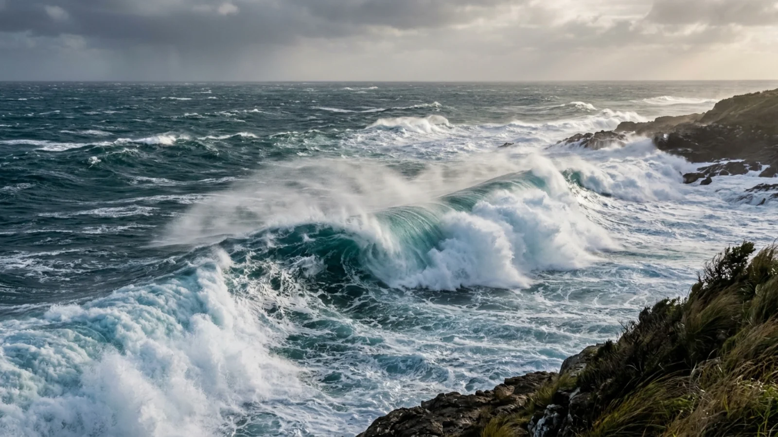
Wind is the main force that produces ocean waves. Wave size depends on wind speed, how long it blows and the distance it blows over (the fetch). Other generating forces are earthquakes, landslides and volcanic eruptions (tsunamis) and the gravity of the Moon and Sun (tides). Once water is disturbed, gravity and, for tiny ripples, surface tension pull it back, which is what makes it oscillate as a wave.
Waves need a disturbing force and a restoring force. Disturbing forces include wind, seismic movements of the seafloor, landslides, volcanic explosions, passing ships and the tidal pull of the Moon and Sun. Restoring forces pull the surface back toward flat: surface tension for capillary ripples under about 1.7 cm wavelength, and gravity for everything larger. Waves carry energy across the ocean while the water itself mostly moves in small circles.
How does wind make waves?
Wind blowing over water creates tiny ripples, which give the wind more surface to push on, so the waves grow.
Three factors control how big wind waves get: wind speed, wind duration and fetch, the distance of open water the wind blows over. A short gust on a lake produces chop; a storm blowing for days across thousands of kilometres of the Southern Ocean produces huge swells. When a sea reaches the largest waves a given wind can make, it is called a fully developed sea. Swells can then travel thousands of kilometres from the storm that made them, arriving as clean, evenly spaced waves on distant coasts.
What types of ocean waves are there?
Waves are classified by what generates them and by wavelength.
| Wave type | Generating force | Typical period |
|---|---|---|
| Capillary waves (ripples) | Light wind; restored by surface tension | <0.1 s |
| Wind waves and swell | Wind | 1–30 s |
| Seiches | Wind or pressure changes in enclosed basins | Minutes to hours |
| Tsunamis | Earthquakes, landslides, eruptions | 10 min to 2 h |
| Tides | Gravity of Moon and Sun | ~12.4 or ~24.8 h |
| Internal waves | Tides and currents over seafloor features | Minutes to hours |
Internal waves travel along density boundaries inside the ocean and can be over 100 m tall without showing at the surface; see the biggest waves are underwater.
How do earthquakes make tsunamis?
When a fault suddenly lifts or drops the seafloor, it displaces the entire water column above, creating a wave that can cross an ocean at jet speed.
In deep water a tsunami may be less than a metre high but hundreds of kilometres long, travelling at around 700–800 km/h. As it reaches shallow water it slows and piles up, sometimes to tens of metres. The 2004 Indian Ocean tsunami, triggered by a magnitude 9.1 earthquake, killed roughly 230,000 people in 14 countries; see Indian Ocean tsunami deaths and how tsunamis form. Landslides can produce even taller local waves, as in Lituya Bay, Alaska, in 1958.
How does wind actually start a wave?
It sounds obvious that wind makes waves, but explaining exactly how a breeze over flat water creates the first ripple took scientists until the 1950s. The modern picture combines two ideas published in 1957. The first, proposed by O. M. Phillips, starts with a perfectly calm sea. Turbulent wind is gusty and uneven, so it presses down on the water harder in some places than others. Those random pressure fluctuations raise ripples only a few centimetres long. The second idea, from John W. Miles, explains how the ripples grow. Once the surface is rough, the airflow over each little crest and trough becomes uneven, and the wind pushes harder on the side of the wave facing it. The bigger the waves get, the bigger that pressure difference becomes, so growth speeds up exponentially.
A third process takes over as the sea builds. Waves of slightly different lengths interact with each other and pass energy from shorter waves to longer ones, a nonlinear transfer described by Klaus Hasselmann and colleagues in 1973. That is why a growing sea develops longer and longer waves over time. Eventually the longest waves travel faster than the wind that made them, and the wind can no longer add energy to them. At that point the sea is “fully developed”: for that wind speed, the waves will not get any bigger however much longer it blows. Willard Pierson and Lionel Moskowitz described the shape of this fully developed sea in the 1960s, and their wave spectrum is still used by engineers and forecasters.
How big can wind waves get?
Oceanographers describe a sea state using the significant wave height, the average height of the highest one-third of the waves. It roughly matches what an experienced observer would estimate by eye, but individual waves can be much taller. In December 2016 the World Meteorological Organization certified a new record for the highest significant wave height measured by a buoy: 19 m (62.3 ft). It was recorded on 4 February 2013 by an automated UK Met Office buoy in the North Atlantic between Iceland and the UK, at about 59°N, 11°W. The waves followed a very strong cold front with winds of up to 43.8 knots. The previous record, 18.275 m, had also been set in the North Atlantic, in December 2007.
The North Atlantic produces these extremes because deep low-pressure systems there generate strong, sustained winds over a long fetch, especially in winter. The Southern Ocean has even longer fetch, since its westerly winds blow around the globe with almost no land in the way. That is why surfers on coasts far from Antarctica, from South Africa to Chile, regularly ride swells born in Southern Ocean storms. Swells from the Indian Ocean have been recorded in California after travelling more than half way around the world. As swells travel, they sort themselves by speed, since longer waves move faster, so the long, clean lines that reach a distant coast are very different from the chaotic sea in the storm that made them.
Rogue waves: from sailors’ tales to measurements
For centuries, sailors told stories of single enormous waves that seemed to come from nowhere. In 1826 the French naval officer Jules Dumont d’Urville reported waves up to 33 m high in the Indian Ocean, with three colleagues as witnesses. He was publicly ridiculed by the scientist François Arago, at a time when many people believed no wave could exceed about 9 m. As late as the mid-1990s, popular oceanography textbooks hardly mentioned “freak” or “rogue” waves.
Oceanographers now define a rogue wave as one more than twice the significant wave height of the surrounding sea. The first instrument record of such a wave came from the Gorm platform in the central North Sea in 1984. The breakthrough came on 1 January 1995 at the Draupner gas platform, about 160 km southwest of the southern tip of Norway. The platform had been built to withstand a calculated 1-in-10,000-year wave of 20 m and carried a laser rangefinder pointing at the sea. At 3 pm it recorded a wave with a total height of 25.6 m, with its crest 18.5 m above the still-water level. The significant wave height around it was about 12 m, so the Draupner wave was more than twice as tall as its neighbours. Rogue waves are now accepted as natural events that occur where high winds, strong currents and wave interactions combine to merge several waves into one. They are blamed for the loss of ships such as the German freighter MS München in 1978.
Rogue waves have also been implicated in the loss of the Ocean Ranger, a semi-submersible drilling rig that sank in Canadian waters on 15 February 1982. Researchers have even described the opposite phenomenon in theory and in wave tanks: “rogue holes”, sudden troughs more than twice the significant wave height deep. These have been reproduced experimentally but not yet confirmed at sea. Together, these findings changed how offshore platforms and ships are designed, since engineers can no longer assume that the biggest wave in a storm will be only modestly larger than the rest.
Waves made by weather: meteotsunamis
Not every tsunami-like wave starts with an earthquake. A meteotsunami is a sea wave caused by a rapid change in air pressure, usually from a fast-moving storm front or squall line. As the pressure jump travels across the water, it pushes the sea surface down and up. If the storm moves at about the same speed as long waves travel in that depth of water, the wave can grow, much as a surfer is carried along by a swell. Meteotsunamis are usually local, but when they reach a bay or harbour whose natural sloshing period matches the wave, resonance can amplify them dangerously. Waves of over 6 ft have been recorded.
They are more common than once thought. Only about 3% of historical tsunami events from 2000 BC to 2014 are known to have had meteorological causes. But about 10% of historical tsunamis have unknown origins, and meteotsunamis have probably often been mistaken for seiches. In 2019 NOAA estimated that about 25 meteotsunamis affect the US East Coast each year, and about 126 a year occur in the Great Lakes. In some places they are frequent enough to have local names, including rissaga in Catalan around the Balearic Islands, marrobbio in Italian, and abiki in Japanese. Nagasaki Bay in Japan is one of the places especially prone to them.
Seiches: the sloshing of enclosed waters
A seiche is a standing wave in an enclosed or partly enclosed body of water, much like the water sloshing back and forth in a bathtub. Wind or a change in air pressure pushes water toward one end of a lake or bay. When the push stops, the water flows back, overshoots and keeps oscillating, with a period that depends on the size and depth of the basin. The word was popularised by the Swiss scientist François-Alphonse Forel, who began the first scientific observations of the effect in Lake Geneva in the late nineteenth century. He found that the lake’s lengthwise seiche had a period of about 73 minutes, and the crosswise one about 10 minutes. In New Zealand’s Lake Wakatipu, the water level at Queenstown rises and falls by about 20 cm on a 27-minute cycle.
Large seiches can be hazardous. Lake Erie is especially prone to them because it is shallow and runs northeast to southwest, the same direction as the prevailing winds. In 1954 the remnants of Hurricane Hazel piled water up along the Lake Ontario shore near Toronto and set off a seiche that then flooded parts of the opposite shore. On 13 July 1995 a seiche on Lake Superior made the water level fall and rise by about one metre within 15 minutes, leaving some boats hanging from their mooring lines. Harbours, bays and estuaries often have small seiches of a few centimetres with periods of a few minutes.
Waves you can detect with a seismometer
Ocean waves are so energetic that they shake the solid Earth. Every seismometer on the planet records a constant background hum called microseisms, most of it generated by ocean waves. The strongest signals have periods of about 4 to 30 seconds, matching typical ocean swell. Microseismic noise usually shows two peaks. The weaker one, at periods around 16 seconds, comes from swell interacting with the sloping seafloor in shallow water and has the same period as the waves. Klaus Hasselmann first worked out the details of that mechanism. The stronger peak, at about half that period, is produced when wave trains travelling in opposite directions meet and press rhythmically on the seafloor.
Because this seismic noise carries information about the sea state, scientists can use seismograph records to estimate ocean wave conditions over periods of hours to days. In that sense, the restoring and disturbing forces that make ocean waves reach far beyond the sea surface. They show up in the bedrock under continents, thousands of kilometres from the nearest storm.
Why do waves break?
As waves reach shallow water, the bottom slows the base of the wave while the crest keeps going, until the crest topples forward.
Waves begin to feel the bottom when water depth is about half their wavelength. They slow, shorten and steepen; when wave height reaches roughly 0.8 times the water depth, they break. Gently sloping beaches give spilling breakers; steeper reefs give plunging, tubing breakers that surfers seek out; very steep shores give surging waves that barely break at all.
Does the water travel with the wave?
Mostly no. In deep water, each water particle moves in a circle and returns almost to where it started; it is the energy that travels.
That is why a floating bird bobs up, forward, down and back as a wave passes rather than riding it to shore. Near the coast, the circles flatten and some water does move shoreward, which then flows back out, sometimes as a rip current.
What is the main force that produces ocean waves?
Wind. It transfers energy to the water surface, and wave size depends on wind speed, duration and fetch.
What forces cause tsunamis?
Sudden seafloor movement from earthquakes, plus underwater landslides, volcanic eruptions and, rarely, asteroid impacts.
Are tides waves?
Yes. Tides are extremely long waves caused by the gravity of the Moon and Sun.
What is the restoring force for ocean waves?
Gravity for most waves; surface tension for tiny capillary ripples.
What is fetch?
The distance of open water over which the wind blows; longer fetch allows bigger waves.
What is the biggest wave ever recorded?
The largest surfed wave was about 26 m at Nazaré, Portugal; the largest wave run-up was about 524 m at Lituya Bay, Alaska, in 1958.
- NOAA Ocean Service: What causes ocean waves?
- Guinness World Records: Largest wave surfed (Sebastian Steudtner, 2020).
- Miller, D. J. (1960). Giant waves in Lituya Bay, Alaska. USGS Professional Paper 354-C.
- Phillips, O. M. (1957). On the generation of waves by turbulent wind. Journal of Fluid Mechanics 2.
- Miles, J. W. (1957). On the generation of surface waves by shear flows. Journal of Fluid Mechanics 3.
- Pierson, W. J. & Moskowitz, L. (1964). A proposed spectral form for fully developed wind seas. Journal of Geophysical Research 69.
- World Meteorological Organization (2016). New world record for highest significant wave height measured by a buoy (19 m, North Atlantic, 4 February 2013).
- NOAA (2019). Meteotsunamis: frequency on the US East Coast and Great Lakes.
Blane Perun has been exploring Earth’s oceans and marine life for over 25 years. Founder of TheSea.Org in 1999, underwater photographer, coral aquaculture pioneer, and explorer of 80+ countries.
