Whale Shark Migration Map — Ocean Wanderers That Gather Where the Plankton Blooms
Whale sharks roam tropical and warm-temperate seas, mostly between 30°N and 35°S in water above about 21°C, and gather seasonally at plankton hotspots: Ningaloo Reef, the Yucatán, the Philippines, the Galápagos, Mozambique, the Arabian Gulf and more. The longest tracked migration is 20,142 km, by a female named Anne tagged off Panama, who was last tracked near the Mariana Trench close to Guam.
To follow food. Whale sharks feed on plankton, fish eggs and small fish, which bloom in predictable places at predictable times: coral spawning at Ningaloo, tuna spawning off the Yucatán, krill and shrimp swarms in the Philippines. Between those feasts they cross open ocean, often diving deep. Breeding and pupping grounds remain largely unknown. See how whale sharks reproduce.
How do scientists map whale shark movements?
No single method shows the whole picture, so whale shark migration maps are stitched together from several kinds of evidence. The first is satellite telemetry. Towed or fin-mounted tags send a signal to Argos satellites each time the shark breaks the surface, giving a fairly precise position. Because whale sharks spend most of their time below the surface, the tracks are full of gaps, and a tag that stops transmitting may have failed, fallen off, or gone down with a dead shark.
The second is pop-up archival tags. These record depth, water temperature and light level for months, then release, float to the surface and upload a summary. Daily changes in light let researchers estimate the shark’s approximate position, while the depth record reveals diving behaviour. A third method is acoustic tagging: small transmitters inside the shark are picked up by underwater receivers moored at known spots, which shows when individual sharks return to the same reef year after year.
The fourth, and the one anyone with an underwater camera can contribute to, is photo-identification. Every whale shark has a unique pattern of pale spots and stripes, and the area just behind the gills on the left side is used as a standard reference. In 2005, Zaven Arzoumanian, Jason Holmberg and Brad Norman published a method adapted from an algorithm astronomers use to match star patterns, allowing computers to compare spot patterns across thousands of photos. That approach underpins Wildbook for Whale Sharks (now Sharkbook), where divers and researchers upload encounter photos. Matching the same shark at two sites, sometimes years apart, adds a movement record without any tag at all.
Genetics adds the longest time scale. Comparisons of DNA from sharks around the world show how much breeding mixes populations. Whale sharks are usually split into two subpopulations, one in the Atlantic and one across the Indian and Pacific Oceans, with the Indo-Pacific holding the large majority of the world’s whale sharks.
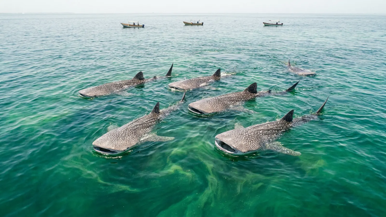
Where are the major whale shark hotspots?
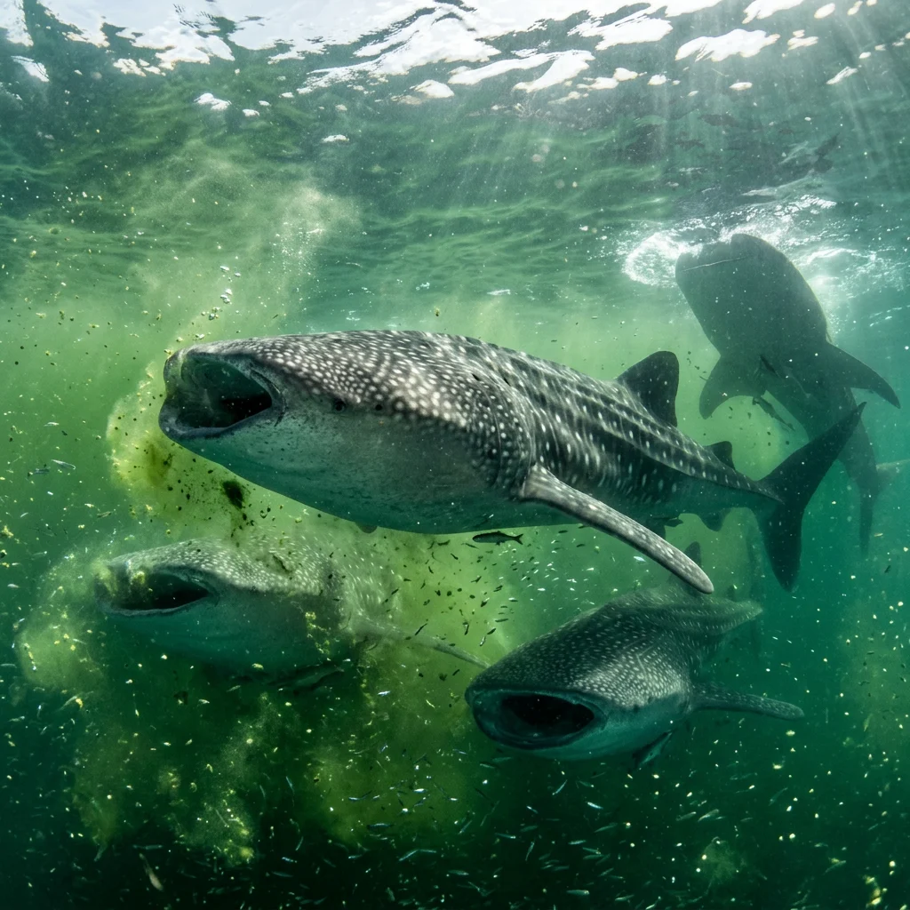
Coastal feeding aggregations around the tropics, each with its own season.
| Hotspot | Region | Typical season (approx.) | Who shows up |
|---|---|---|---|
| Ningaloo Reef | Western Australia | About March–July | Mostly juvenile males |
| Yucatán / Isla Mujeres & Holbox | Mexico (Caribbean) | About June–September | Hundreds at once; 400+ in 2009 |
| La Paz | Gulf of California, Mexico | About November–May | Juveniles |
| Donsol, Sogod Bay, Palawan | Philippines | Donsol about December–May | Juveniles, some adults |
| Darwin & Wolf Islands | Galápagos, Ecuador | About June–December | 91.5% adult females (Darwin, 2011–13) |
| Tofo / Inhambane | Mozambique | Much of the year, best June–January | Juveniles |
| South Ari Atoll | Maldives | Year-round | Mostly juvenile males |
| Al Shaheen field | Qatar, Arabian Gulf | Northern summer | Large feeding groups |
| Gladden Spit | Belize | About March–June | Feeding on snapper spawn |
| Djibouti | Gulf of Tadjoura | About November–February | Juveniles |
Seasons are approximate and shift with ocean conditions. Wildbook for Whale Sharks, a global photo-ID database, has catalogued thousands of individuals across these sites.
What sets the timing of each gathering?
Almost every coastal aggregation lines up with a predictable burst of food. At Ningaloo it is the plankton bloom that follows coral spawning; in the Yucatán and off Qatar it is fish eggs released by spawning tunas; at Gladden Spit it is snapper spawn; in Donsol it is dense swarms of small shrimp and other zooplankton in the bay. Whale sharks are filter feeders that need concentrated food to make feeding worthwhile, and these events provide it for a few weeks or months each year.
Ocean conditions shift those dates. Warmer or cooler years, changes in upwelling and the timing of spawning can push a season earlier or later, or thin it out entirely. That variability is part of why the map is drawn in seasons rather than dates. Human activity can distort the pattern too. At Oslob in the Philippines, where fishermen hand-feed whale sharks for tourists, studies have found that provisioned sharks stay in the area far longer than they would naturally, raising concerns about altered migration, collisions with boats and dependence on handouts.
Where do Atlantic whale sharks go?
The best-studied Atlantic gathering is off the north-eastern tip of Mexico’s Yucatán Peninsula, around Isla Holbox, Isla Contoy and Isla Mujeres. In summer, whale sharks feed there on dense plankton and, at the offshore site known as the Afuera, on the eggs of spawning little tunny. In 2009, more than 400 whale sharks were recorded feeding in the area at once, one of the largest aggregations ever documented, published by Rafael de la Parra Venegas and colleagues in 2011.
Robert Hueter of Mote Marine Laboratory led a long-term tagging programme on these sharks from 2003, published in 2013. After the feeding season, tagged sharks spread out across the Gulf of Mexico, into the Caribbean, through the Straits of Florida and into the open Atlantic. Some returned to the Yucatán for as many as six years. The most remarkable track came from a large, apparently pregnant female nicknamed Rio Lady, who travelled about 7,200 km from Mexico into the South Atlantic, between Brazil and Africa, crossing the equator before her tag came off. Hueter suggested that mature, pregnant females may travel to mid-ocean areas around seamounts or remote islands to give birth, an idea that remains to be tested.
Smaller Atlantic hotspots fit the same feeding pattern. At Gladden Spit in Belize, whale sharks arrive around full moons in spring to feed on the eggs of spawning snappers. Far out in the South Atlantic, St Helena hosts adult sharks during the southern summer, and mating has been observed there twice, making it one of the very few places where adult whale sharks of both sexes gather.
Where do Indian Ocean whale sharks go?
Ningaloo Reef in Western Australia is where whale shark tourism and research grew up together. Sharks arrive in autumn, around the time of the mass coral spawning that fuels a burst of plankton along the reef. In 2003 and 2004, Steven Wilson and colleagues tagged 19 sharks there with pop-up archival tags. Six produced long-term tracks, and all six headed north-east from Ningaloo into the Indian Ocean, toward Indonesia, using both coastal and offshore waters and diving to at least 980 m.
Other Indian Ocean hotspots, including Tofo in Mozambique, the South Ari Atoll in the Maldives and the Gulf of Tadjoura in Djibouti, also attract mainly juveniles. Photo-ID shows that many of the same individuals return to their site year after year, but matches between distant sites are rare, which suggests that juveniles are faithful to a region even while adults roam widely. In the Arabian Gulf, aggregations around the Al Shaheen oil field off Qatar feed on the eggs of spawning mackerel tuna during the northern summer.
Why do the Galápagos see mostly adult females?
The eastern Pacific produces a different pattern. Around Darwin Island, at the northern edge of the Galápagos, a 2011–2013 study found that 91.5% of whale sharks seen were adult females, many of them looking pregnant. Unlike the feeding crowds at Ningaloo or the Yucatán, these sharks rarely feed at the island. They appear to pass through, often staying near the surface for a short time before moving offshore.
That has made the Galápagos central to the question of where whale sharks give birth. Only one pregnant whale shark has ever been examined closely: a female of about 10.6 m caught off Taiwan in the mid-1990s carried around 300 embryos at different stages, as reported by Joung and colleagues in 1996. Newborn whale sharks are almost never seen, so the pupping grounds remain unknown. The leading hypothesis is that females give birth far offshore or around remote islands and seamounts, and the movements of adult females from places like Darwin Island and the Yucatán are the best clues researchers have.

How far can a whale shark travel?
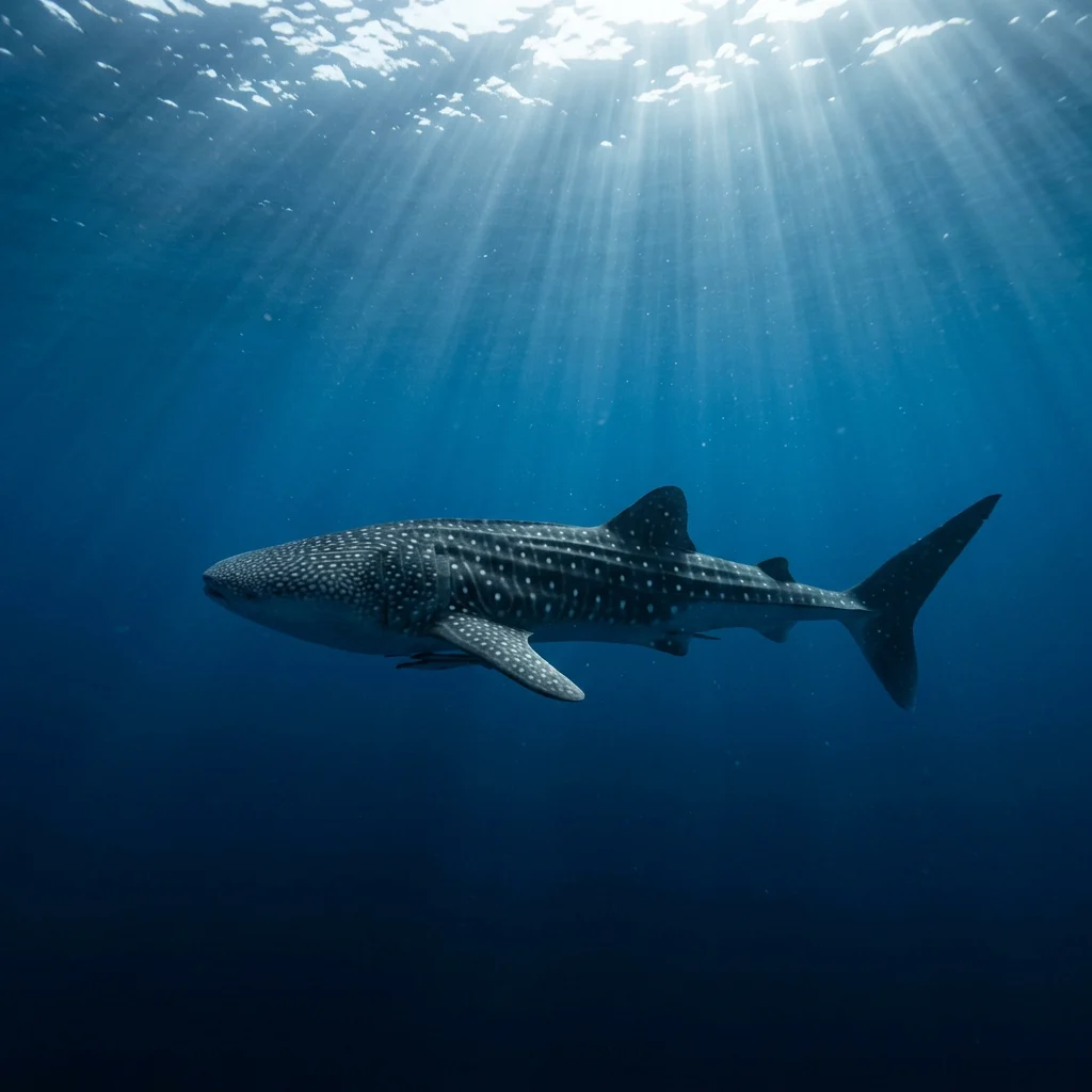
Across an entire ocean. The record is 20,142 km.
In 2011, researchers led by Héctor Guzmán of the Smithsonian Tropical Research Institute fitted a satellite tag to a female whale shark near Coiba Island, Panama, and named her Anne. The tag reported her position to Argos satellites only when she was near the surface, and it kept working for 841 days. Anne swam south-west to the waters around the Galápagos Islands, then struck out west across the Pacific. For 235 days the tag fell silent, probably because she was staying too deep for it to reach a satellite. When it resumed, she was far across the ocean, and the last fixes placed her near the Mariana Trench, east of the Philippines and close to Guam. The total track was 20,142 km (about 12,500 miles), reported in Marine Biodiversity Records in 2018 as the longest whale shark migration on record.
The previous record came from one of the first whale shark tracking projects. Between 1994 and 1996, Scott Eckert and Brent Stewart tagged 17 whale sharks in the Gulf of California. Six stayed within the gulf, but four left and ranged widely across the North Pacific, and one was followed for 37 months over more than 13,000 km, reaching the western North Pacific. Together, these two tracks show that the eastern and western Pacific are connected by individual sharks, not just by a shared species name.
What does the vertical map look like?
Migration is not only horizontal. Depth tags show that whale sharks typically cruise at the surface near shore from sunrise to mid-afternoon, then spend the late afternoon and night making repeated up-and-down oscillations in open water. About 95% of that oscillating time is spent in the upper 200 m, but sharks also make regular dives below 500 m. The deepest recorded dive, 1,928 m, came from a shark tagged in the Gulf of Mexico and was published in 2015.
Why they dive so deep is still debated. Following migrating plankton and small fish that move down by day and up at night is one explanation. Others include warming up and cooling down, or reading the ocean’s layers for navigation. Whatever the reason, it means a two-dimensional map captures only part of their movement, and deep diving is one reason satellite tags go silent for long periods, as happened with Anne.
How do juveniles, adults and sexes differ in their movements?
One of the strongest patterns in whale shark research is segregation by size and sex. Most coastal feeding aggregations, including Ningaloo, the Maldives, Djibouti, Mozambique and the Philippines, are dominated by juvenile males, often 4–8 m long. Adult males and, especially, adult females are rarely seen at these sites. The Galápagos and St Helena are the notable exceptions, which is why they attract so much attention.
The likely explanation is that young sharks depend on predictable, food-rich coastal sites while they grow, and that adults, which can store more energy and dive deeper, spend more time in the open ocean. This has practical consequences. Most of what we know about whale shark behaviour comes from young animals, and the adults that produce the next generation live mostly where they are hardest to study and hardest to protect.
Why does mapping migration matter?
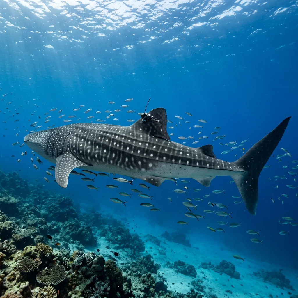
Because whale sharks cross borders, shipping lanes and fishing grounds that no single country controls.
A 2022 study in PNAS, led by Freya Womersley and David Sims and drawing on satellite tracks from 348 whale sharks worldwide, found that about 92% of the horizontal space and nearly half of the vertical space used by the tracked sharks overlapped with large-vessel traffic. About a quarter of the tags stopped transmitting in busy shipping areas, and some depth records showed sharks swimming normally, then sinking slowly to the seafloor, the signature of a fatal ship strike. Collision risk was highest in the Gulf of Mexico, the Arabian Gulf and the Red Sea, near some of the world’s busiest ports.
Migration maps help identify collision hotspots, place protected areas and justify international protection, such as the species’ 2017 listing on Appendix I of the Convention on Migratory Species. See why whale sharks are endangered.
Using the map to plan a whale shark trip
For divers and snorkellers, the migration map works as a calendar. The best encounters come at coastal feeding sites during their peak season, when sharks are concentrated near the surface. Ningaloo is strongest roughly from March to July, the Yucatán from about June to September, La Paz in the Gulf of California through the northern winter and spring, and Donsol in the Philippines from about December to May. The Maldives and Mozambique offer encounters for much of the year, while the Galápagos offers a chance to see huge adult females, mainly on liveaboard dive trips to Darwin and Wolf.
Seasons drift from year to year with water temperature and plankton, so local operators’ recent sighting records are a better guide than any fixed table. Wherever you go, choose operators that follow the local code of conduct: limited numbers of swimmers per shark, keeping a distance of a few metres, no touching, no flash photography and no riding. Uploading clear photos of the left side behind the gills to a photo-ID database adds your sighting to the global map.

Where do whale sharks migrate?
Between seasonal plankton hotspots in tropical and warm-temperate oceans, often crossing open ocean.
How far do whale sharks migrate?
The longest recorded track is 20,142 km.
When is whale shark season at Ningaloo?
Roughly March to July.
When can I see whale sharks in Mexico?
Off the Yucatán, roughly June to September.
Do whale sharks live in the Mediterranean?
No. They are absent from the Mediterranean.
How do scientists track whale sharks?
With satellite tags, acoustic tags and photo-ID of their unique spot patterns.
Where do whale sharks breed?
Largely unknown; pupping grounds have not been confirmed.
Do whale sharks return to the same place every year?
Many do. Photo-ID and acoustic tags show juveniles returning to sites such as Ningaloo and the Yucatán for years; some Yucatán sharks returned for up to six seasons.
- PADI (2019). Best locations to swim with whale sharks by month (season guide).
- Smithsonian Tropical Research Institute (2018). Whale shark “Anne” logs longest recorded trans-Pacific migration (20,142 km).
- Womersley, F.C. et al. (2022), PNAS. Global collision-risk hotspots of marine traffic and the whale shark.
- IUCN Red List (Pierce & Norman, 2016). Rhincodon typus: Endangered; >50% decline over three generations (~63% Indo-Pacific, >30% Atlantic).
- Guzmán, H.M. et al. (2018). Longest recorded trans-Pacific migration of a whale shark. Marine Biodiversity Records 11: 8.
- Eckert, S.A. & Stewart, B.S. (2001). Telemetry and satellite tracking of whale sharks in the Sea of Cortez and the North Pacific. Environmental Biology of Fishes 60.
- Hueter, R.E., Tyminski, J.P. & de la Parra, R. (2013). Horizontal movements, migration patterns, and population structure of whale sharks in the Gulf of Mexico and northwestern Caribbean Sea. PLoS ONE 8(8).
- Wilson, S.G., Polovina, J.J., Stewart, B.S. & Meekan, M.G. (2006). Movements of whale sharks tagged at Ningaloo Reef. Marine Biology 148: 1157–1166.
- de la Parra Venegas, R. et al. (2011). An unprecedented aggregation of whale sharks in Mexican coastal waters of the Caribbean Sea. PLoS ONE 6(4).
- Arzoumanian, Z., Holmberg, J. & Norman, B. (2005). An astronomical pattern-matching algorithm for computer-aided identification of whale sharks. Journal of Applied Ecology 42.
- Joung, S.J. et al. (1996). The whale shark is a livebearer: 300 embryos found in one megamamma supreme. Environmental Biology of Fishes 46.
Blane Perun has been exploring Earth’s oceans and marine life for over 25 years. Founder of TheSea.Org in 1999, underwater photographer, coral aquaculture pioneer, and explorer of 80+ countries.
About Blane Perun → More on Whale Shark →