Taiwan Coral Reef Maps — Kenting, Green Island, Xiaoliuqiu and Penghu
Taiwan’s coral reefs are concentrated in the warm south and around its offshore islands. The main areas are Kenting on the southern tip of the Hengchun Peninsula; Green Island (Lyudao) and Orchid Island (Lanyu) off the south-east coast; Xiaoliuqiu, a small coral island off the south-west; and the Penghu islands in the Taiwan Strait. Taiwan also administers the remote Dongsha (Pratas) Atoll in the northern South China Sea. Reefs here exist so far north because the warm Kuroshio Current carries tropical water past the island. UNEP-WCMC maps roughly 190 km² of reef.
Taiwan straddles the Tropic of Cancer, at the northern edge of where coral reefs can grow. Its northern coasts are too cool in winter for reef-building, but its southern tip and offshore islands are washed by warm Pacific water and support reefs with a surprisingly high diversity of corals and fish. Within a few hours’ travel you can go from temperate rocky shores to genuine tropical reef. This map and guide shows where Taiwan’s reefs are and what makes each area distinctive.
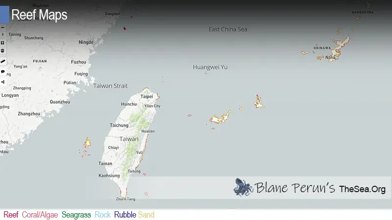
Taiwan coral reef map
Reef clusters in the south and around the offshore islands; the cooler north has little.
On the map, coral shading is densest around the Hengchun Peninsula at Taiwan’s southern tip, around Green Island and Orchid Island to the south-east, around tiny Xiaoliuqiu off the south-west coast, and among the many islands of the Penghu archipelago in the Taiwan Strait. Along the populous west coast, with its sandy, sediment-laden shores, and the cooler north, reef is scarce.
The reef outlines are taken from the UNEP-WCMC global warm-water coral reef dataset, compiled from satellite imagery and surveys. Coral shading marks where reef habitat has been mapped, not the amount of living coral, and small coral communities on rocky shores may not appear at all.
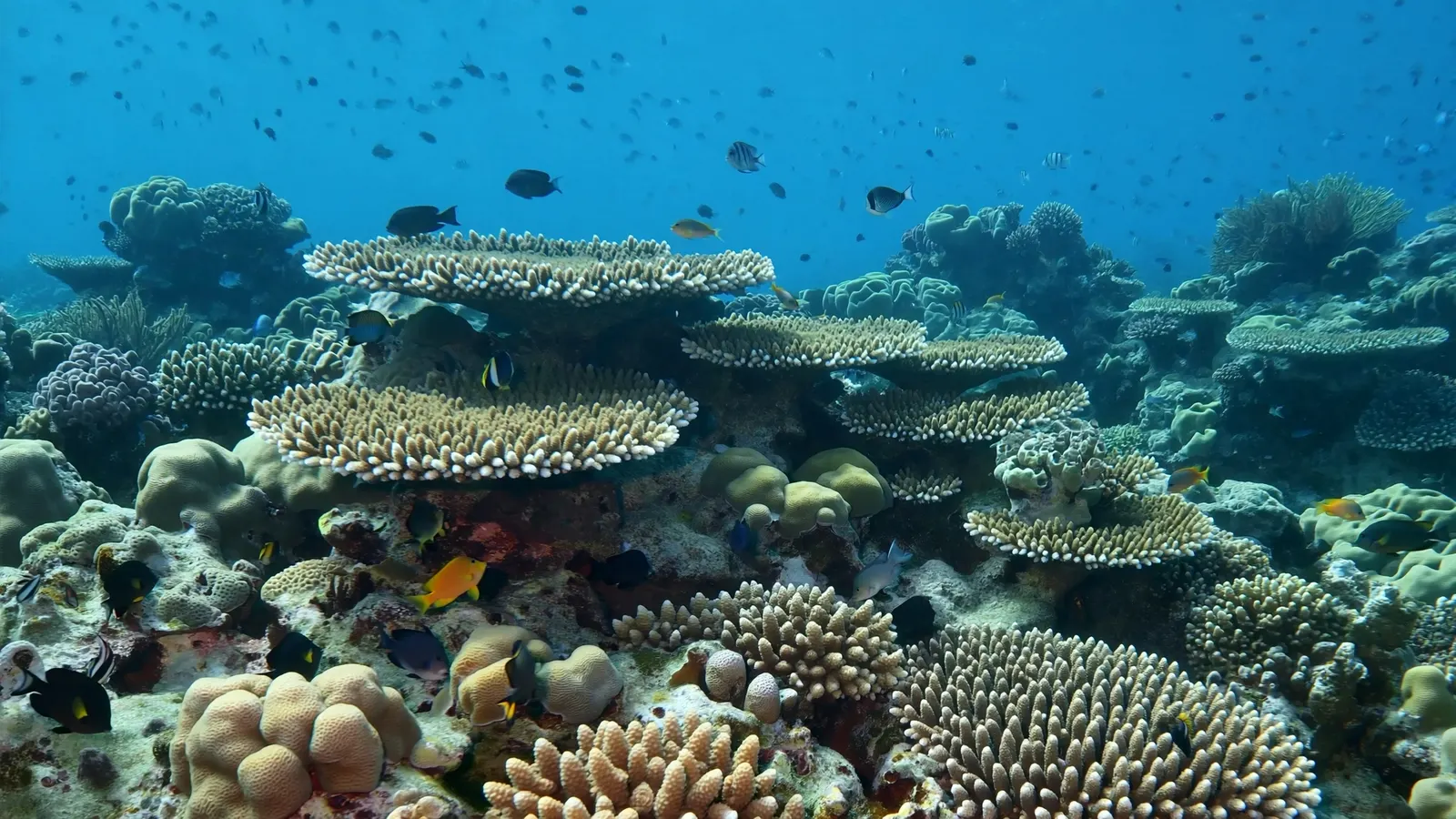
Subtropical reefs on the Kuroshio
A warm ocean current lets coral reefs thrive further north than you might expect.
The Kuroshio is the western Pacific’s great warm current, the Pacific counterpart of the Gulf Stream. It flows north past the Philippines, along Taiwan’s east coast and on toward southern Japan, carrying warm water and the larvae of tropical corals and fish. Green Island and Orchid Island sit right in its path, which is why they have some of Taiwan’s best-developed fringing reefs. The same current explains the reefs of Okinawa further north — see our Japan coral reef maps.
Because Taiwan lies on this warm conveyor belt, its reefs are richer in species than their latitude suggests, with hundreds of hard coral species recorded around the island. But they also experience cooler winters than equatorial reefs, and in some years cold-water events have caused coral and fish die-offs, particularly in Penghu, where an unusual cold surge in early 2008 killed large numbers of corals and fish.
Taiwan’s main reef areas
Each island group has its own reef character.
- Kenting (southern tip) — fringing reefs along the Hengchun Peninsula, protected within Kenting National Park, Taiwan’s first national park. Nanwan Bay and the coasts around the cape are the focus of decades of reef monitoring and research.
- Green Island / Lyudao (south-east) — a volcanic island in the Kuroshio with rich fringing reefs, clear water and a famous giant Porites coral colony known locally as the “Big Mushroom”.
- Orchid Island / Lanyu (south-east) — a volcanic island with healthy reefs, home to the indigenous Tao people and their long tradition of flying-fish fishing.
- Xiaoliuqiu / Lamay Island (south-west) — a small raised coral-limestone island ringed by reef, famous as one of the easiest places in East Asia to snorkel with wild green turtles.
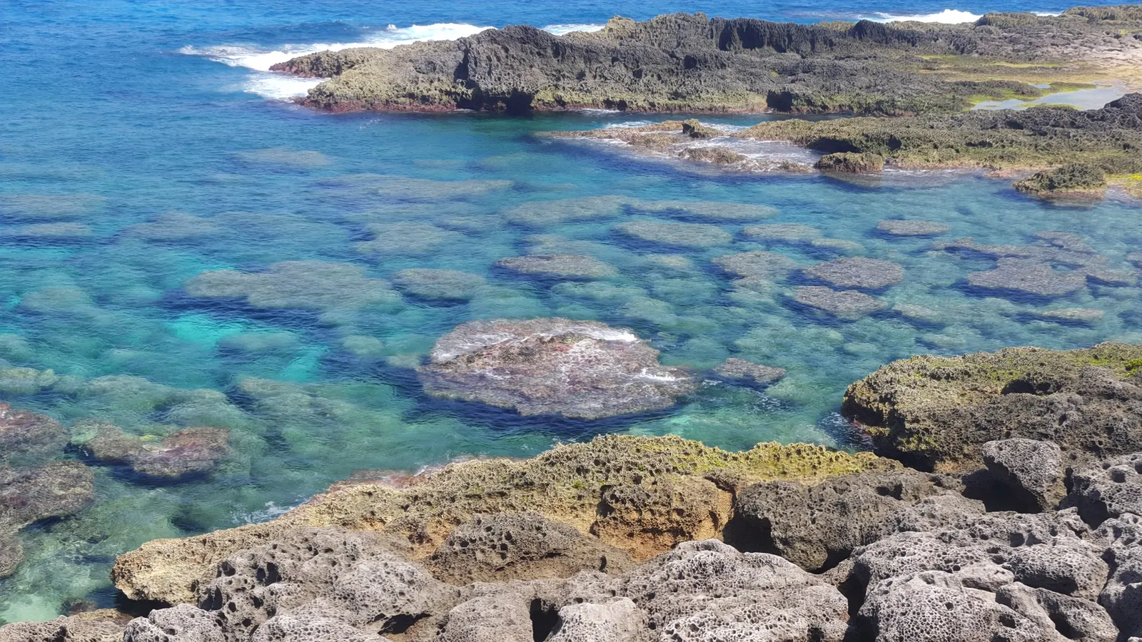
- Penghu (Taiwan Strait) — an archipelago of basalt islands with fringing reefs and coral communities in shallower, more variable water; the southern Penghu islands have a marine national park.
- Dongsha / Pratas Atoll (South China Sea) — a large, remote coral atoll protected as a marine national park.
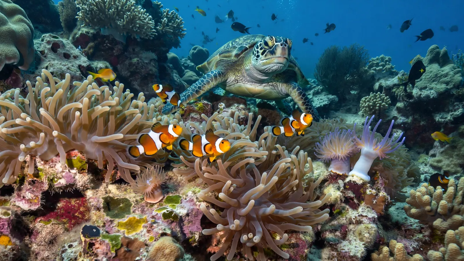
Reef life around Taiwan
Tropical corals and fish meet species from cooler northern waters.
Taiwan’s southern reefs hold the corals typical of the western Pacific: branching and table Acropora, massive Porites, brain-like faviids, mushroom corals and a rich variety of soft corals, which are especially abundant on some current-swept reefs around Kenting and the offshore islands. Reef fish include butterflyfish, angelfish, damselfish, clownfish living in sea anemones, parrotfish, surgeonfish, wrasses, groupers and moray eels. Divers also see nudibranchs, cuttlefish, octopus and sea snakes, and green turtles are common around Xiaoliuqiu and Green Island.
Because the Kuroshio brings larvae from the Philippines and the wider Coral Triangle, Taiwan’s reefs share many species with reefs further south. At the same time, the island’s cooler winters mean the coral community thins out toward the north, and reefs in Penghu and the north-east support fewer reef-building species. This mix makes Taiwan a useful place to study how reef communities change at their northern edge — a question that matters as warming oceans allow some tropical species to spread toward the poles. For an overview of reef life, see what animals and plants live in coral reefs.
Reef science and society in Taiwan
Taiwan has an active reef research community and growing public interest.
Universities and research institutes in Taiwan run long-term monitoring at Kenting and the offshore islands, coral breeding and restoration work, and studies of how reefs near their temperature limits respond to heat and cold. Dive operators, citizen-science reef surveys and conservation groups have become increasingly involved, and public concern about reef health has grown. Reef tourism — diving, snorkelling and glass-bottom boat trips — is an important part of the economies of Kenting and the offshore islands.
Threats to Taiwan’s coral reefs
Crowds, runoff, fishing and temperature extremes.
Taiwan’s reefs face intense local pressure because they are so accessible to a large population. Sewage and runoff from coastal towns and hotels fuel algal growth, especially around Kenting. Heavy tourism brings trampling, boat traffic and sunscreen pollution at popular sites. Overfishing has reduced herbivores and large reef fish. Coastal development has altered many shorelines. Marine heatwaves have caused bleaching in recent years, while occasional cold surges threaten reefs in the Taiwan Strait. Typhoons are a natural but powerful disturbance. Marine protected areas, fishing restrictions, sewage improvements and restoration projects are part of the response. Read more on our coral reef conservation pages.
Related on TheSea
Does Taiwan have coral reefs?
Yes. Taiwan has fringing coral reefs around its southern tip at Kenting and around Green Island, Orchid Island, Xiaoliuqiu and the Penghu islands, plus the remote Dongsha (Pratas) Atoll. UNEP-WCMC maps roughly 190 km² of reef.
Where is the best snorkelling in Taiwan?
Green Island, Xiaoliuqiu and Kenting are the most popular. Xiaoliuqiu is especially known for green turtles, and Green Island for its clear water and rich reefs.
Why does Taiwan have coral reefs so far north?
The warm Kuroshio Current carries tropical water and coral larvae north along Taiwan’s east coast, keeping the south and the offshore islands warm enough for reef-building corals.
Can you see sea turtles in Taiwan?
Yes. Green turtles are commonly seen grazing on shallow reefs around Xiaoliuqiu, and also around Green Island and other southern sites.
What is Kenting National Park?
Taiwan’s first national park, established in 1984 on the southern tip of the island. It includes marine areas protecting fringing coral reefs and is a centre for reef research.
What threatens Taiwan’s coral reefs?
Sewage and runoff, heavy tourism, overfishing, coastal development, marine heatwaves, occasional cold surges and typhoons.
- UNEP-WCMC, WorldFish Centre, WRI, TNC: Global distribution of warm-water coral reefs, v4.1 (2021)
- Kenting National Park Headquarters: marine resources
- Ocean Conservation Administration (Taiwan): coral reef monitoring
Blane Perun has been exploring Earth’s oceans and marine life for over 25 years. Founder of TheSea.Org in 1999, underwater photographer, coral aquaculture pioneer, and explorer of 80+ countries.
About Blane Perun → More Asian Coral Reef Maps →